Elevation: 10,482 ft
Prominence: 336
This peak is not in the book. Updated October 2025
Peak 10482 is located just over ½ mile north-northwest of Patterson Peak in the northern Lemhis. It can be climbed in combination with nearby Patterson Peak or directly from the Patterson Creek Trail to its east. USGS Yellow Peak
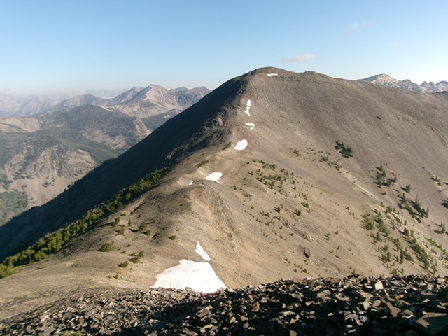
Peak 10482 and its south ridge (left of center). This was my ascent route. Livingston Douglas Photo
Access
Same as for Patterson Peak. This is the second leg of a 2-peak adventure that includes Patterson Peak (10,603 feet) and Peak 10482. It covers 7.5 miles with 3,420 feet of elevation gain round trip.
South Ridge, Class 2
The Ascent
From the 10,140-foot connecting saddle with Patterson Peak, scramble north up a ridge of blocks/strata, talus, and scree. It is best to stay left/west of the ridge blocks for the easiest going. The summit of Peak 10482 is a small perch with a decent cairn. Stand atop another ground boulder just northeast of the cairn to ensure that you reached the highest point.
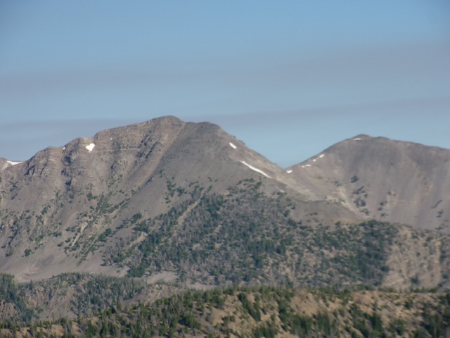
Patterson Peak (left) and Peak 10482 (right) as viewed from the southeast. Livingston Douglas Photo
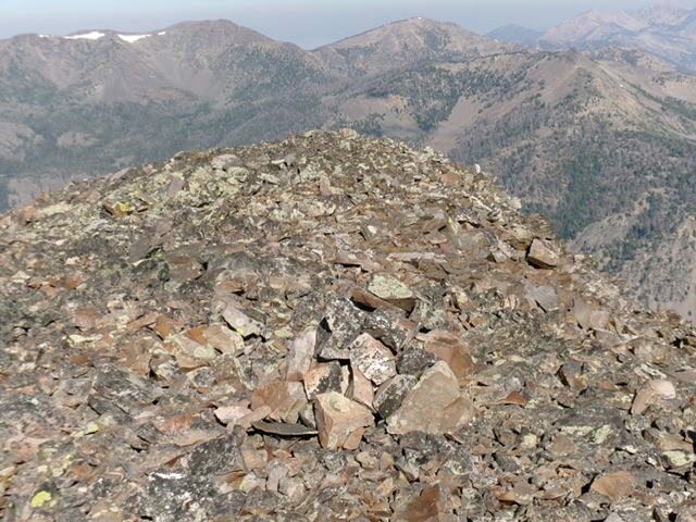
The rocky summit of Peak 10482. Livingston Douglas Photo
South Ridge/East Gully, Class 3
The Descent
From the summit, descend south back down to the 10,140-foot connecting saddle. From the saddle, descend east down steep, loose/hard gravel and scree with a little veg and some scattered pines mixed in. Reach a marshy upper basin with a small stream in it. Follow this stream east then northeast then southeast as it quickly becomes more substantive. The stream drainage is grassy and flat in sections and is steep and rocky in other sections.
Stay to the stream’s left/north side on the edge of a pine forest for the easiest going. The stream weaves a lot and rocky sections (mostly talus/scree) are unavoidable. Sometimes the stream goes underground. The grassy sections near the stream are thick and often have loose rock hidden in them. There were only 1-2 minor uphills required to stay in the forest. Lower down, the stream bends right-ish/southeast to descend steeply to the west fork of Big Eightmile Creek.
Leave the stream drainage here and bushwhack down the relatively easy pine forest directly to the creek. Stay on forested shoulders instead of gullies to avoid the worst of the blowdown. Once back on the ATV trail, follow it for a fast mile back to the trailhead.
Additional Resources
Regions: EASTERN IDAHO->Lemhi Range
Mountain Range: Lemhi Range
Longitude: -113.62259 Latitude: 44.60329