Elevation: 10,519 ft
Prominence: 689
Climbing and access information for this peak is on Page 301 of the book. The elevation and prominence figures are based on recent LiDAR updates. The USGS quad shows an elevation of 10,507 feet. Updated October 2025
Slate Roof Peak is located on the main Lemhi Range Crest above the headwaters of the Middle Fork Little Timber Creek and both the Park Fork and the Lake Fork of Big Creek in the Lemhi Range. It is most easily climbed from the Middle Fork Little Timber Creek Trail/FST-187. Slate Roof Peak offers magnificent view of several nearby 10ers. USGS Yellow Peak
Slate Roof Peak. Dave Pahlas Photo
Access
Middle Fork Little Timber Creek Trail/FST-187 [(A)(8.2)(a) on Page 314]. This is the first leg of a 2-peak adventure that includes Slate Roof Peak and Peak 10428. It covers 12.0 miles with 3,275 feet of elevation gain round trip.
Map Errors
The USGS topo map fails to show the very useful FST-183-02 which traverses the south face of Slate Roof Peak and crosses the southwest ridge. The National Forest map mis-positions FST-183-02; the trail does NOT initially drop into a valley on the north side of Yellow Peak.
East Ridge, Class 2
The Climb
From the trailhead, hike up well-beaten FST-187 (a foot/horse/MC trail) for 4.0 miles to a 9,500-foot pass that separates Yellow Peak (10,971 feet) from Slate Roof Peak. From the pass, bushwhack northwest up the rock-and-forest ridge crest to reach a flattish area. Contrary to comments by another Idaho climber, there is no trail (nor remnants thereof) on the east ridge. Skirt the left/southwest side of a few ugly ridge towers early on. After passing those rocky ridge towers, stay close to the narrow, exposed ridge crest (on its right/northeast side) in solid ridge rock, stable talus (mostly ground talus), and stable ground scree/gravel. The ridge pines are not a problem.
The ridge bends left/west in a flattish, open area of rocky outcrops (which can be climbed over or skirted) and easy tundra with stable ground rock. Skirt the left/south sides of the rocky outcrops on angled, but easy, talus. The ridge then bends right/northwest and steepens considerably. The terrain is stable talus and solid ridge rock with some easy scree/gravel mixed in. Stay mostly to the right/northeast on the edge of the ridge for the most stable footing in this section.
The ridge does a final rocky bend right-ish/north after crossing a false summit hump. The high point of Slate Roof Peak has two large summit cairns only 10 feet apart. The cairn on the right/east edge seems slightly higher. There is lots of dinner-plate shale with which to build summit cairns.
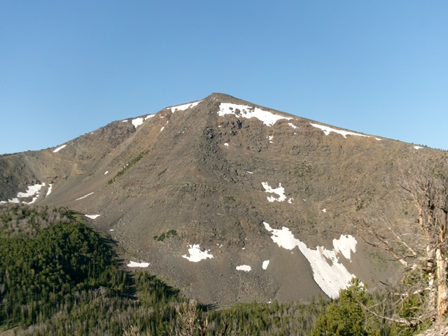
Slate Roof Peak as viewed from the northeast. Livingston Douglas Photo
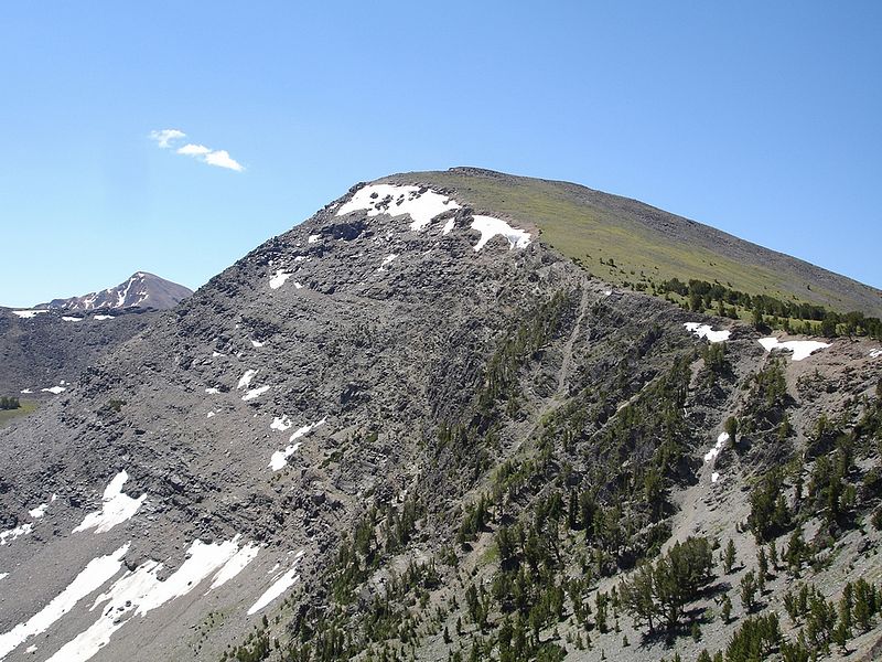
Slate Roof Peak as viewed from midway up the east ridge. This was my ascent route. Livingston Douglas Photo

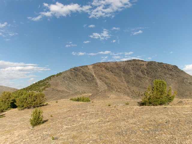
Slate Roof Peak as viewed from Peak 10428 to its southwest. Livingston Douglas Photo
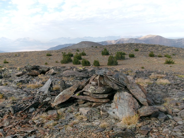
The summit of Slate Roof Peak. Livingston Douglas Photo
Southwest Ridge, Class 2
The Descent
From the dual-cairned summit, head south across an easy mix of tundra and ground rock to come up over the [lower] south summit hump. Descend southwest down an easy ridge of stable ridge rock with some pines near the 10,140-foot connecting saddle with Peak 10428. This concludes the first leg of today’s 2-peak journey. Peak 10428 is up next.
South Face, Class 2
The Descent
This is the final leg of a 2-peak journey that includes Slate Roof Peak and Peak 10428. From the 10,140-foot connecting saddle with Peak 10428, scramble a short distance northeast then begin an upward contour on the south face to intersect FST-183-02, a decent foot/MC trail. The terrain here is angled talus and scree with a bit of up-and-down to make steady progress. Reach a pine forest with loose, angled gravel (not fun) and quickly reach FST-183-02. The net uphill from the connecting saddle is only 10 vertical feet. Once on this magnificent, well-beaten (or ridden) trail, follow it east then southeast as it crosses the south face of Slate Roof Peak (with some minor ups and downs) and returns you to the critical 9,500-foot saddle and a signed junction with FST-187/Middle Fork Little Timber Creek Trail. Follow FST-187 back for 4.0 miles back to the trailhead.
Additional Resources
Regions: EASTERN IDAHO->Lemhi Range
Mountain Range: Lemhi Range
Longitude: -113.53819 Latitude: 44.54429