Elevation: 10,542 ft
Prominence: 599
Climbing and access information for this peak is on Page 301 of the book. The book does not identify the peak by its proposed name. The elevation and prominence figures are based on recent LiDAR updates. The USGS quad shows an elevation of 10,540 feet. Updated October 2025
U Mountain sits atop a U-shaped ridge that connects Slate Roof Peak (10,519 feet) to Peak 10522. An unnamed mountain lake (Lake 9526) sits under the “U.” U Mountain can be climbed via a ridge traverse from Slate Roof Peak or directly from the Middle Fork Little Timber Creek with a steep bushwhack. USGS Yellow Peak
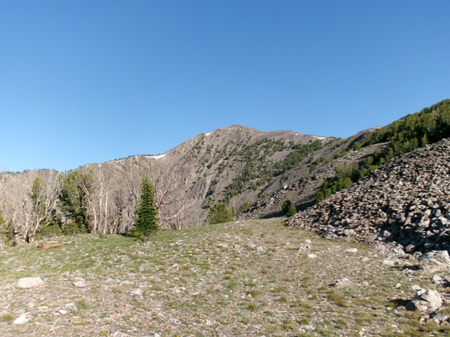
U Mountain as viewed from the east. Livingston Douglas Photo
Access
The North Fork Little Timber Creek access (FST-183) is currently blocked by posted, gated private ranch land. The only public access is from its south side via FST-187/Middle Fork Little Timber Creek Trail [(A)(8.2)(a) on Page 314]. This is the first leg of a 2-peak adventure that includes U Mountain and Peak 9960. It covers 9.0 miles with 3,700 feet of elevation gain round trip.
Map Errors
There is an unmapped climber’s trail that leaves FST-187 just before the creek crossing and heads west up to Lake 9157.
Southeast Shoulder/East Ridge, Class 2+
The Climb
From the Middle Fork Little Timber Creek trailhead, hike about 2-1/2 miles up FST-187 (a narrow foot/MC trail) to the log crossing of Middle Fork Little Timber Creek, where the trail turns left/south to climb steeply up to a pass. Leave the trail a short distance below this creek crossing at about 8,660 feet. Follow an unmapped climber’s trail that leaves the north side of FST-187 at a clearing and heads up to Lake 9157 at the headwaters of Middle Fork Little Timber Creek.
Follow this climber’s trail briefly as it heads northwest then west. Leave the trail and bushwhack northwest then west up through steep, but reasonable, pine forest to find a ridge/shoulder that heads left/northwest. This climb is in a mix of pine forest, a few open (or semi-open) areas, and some patches of boulders/talus. Reach a grassy, flat open bench at about 9,800 feet. Move to its left/west side then scramble diagonally right/northwest up through talus then easy pine forest. Skirt a rocky hump and reach the crest of the east ridge.
Follow the forested ridge west up through easy, gapped pines to reach open terrain. Scramble west then northwest then west to the rocky summit on easy tundra and stable ground rock. There are some easy ridge outcrops to navigate and a final, high talus slope to climb. I built up the summit cairn. The summit provides beautiful views down to two nearby lakes (Lake 9526 and Lake 9157) as well as open views to other nearby 10ers. The view of rugged Peak 9960 and its wicked connecting ridge is a rather ominous sight.
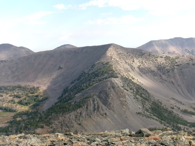
U Mountain (in center) and its connecting ridge to Slate Roof Peak to its south. Livingston Douglas Photo
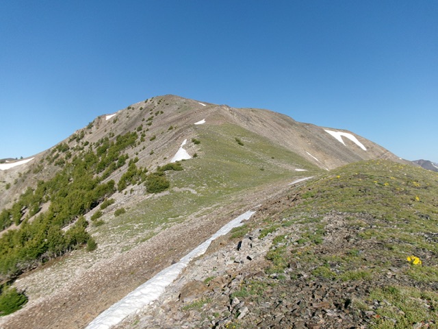
Looking up the upper east ridge at the summit. This was my ascent route. Livingston Douglas Photo
Northeast Ridge, Class 2
The Descent
From the summit, descend back down the east ridge to its junction with the northeast ridge. The northeast ridge leads down to the connecting saddle with Peak 9960. Descend the northeast ridge in a steep-ish mix of tundra and scree. Lower down, patches of ridge pines join the mix and make the descent a bit tedious. Reach the small, 9,620-foot connecting saddle with Peak 9960 in ½ mile and about 25 minutes. This concludes the first leg of today’s 2-peak journey. Peak 9960 is up next.

U Mountain and its easy northeast ridge (in mid-ground, left of center). This was my descent route.
Additional Resources
Regions: EASTERN IDAHO->Lemhi Range
Mountain Range: Lemhi Range
Longitude: -113.53869 Latitude: 44.56279