Elevation: 10,623 ft
Prominence: 319
This peak is not in the book. The elevation and prominence figures are based on recent LiDAR updates. The USGS quad shows an elevation of 10,624 feet. Updated October 2025
Peak 10623 is located about a mile north of Ray Lode Peak and is southwest of Gunsight Peak (10,838 feet). It can be climbed in combination with Ray Lode Peak or Gunsight Peak or directly from Big Eightmile Creek via its north ridge. USGS Yellow Peak
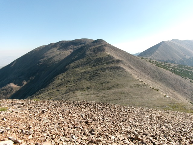
Peak 10623 and its south ridge. The summit hump is left of center. This was my ascent route. Livingston Douglas Photo
Access
Same as for Ray Lode Peak (10,720 feet). FST-183 is always on the west side of Big Eightmile Creek. The first mile of the trail isn’t even shown on the USGS topo map. This is the second leg of a 2-peak adventure that includes Ray Lode Peak and Peak 10623. It covers 8.0 miles with 3,550 feet of elevation gain round trip.
South Ridge, Class 2
From the 10,308-foot connecting saddle with Ray Lode Peak, scramble north-northeast over a gentle ridge hump in broken rock and talus. Drop 25 feet to a minor saddle then continue north up broken rock then talus to the rocky, boulder-and-talus summit of Peak 10623. There is no clear “highest boulder” up here. I built a good-sized cairn on the boulder that seems to be the high point.
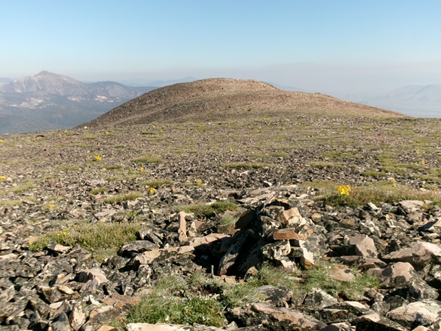
The summit of Peak 10623. Livingston Douglas Photo
North Ridge/West Face, Class 3
The Descent
From the summit, descend north-northwest on a summit “finger” of talus then follow the chunky ridge talus (steep-ish in spots) down to Saddle 9995. From this small saddle, bushwhack west down a forested but very rocky face. Stay out of minor gullies and patches of steep talus/scree fields. Remain in the pine forest as much as possible. This descent is steep, loose, rocky, and slow (Class 3 in sections). It requires careful downclimbing of face rock, boulders, and steep pine forest with loose scree/gravel and dirt.
Stay in open rock gullies at times (to avoid deadfall) and on the edge of the forest (near a rocky gully) at times as well. Lower down, the forest gets thick. Look for open rock or areas of forest with less deadfall. The mix of steep rock, downed logs, and trees is tedious to descend. Finally, the slope eases as you approach Big Eightmile Creek. Cross a large, grassy field then enter the forest again and find the creek. Cross to the west side of the creek on downed logs and quickly find the ATV trail. Follow the trail for about a mile back to the trailhead.
Additional Resources
Regions: EASTERN IDAHO->Lemhi Range
Mountain Range: Lemhi Range
First Ascent Information:
- Other First Ascent: North Ridge/West Face—Descent
- Year: 2025
- Season: Summer
- Party: Livingston Douglas
Longitude: -113.54889 Latitude: 44.58659