Elevation: 10,650 ft
Prominence: 590

Climbing and access information for this peak is on Page 256 of the book. Livingston Douglas revised this page adding a new ascent route, a new descent route, and new photos. Additionally, he linked this peak up with two additional 10ers. See his trip report at this link: The Scorpion Cirque Traverse. Updated October 2025
Pincer Peak is the 220th-highest peak in Idaho. Pincer Peak is located just over a mile north of Scorpion Mountain on a high ridge corner that overlooks both Garfield Canyon and Muldoon Canyon in the Pioneer Mountains. This is a rugged area and is not for novice climbers. Pincer Peak can be climbed in combination with nearby Scorpion Mountain and Antares Peak in a superb, 3-peak ridge traverse. USGS Star Hope Mine
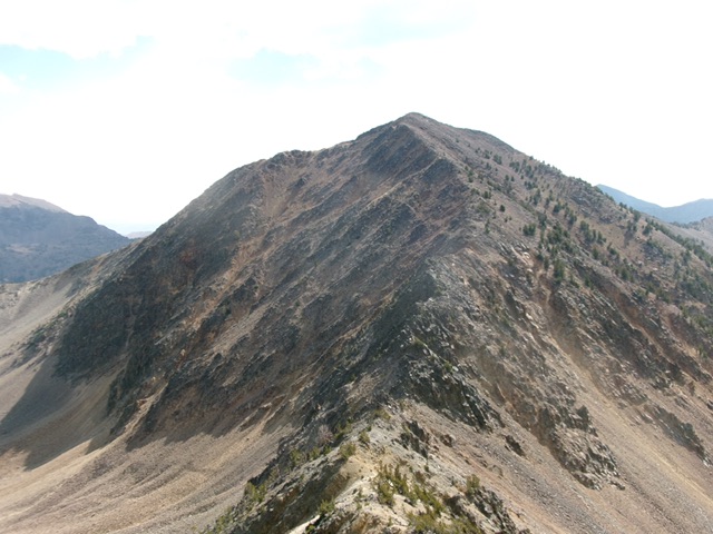
Pincer Peak and its west ridge (in center). This was my descent route. Livingston Douglas Photo
Access
Same as for Scorpion Mountain. This is the second leg of a 3-peak adventure that includes Scorpion Mountain (10,545 feet), Pincer Peak, and Antares Peak (10,651 feet). It covers 9.5 miles with 5,050 feet of elevation gain round trip.
Map Errors
Contrary to the USGS topo map, there is only a foot trail for the first mile up into Garfield Canyon. The old road is simply gone.
South Ridge, Class 2+
The Climb
From the 10,020-foot connecting saddle with Scorpion Mountain, scramble north-northwest and skirt the left/west side of a ridge hump in mostly rocky terrain. There are minor goat trails here. Drop 60 vertical feet to a higher saddle at 10,140 feet. Continue north-northwest in endless rock on a narrow ridge crest to reach the false summit hump. Drop 15 vertical feet and scramble north to the summit of Pincer Peak. The summit has a nice cairn. The view of nearby, rugged Antares Peak is a rather frightening sight from here, especially if it is the next peak on today’s agenda.

Pincer Peak as viewed from The Claw (10,613 feet) to its north. Livingston Douglas Photo

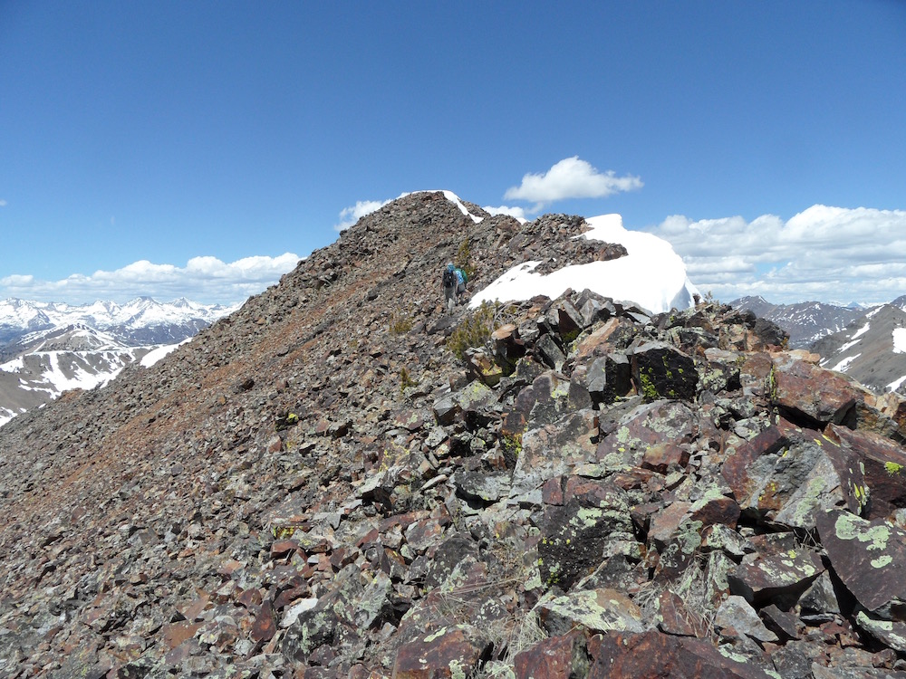
Pincer Peak and its south ridge (in center and left of center). This was my ascent route. Livingston Douglas Photo
West Ridge, Class 3
The Descent
From the summit, downclimb west then northwest on a narrow, rocky ridge crest (Class 3 with some minor ridge towers) to reach the 10,060-foot connecting saddle with Antares Peak. This concludes the second leg of today’s 3-peak journey. Antares Peak (10,651 feet) is up next.
The summit of Pincer Peak. John Platt Photo
Additional Resources
Regions: EASTERN IDAHO->Pioneer Mountains
Mountain Range: Pioneer Mountains
Year Climbed: 1994
Longitude: -113.89329 Latitude: 43.64809