Elevation: 10,820 ft
Prominence: 480
Climbing and access information for this peak is on Page 257 of the book. In the book, the elevation is listed as 10,800 feet. Published November 2025
Peak 10820 sits on a high ridgeline on the east side of Muldoon Canyon. It is located due south of Peak 10940 and due east of rugged Peak 10613/The Claw. Peak 10820 is most easily climbed from Iron Bog Lake to its south. USGS Smiley Mountain
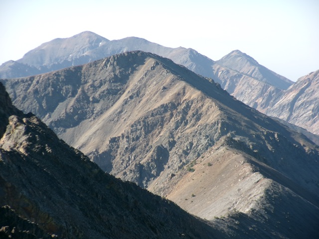
Peak 10820 (in mid-ground) as viewed from Peak 10940 to its north. Livingston Douglas Photo
Access
Muldoon Canyon/Iron Bog Lake Trail/FST-065 [(C)(3.4)(a) on Page 260]
Map Errors
The Muldoon Canyon Trail stays on the east side of Muldoon Creek and never crosses it. The USGS topo map incorrectly shows it mostly on the west side of the creek.
West Gully/Northwest Ridge, Class 3
The Ascent
From the Muldoon Canyon trailhead, hike about two miles south on the poorly-maintained FST-065 to an open area (in grass) near Muldoon Creek. This area is a short distance off-trail. Peak 10820 is readily visible from here to the east-southeast. From this open area, scramble southeast briefly up some rolling shoulders of thick-ish sagebrush to reach a rounded shoulder (of sorts) in the center of the wide west gully of Peak 10820. The west gully heads up to a 10,340-foot saddle just northwest of the peak.
This shoulder is mostly thick-ish sagebrush and some leafy veg. It is not very rocky initially. As you advance, the scrub shortens but the underlying base becomes scree/gravel and the slope steepens. The shoulder ends in the gully itself. Scramble east up the rocky gully (not difficult). It narrows higher up and becomes a mix of firs, ground rock ribs, and loose scree/gravel with some scrub/tundra mixed in. The upper half of the gully is pretty steep and loose, but it goes thanks to embedded rock ribs.
Skirt the thick firs higher up as necessary and scramble on all fours at times to advance up the loose rock (Class 3). Move onto Class 3 rocky ribs at times for better footing. Reach the 10,340-foot saddle on the northwest ridge. Scramble south then southeast up the ridge to the summit plateau. There is a goat trail (at times) just below the ridge crest on its right/west side. The ridge crest has Class 3 rocky outcrops initially then easier ridge rock (Class 2) the rest of the way. If you stay off the crest, you may be able to keep this ridge climb at Class 2 difficulty.
The summit had a decent cairn which I built up substantially. It is an open, flat spot that heads downward in all directions. The summit offers a nice view of nearby Iron Bog Lake to the south-southeast as well as a nice view of Point 10920 and Peak 10940 to the north and the rugged connecting ridge. Peak 10820 is a double-summitted peak. The west summit is clearly the high point.
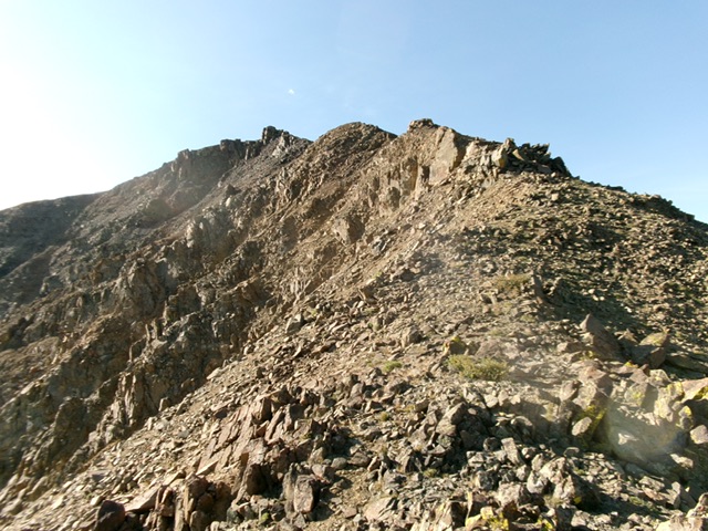
The rocky northwest ridge of Peak 10820. This was the final leg of my ascent route. Livingston Douglas Photo
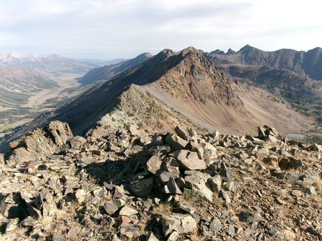
The enlarged summit cairn atop Peak 10820, looking north along the high, rocky ridge crest. Livingston Douglas Photo
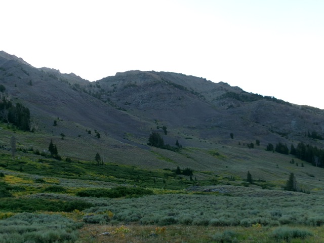
Peak 10820 as viewed from the valley floor to its northwest. Livingston Douglas Photo
Additional Resources
Regions: EASTERN IDAHO->Pioneer Mountains
Mountain Range: Pioneer Mountains
First Ascent Information:
- Other First Ascent: West Gully/Northwest Ridge
- Year: 2025
- Season: Summer
- Party: Livingston Douglas
Longitude: -113.8524 Latitude: 43.6651