Elevation: 10,940 ft
Prominence: 280
Climbing and access information for this peak (shown as Peak 10920) is on Page 257 of the book. When LiDAR updates become available, it is likely that neither of these elevation figures will be correct. Published November 2025
Peak 10940 is the high point on a rugged, rocky ridgeline that sits on the west side of Brockie Lake in the Pioneer Mountains. It is most easily climbed via a steep scramble from the Muldoon Canyon Trail to its west. USGS Smiley Mountain
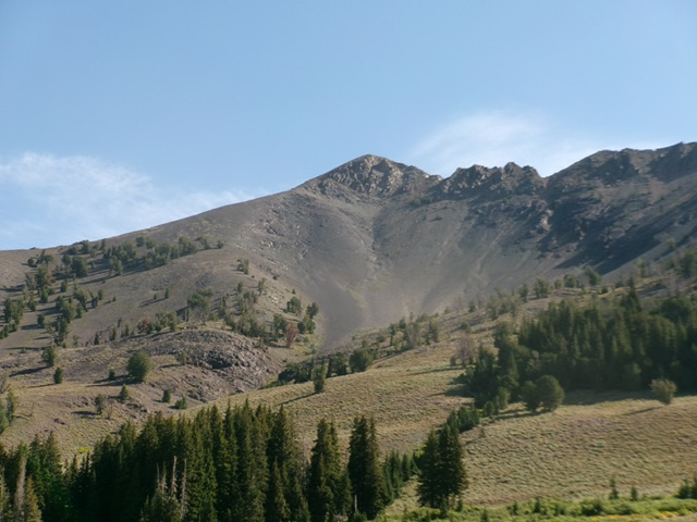
Peak 10940 as viewed from the valley floor to its southwest. Livingston Douglas Photo
Access
Muldoon Canyon/Iron Bog Lake Trail/FST-065 [(C)(3.4)(a) on Page 260]
Map Errors
The Muldoon Canyon Trail stays on the east side of Muldoon Creek and never crosses it. The USGS topo map incorrectly shows it mostly on the west side of the creek.
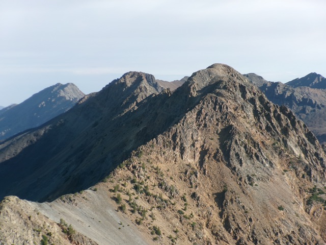
Peal 10940 (left of center) and Point 10920 (dead center) as viewed from Peak 10820 to the south. Livingston Douglas Photo
West Ridge, Class 3
The Ascent
From the Muldoon Canyon trailhead, hike about 1.1 miles south on the poorly-maintained FST-065 to reach a feeder stream crossing. This stream comes down from a large gully to the left/east. The gully sits just left/north of the [rounded] west ridge of Peak 10940. You can see the summit from this point. Leave the trail soon after crossing to the south side of the feeder stream. Bushwhack southeast up onto the rounded ridge through sagebrush.
Climb east up a reasonably well-defined shoulder (contrary to what the USGS topo map shows) in steep scrub, scree, and gravel. Skirt the right/south side of a thick patch of pine forest early on. Once past the forest, continue up the steep, open ridge and skirt a few downed trees. Find a few scattered pines midway up. Reach a steep hill at about 9,550 feet. This is the crux of the climb. Scramble up steep, loose scree/gravel for 450 vertical feet (Class 3 work, sometimes on all fours) to reach flatter ground.
Continue east up flatter (but still steep-ish) scree/gravel to reach a final section of relatively good ridge rock and stable talus. Climb up to the small, airy summit of Peak 10940. I found only a minimal 1-rock cairn here so I took the time to build a nice summit cairn on the high point for future climbers to enjoy. There was lots of loose talus nearby with which to build it. The summit offers magnificent views of two ranked 11ers to the north and northeast as well as Point 10920 and Peak 10820 to the south. Brockie Lake sits over 1,000 feet below the summit in a basin to the north-northeast.
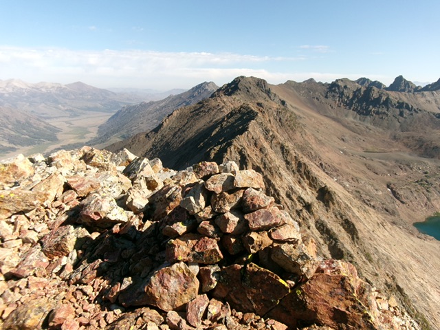
The newly-built summit cairn atop Peak 10940, looking north along the rocky, high ridge crest. Livingston Douglas Photo
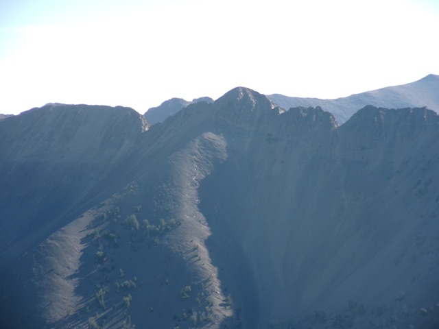
Peak 10940 (dead center) and its steep west ridge (just left of center). This was my ascent route. Livingston Douglas Photo
Additional Resources
Regions: EASTERN IDAHO->Pioneer Mountains
Mountain Range: Pioneer Mountains
Longitude: -113.8559 Latitude: 43.6822