Elevation: 10,965 ft
Prominence: 307
This peak is not in the book. Elevation and prominence figures are based on recent LiDAR updates. The USGS quad shows an elevation of 10,900 feet and a prominence of 240 feet. Published March 2026
This peak is located east of Sheephead Peak on the main Lost River Range crest It sits on a ridge line that runs east toward Methodist Peak. USGS Mackay
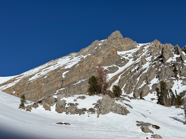
South view of Bear Creek Peak taken from Peak 9600. Derek Percoski Photo
Access
Approach via Bear Creek Trail/FST-092 [(D)(3)(a) on Page 294]
South Face, Class 2
Approach via Bear Creek Trail/FST-092 [(D)(3)(a) on Page 294]. At 7,600 feet, there is an obvious fork in the drainage, this is where you leave the Bear Creek Trail and take a left up Methodist Gulch. Here’s the part where it would be easy to make a mistake: when you reach the back of Methodist Gulch you need to take a sharp right turn at 9,400 feet. Following the path in front of you would lead to the Sheephead/Invisible saddle. Ascending the south face toward the saddle west of the peak is the simplest (Class 2 route). Perhaps a more direct, more scrambly line directly to the summit would be desirable. The talus was all covered in snow for my ascent. On the walk from the saddle to the summit, there are a couple obstacles that are easily avoided by staying to the right.
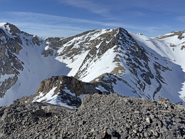
Looking down at the saddle from the summit. In the back is a hump between South Wet and Sheephead. Derek Percoski Photo
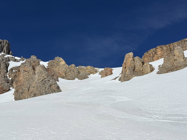
Looking up the south face, directly below the saddle. Derek Percoski Photo
Additional Resources
Regions: EASTERN IDAHO->Lost River Range
Mountain Range: Lost River Range
First Ascent Information:
- First Ascent Year: 2026
- Season: Winter
- Route: South Face
- Party: Derek Percoski
Longitude: -113.51902 Latitude: 43.98260