Elevation: 11,523 ft
Prominence: 309
This peak is not in the book. Based on LiDAR measurements, it was determined that this peak has 309 feet of prominence and is now on the ranked list of Idaho 11ers. Published December 2025
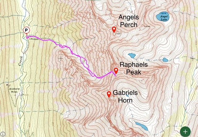
Raphaels Peak sits on the impressive ridge that divides Wildhorse Creek from Fall Creek. It is nestled into the ragged terrain between Angels Perch to its north and Gabriels Horn to its south. USGS Standhope Peak
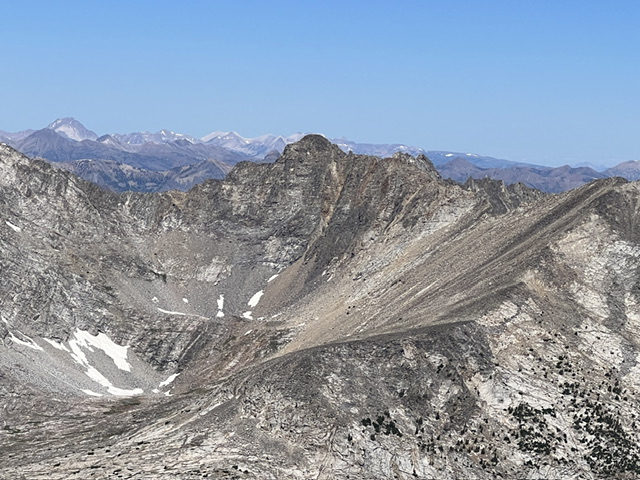
The southeast face of Raphael Peak as viewed from Recess Peak. Derek Percoski Photo
West Face, Class 4
From Wildhorse Creek Road due west of Angels Perch, head east up into the forest at 7,600 feet. The route bends southeast above 9,000 feet as you follow the drainage. Above 10,000 feet, a Class 2 couloir eventually comes into view that leads toward the summit. Just before a 11,300-foot saddle, head south and scramble up steep terrain toward the summit. You will top out just below the summit and see the final Class 4 stretch that puts you on top.
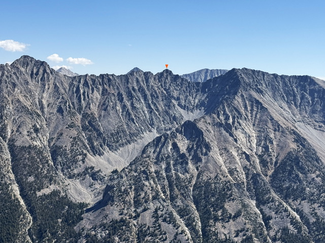
View from Boulder Lake Peak: Angels Perch, Raphael Peak, and Gabriels Horn. Derek Percoski Photo
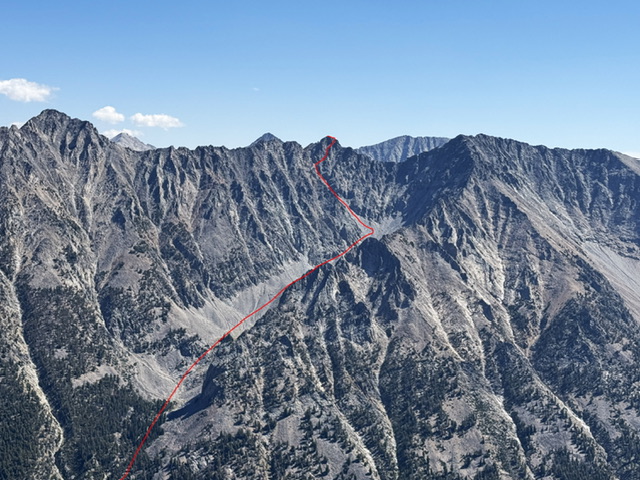
The approach and West Face Route (red line) drawn on the previous photo. Derek Percoski Photo
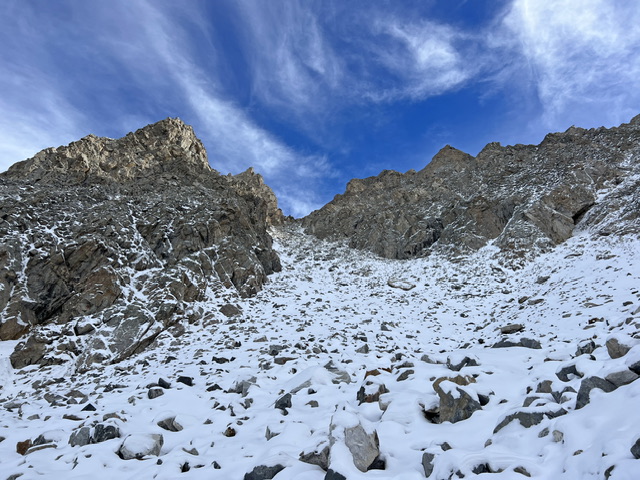
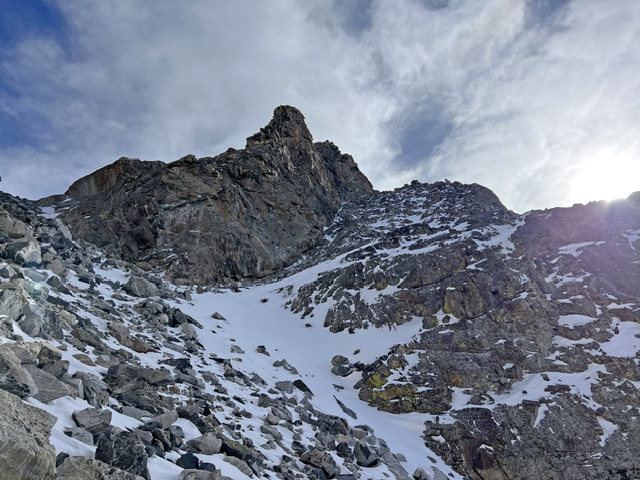
The couloir leading toward the summit. Derek Percoski Photo
This is the point where the route turns south and the scrambling begins. Derek Percoski Photo
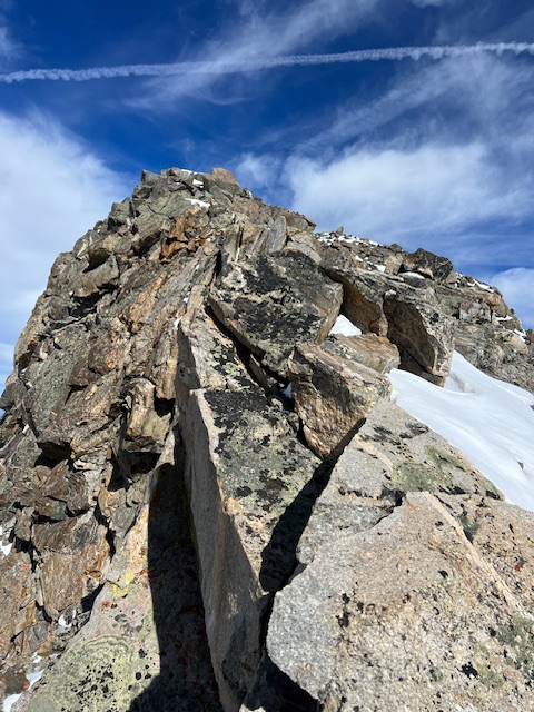
The final Class 4 pitch to the summit
Derek’s GPS track measured 4.23 miles with 3,836 feet of elevation gain round trip.
Potential Alternate Routes
There appears to the be gentler way up via a very long Fall Creek approach. Climb the east portion of the south face (Class 2) then top out east of the summit. From there, I am not sure what the remaining stretch to the summit would entail, but it looks doable. I’m just one man who climbed this mountain one time. My way worked for me, but that does not mean I found the best way.
Additional Resources
Regions: EASTERN IDAHO->Pioneer Mountains
Mountain Range: Pioneer Mountains
Longitude: -114.06685 Latitude: 43.78790