Elevation: 4,224 ft
Prominence: 333
This peak is not in the book. The elevation and prominence figures are based on recent LiDAR updates on Peakbagger.com. Published November 2025
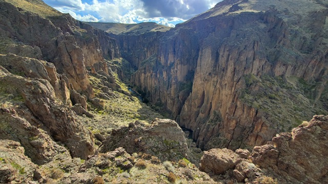
This peak located north of the Owyhee Mountains. It is a nearly vertical-sided island surrounded by the Bruneau River. USGS Stiff Tree Draw
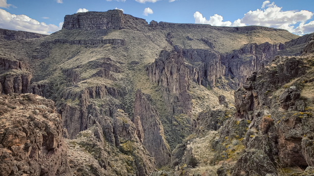
Peak 4224 as viewed from the northwest. Kaden Platt Photo
Access
Access to this peak leaves ID-51 at the signed turn for Missile Base Road. The road is gravel for much of the distance. It is 22.4 miles to the edge of the Bruneau Canyon. If the weather has been wet the area identified as White Lake becomes too deep to drive across. Also keep in mind that getting close to this peak requires good all terrain tires and decent ground clearance. At the end of the road, a faint trail heads down to Sheep Creek.
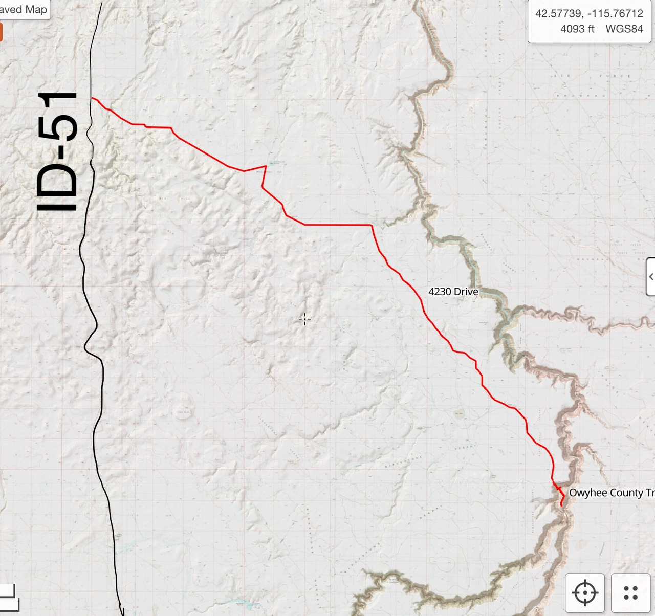
The driving route from ID-51
Northwest Gully, Class 3
The route begins at the edge of the canyon. My round-trip distance was 2.5 miles with 1,600 feet of elevation gain.
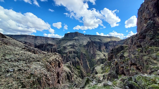
The view shortly after dropping down from your vehicle. Kaden Platt Photo

The trail goes down a narrow wash and sees little use. Kaden Platt Photo
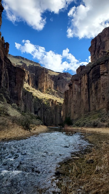
The closer to Sheep Creek that you get, the better the scenery becomes. In my opinion, this is one of the most stunning Owyhee County peaks. Kaden Platt Photo
Once you cross the creek, it is a brushy walk up to the edge of the rim. From there, wander through the boulders up a Class 2+/3 route to reach the summit.

A look at the “route” up. This peak is surrounded by steep walls and Rhyolite towers. Kaden Platt Photo
Looking down into Sheep Creek from halfway up. If not so chossy, I would return here to establish some climbing routes. Kaden Platt Photo
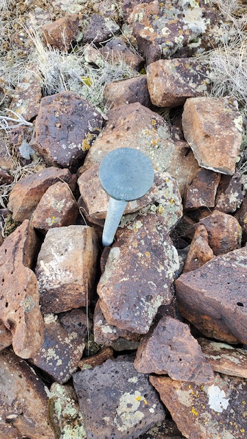
Evidence that this summit has seen previous visitors. Kaden Platt Photo
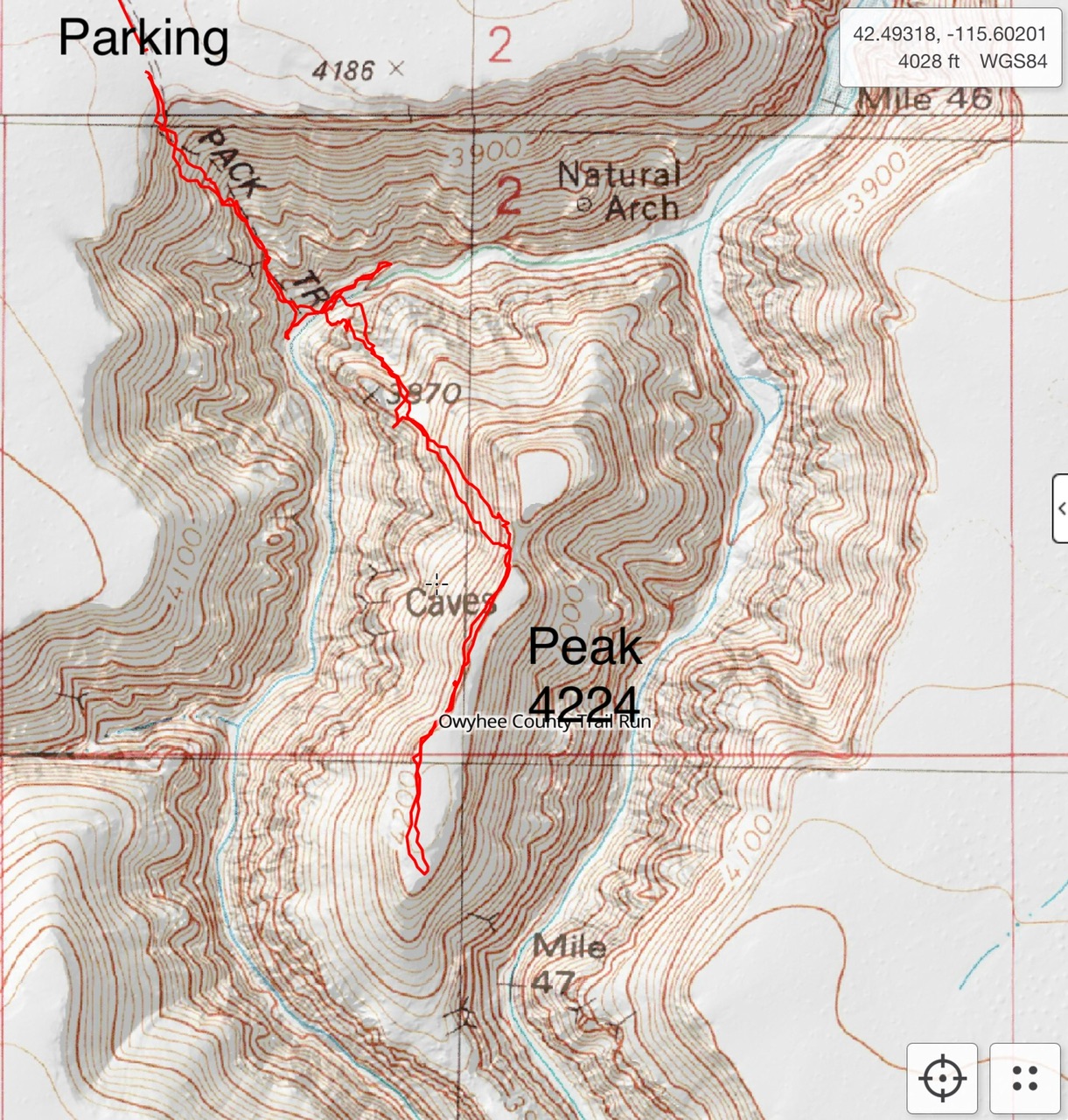
My GPS track
Additional Resources