Elevation: 5,021 ft
Prominence: 278
This peak is not in the book. Published October 2025
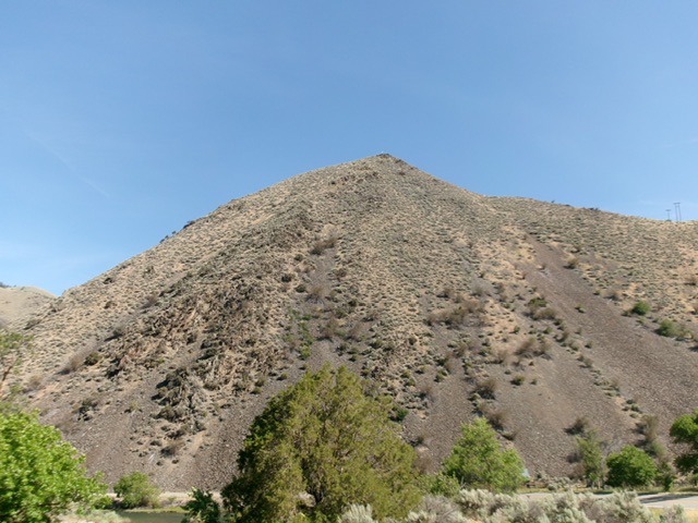
Peak 5021 is located along US-93 and the Salmon River. It sits above a sharp bend in the highway and several ranches on the east side of the highway. Peak 5021 is a western foothill of Goldbug Ridge. USGS Goldbug Ridge
Peak 5021 as viewed from US-93 to its south. Livingston Douglas Photo
Access
Park in a pullout along the Salmon River on US-93 at virtual MM290.3 [4,238 feet; 44°58’52.6”N, 113°57’00.1”W]. Although there is a lot of private land in this area, this climb is entirely on BLM land.
North Gully/East Ridge, Class 2
The Climb
This is probably the easiest, shortest route to the top. From the roadside pullout, walk briefly south on US-93 to reach the toe of a bench that sits above the highway on its east side. This bench leads directly northeast to the critical north gully. Find a weak game trail that heads diagonally right up onto the bench/ramp. Follow this game trail as it heads northeast in field grass and pine forest to reach the mouth of the [obvious] dry gully.
Cross a weak BLM cattle fence and bushwhack east then southeast up the gully on a game trail. The terrain is a mix of field grass, pines, and mountain mahogany. A set of power lines also go up this gully. Leave the gully after the power lines head right/south to cross the east ridge of Peak 5021. Find a spot to ascend diagonally right/southwest to reach the power lines up at the east ridge crossing.
Avoid the talus/scree fields to the right. This short scramble from the gully to the east ridge is in easy field grass with a weak game trail of sorts. Once on the east ridge, scramble west up the steep ridge of scrub and talus to reach the small summit area. There is a TV antenna on top. The summit offers a magnificent view of the Salmon River and the nearby ranches on the valley floor to the south.
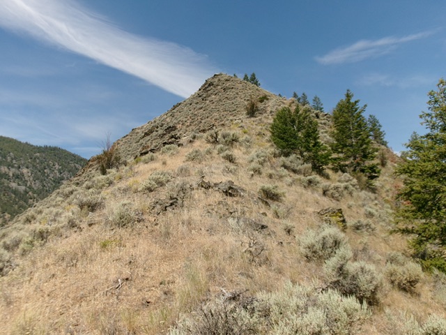
The steep push up the east ridge to the rocky summit. This was the final leg of my ascent route. Livingston Douglas Photo
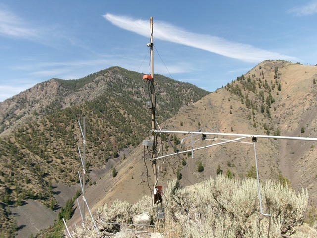
The antenna-clad summit of Peak 5021, looking across the Salmon River drainage at the Twin Peaks (left of center). Livingston Douglas Photo
Additional Resources
Regions: EASTERN IDAHO->Lemhi Range
Mountain Range: Lemhi Range
Longitude: -113.94630 Latitude: 44.97883