Elevation: 5,198 ft
Prominence: 309
This peak is not in the book. The elevation and prominence figures are based on recent LiDAR updates. The USGS quad shows an elevation of 5,193 feet. Published October 2025
Thanks to LiDAR updates, Peak 5198 is now a ranked summit. It sits in the Samaria Hills and is due south of Malad City. The south summit hump is the high point. This area is a mix of private and public land, so be careful. USGS Samaria
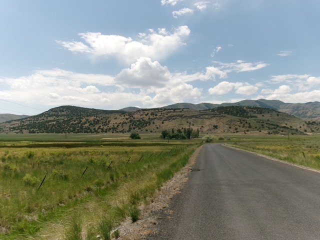
Peak 5198 (in mid-ground) as viewed from Samaria Road to its northeast. The left hump is the summit. Livingston Douglas Photo
Access
From either Exit 13/Malad City or Exit 3/Samaria-Cherry Creek on I-15, get onto Old Highway 191, which is a paved frontage road on the west side of I-15. Head south (from Exit 13) or north (from Exit 3) on Old Highway 191 to a signed junction with Samaria Road. Go west on Samaria Road for 2.5 miles to a side road that heads right/north to a private ranch. There is a locked cattle gate on the south side of the road here. According to LOJ, BLM land extends down to the road here at this locked cattle gate. I confirmed this with the rancher who lives on the side road and owns the private land in this area. Park in the grass near the cattle gate along Samaria Road [4,441 feet; 42°05’01.9”N, 112°16’38.8”W].
Map Errors
Maps show a South Samaria Road and an East Samaria Road. They are actually [signed] “Samaria Road,” which is an excellent, 45MPH paved road.
North Ridge, Class 2+
The Climb
From the cattle gate, head south-southwest across a fenced area then quickly cross an old, rusty cattle fence. Once across the fence, scramble right-ish/southwest up a steep face of thick sagebrush and rocky boulders (a headwall of sorts) higher up. Reach a flat area then scramble south-southwest up steeper sagebrush and a rockier headwall (Class 2+) to reach the crest of the north ridge. Follow the forested ridge crest in junipers and sagebrush to reach semi-open Point 4996 at the north end of the north summit hump.
The terrain here is much more open/gapped and easier—scattered junipers and gapped field grass and scrub. Slowly descend south then southeast in semi-open terrain to reach the 4,900-foot connecting saddle with the [higher] south summit hump. The highest point of this broad saddle is at its east end. From the saddle, scramble south up to a high ridge crest that heads left-ish/southeast. The final push to the summit is flatter and heads left-ish even more (east). The terrain on the north face of the south summit hump is thicker juniper forest but, higher up, it thins out and has many open areas.
The high point of Peak 5198 is in semi-open junipers. The highest boulders are underneath the junipers and are impossible to stand atop. The views to the south and west are mostly open. Other views are hindered by the junipers.
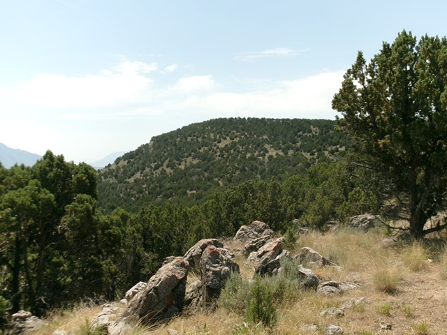
Peak 5198 as viewed from Point 4996 to its north. Livingston Douglas Photo
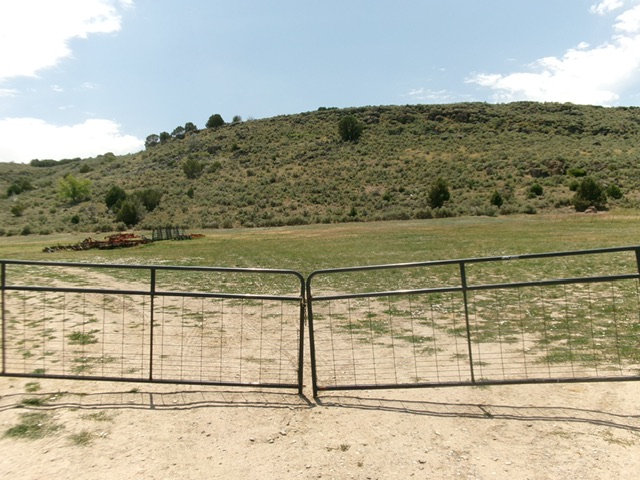
The gated closure at the base of the north ridge (start of climb). This is BLM land and entry is allowed. Livingston Douglas Photo
Additional Resources
Regions: Samaria Mountains->SOUTHERN IDAHO
Mountain Range: Bannock Range
Longitude: -112.2760 Latitude: 42.06714