Elevation: 5,453 ft
Prominence: 318
This peak is not in the book. Elevation and prominence figures are based on recent LiDAR measurements. The map elevation is 5,440 feet. Livingston Douglas climbed the peak via the south ridge which was my descent route. He added a a description of that route and new photos. Updated October 2025
Peak 5453 is located east of Slide Gulch. The peak offers a nice early-season destination. The peak’s upper slopes are mostly treeless and easy to climb. USGS Twin Springs
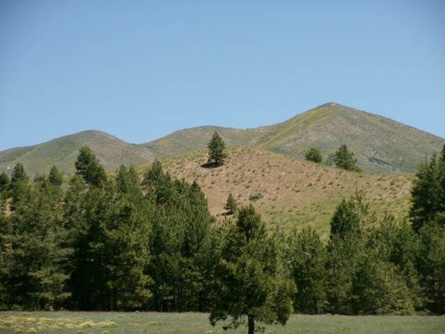
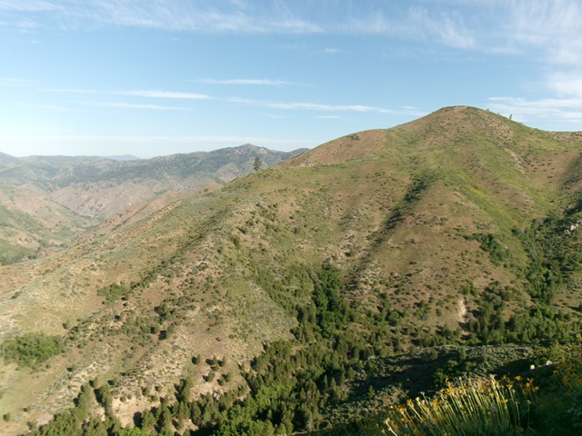
Peak 5453 as viewed from the south
Access
Access the peak by taking the Middle Fork Boise River Road to the Slide Gulch Road [(C)(1) on Page 154]. Follow the Slide Gulch Road southeast to the peak’s South Slopes.
Northeast Ridge, Class 2
The summit is a Class 2 climb from any point along this stretch of road. Some lines will be brushier than others. I climbed the peak by traversing over from Peak 6300 via the connecting ridge line. We followed game trails much of the way. There are brushy spots along the way. We descended the south ridge.
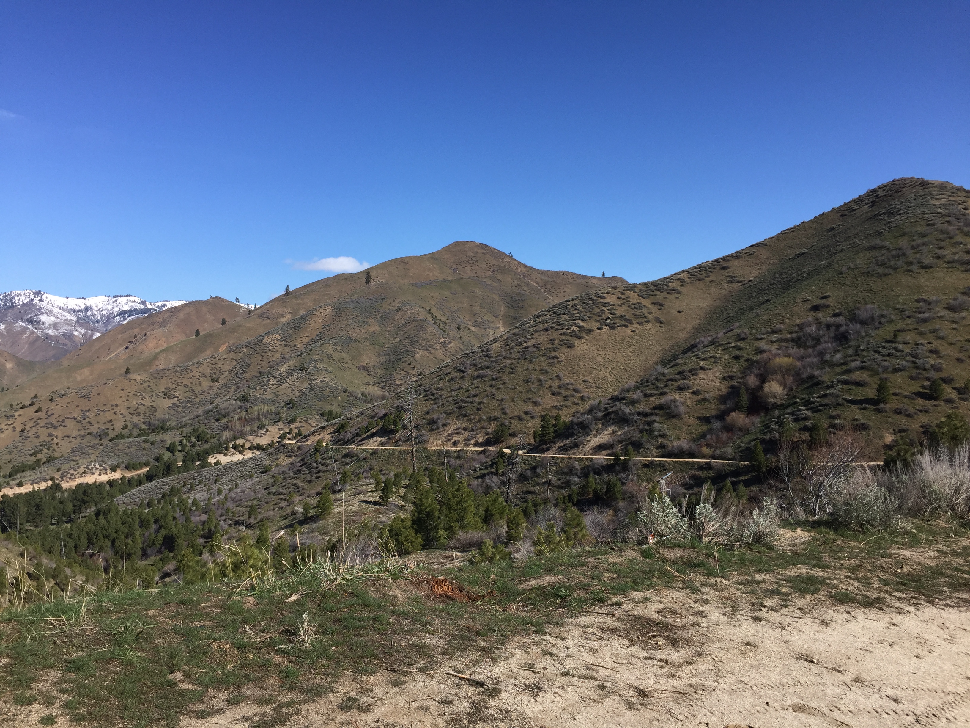
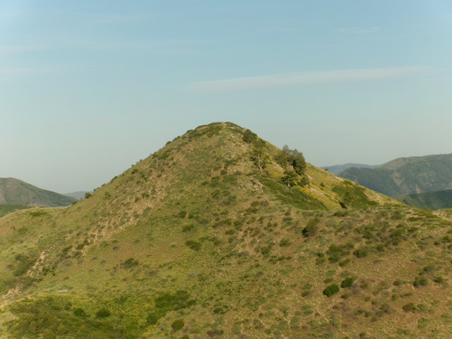
Peak 5453 as viewed from the midpoint between it and Peak 6300.
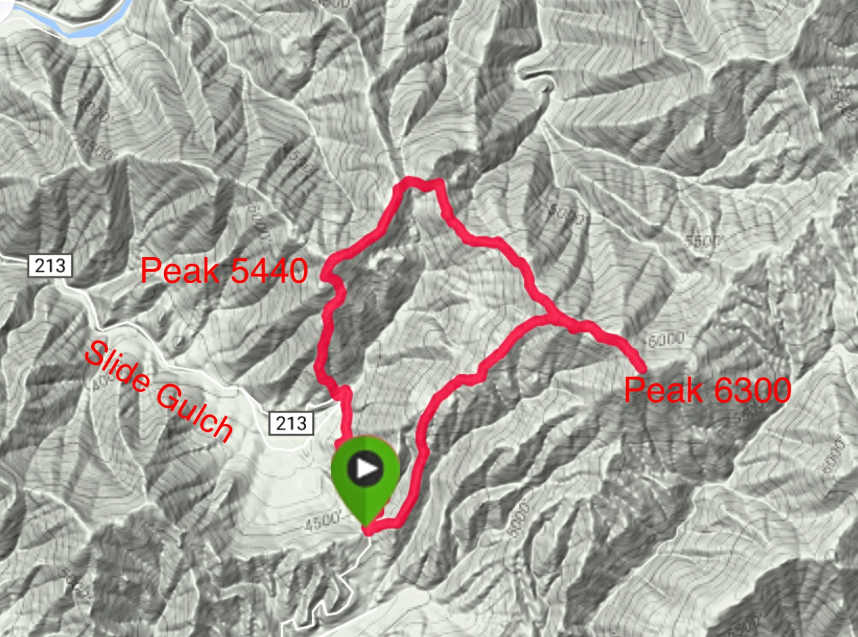
My GPS track for our traverse
South Ridge by Livingston Douglas
Peak 5453 (right of center) as viewed from the southwest. Livingston Douglas Photo
Access
Park at a sharp bend in FSR-213/Slide Gulch Road on the south side of Peak 5453 at 4,295 feet and 43°37’56.8”N, 115°42’38.6”W. This bend is 0.7 miles north-northwest of the Lopez “Cattle Guard” launch point, which is 1.6 miles northeast of the FSR-221/FSR-213 road junction.
South Ridge, Class 2
The Climb
From the road bend, scramble north-northwest up a steep, gravel/dirt and scrub shoulder. This shoulder is one of two shoulders to the west of the road bend. The correct shoulder is the right/east one. These two shoulders merge at about 5,000 feet along with a third shoulder to form the south ridge. This climb is steep but the scrub is not too bad. The sagebrush is gapped and not too thick; the veg is short. Once on the south ridge, it soon jogs right-ish and then splits. Stay on the right fork and climb directly left/northwest up the southeast face of the summit hump. The summit of Peak 5453 is an obvious hump and had a modest cairn, which I built up a bit.
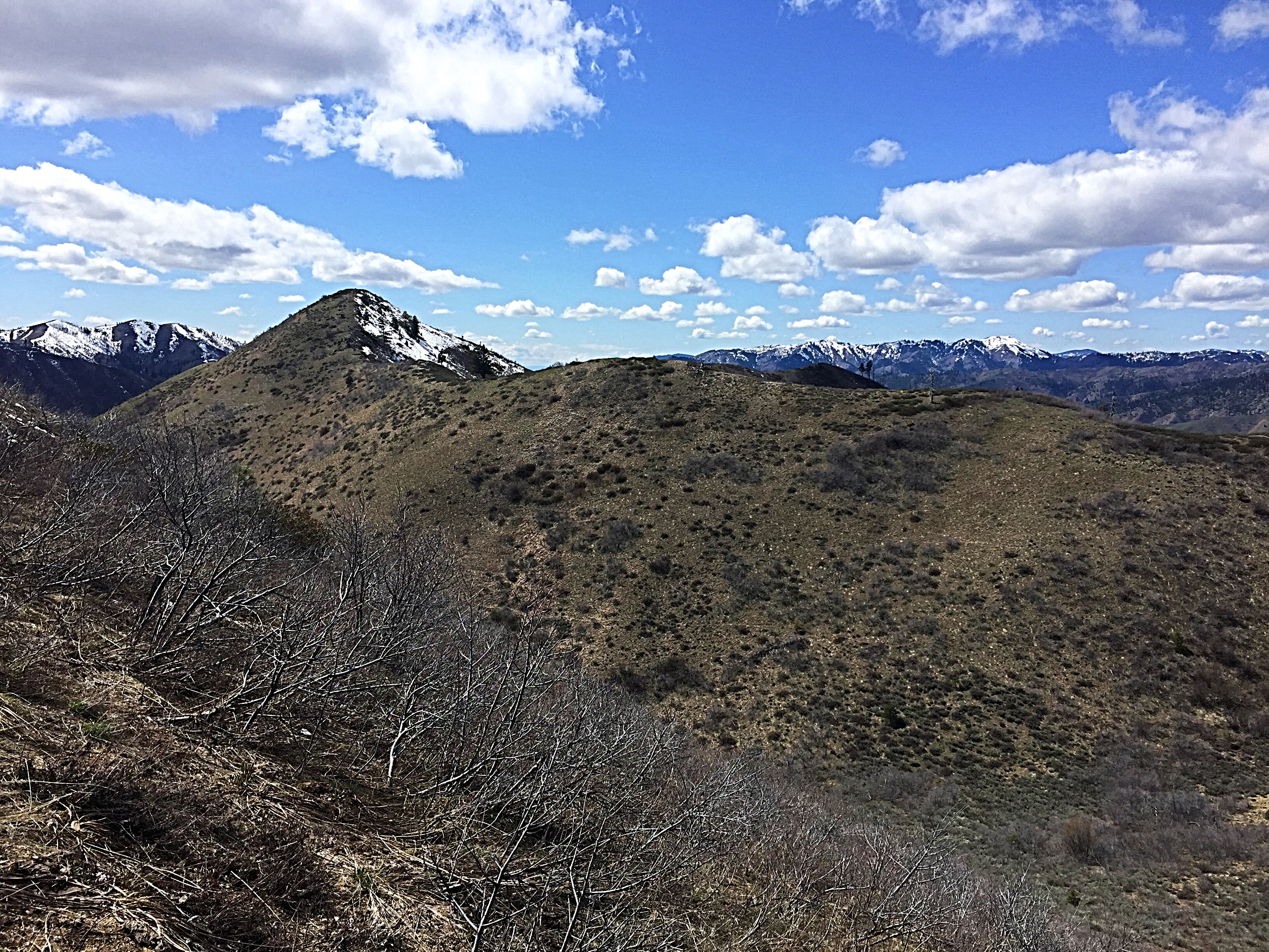
Peak 5453 and its magnificent south ridge (skyline in center and left of center). This was my ascent route. Livingston Douglas Photo
The summit hump of Peak 5453 as viewed from the east. Livingston Douglas Photo
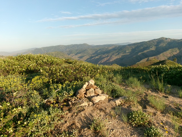
The summit of Peak 5453 with its rebuilt summit cairn. Livingston Douglas Photo
Additional Resources
Regions: Boise Mountains->WESTERN IDAHO
Mountain Range: Boise Mountains
Year Climbed: 2017
Longitude: -115.71139 Latitude: 43.64009