Elevation: 5,480 ft
Prominence: 527
This peak is not in the book. Published October 2025
Peak 5480 sits at the headwaters of both Pony Creek and Graves Creek in the foothills of the Boise Mountains. It is located south of Long Gulch and is most easily reached from FSR-213 to its north. USGS Long Gulch
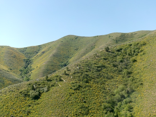
Peak 5480 as viewed from the north early in the ridge climb. Livingston Douglas Photo
Access
Same as for Peak 5664. Continue north then west on FSR-213/West Long Gulch Road. At 3.3 miles from the National Forest boundary, park at a dispersed campsite on a spur road on the left/south side of FSR-213 [4,149 feet; 43°33’22.0”N, 115°39’55.7”W].
North Ridge, Class 2
The Climb
From the dispersed campsite, head south and find a path across the small creek in the willows. Emerge in an open, bare area and move right/west to find a spot to get up through a short patch of willows and reach the critical scrub ridge that heads left-ish/southeast from the valley floor. Once on the ridge, scramble up a mix of sagebrush (with gaps), veg, and clumpy field grass. The ridge is steep but it goes well. The north ridge quickly bends right-ish/south and leads up to a flattish point (Point #1).
The ridge terrain is now easier and has an on-and-off game trail in sections. Head right/southwest from Point #1 to quickly reach Point #2. Go left/south at Point #2 and head south up to Point 5309. From Point 5309, head left/southeast and drop 35 vertical feet to a saddle. From the saddle, climb southeast up over two more minor ridge humps to reach the brushy north summit hump. Continue south and cross a minor saddle to reach the sagebrush-covered high point of Peak 5480. Stay just left/east of thick willows in this short, final ridge traverse. There is no cairn on top and no loose rocks with which to build one.
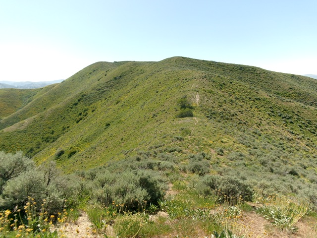
The final push up the north ridge to the summit, which is left of center. Livingston Douglas Photo
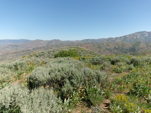
The brushy summit of Peak 5480 with the [lower] north summit hump in center in mid-ground. Livingston Douglas Photo
Additional Resources
Regions: Boise Mountains->WESTERN IDAHO
Mountain Range: Boise Mountains
Longitude: -115.6585 Latitude: 43.5417