Elevation: 5,505 ft
Prominence: 525

This peak is not in the book. Livingston Douglas revised this page. Revised and updated October 2025
Dixie Creek Peak is a beautiful peak with rugged aspects on its north side. It sits just south of Anderson Ranch Dam and offers a splendid view of Anderson Ranch Reservoir from the summit. The only public access is via the magnificent west ridge. USGS Anderson Ranch Dam
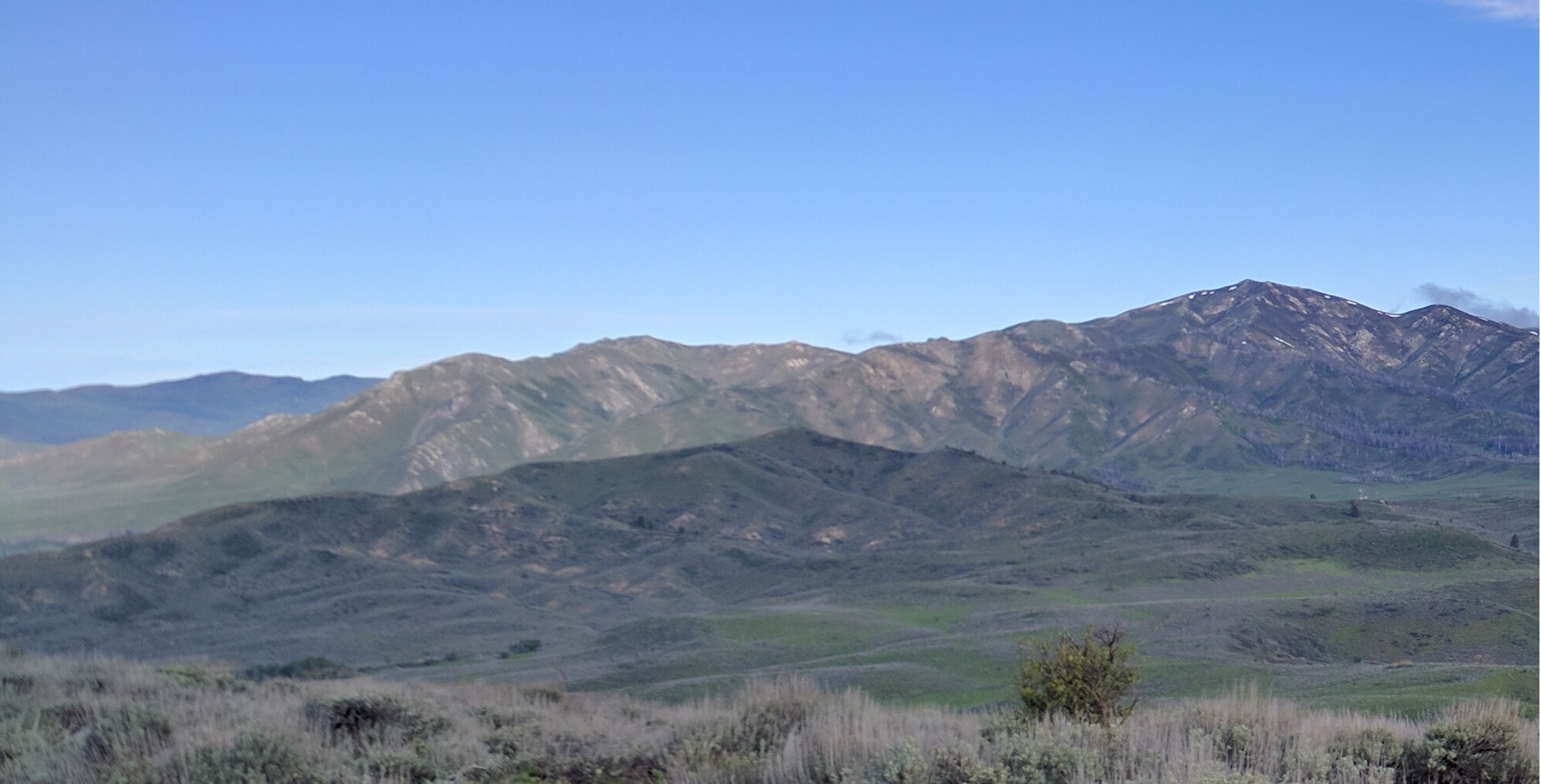
Granite Mountain (back left), House Mountain (back right), and Dixie Creek Peak in the foreground (middle). Erik Pohlmann Photo
Access
Anderson Dam Road is located along US-20 about 20.3 miles from the I-84/US-20 junction. The road is well signed and is 5.2 miles up from (northeast of) Prairie Road which is also well signed. Drive 2.6 miles north up Anderson Dam Road to a junction with a good 2-track road heading right/east. This spur road is 134C. It heads east then north up to a crossing of the west ridge at Point 5014. It is a service road for the nearby power lines and should be drivable with a 4WD vehicle. It is not overly steep and could be easily hiked as it is on public land.
Map Updates
There is no fence row on the west ridge as the USGS topo map indicates.
West Ridge, Class 2
The Climb
From the ridge crossing at Point 5014 at 4,980 feet, scramble east-southeast up the open, magnificent west ridge of Dixie Creek Peak. The ridge is narrow and somewhat steep. The terrain is easy grass/scrub with some underlying scree/gravel. The summit is small and has a small summit cairn. Cross a dilapidated fence row (the barbed wire is laying on the ground but the fence posts remain upright) and walk about 20 feet to the cairned high point. While this final short section is on private land, it is not posted to prohibit entry.
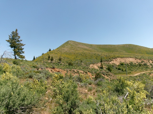
Dixie Creek Peak as viewed from the west. The summit is left of center. Livingston Douglas Photo

The summit hump of Dixie Creek Peak as viewed from midway up the west ridge. This was my ascent route. Livingston Douglas Photo
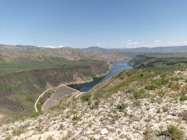
View of Anderson Ranch Dam and the Anderson Ranch Reservoir from the summit. Livingston Douglas Photo
Additional Resources
Regions: Boise Mountains->Danskin Mountains->WESTERN IDAHO
Mountain Range: Boise Mountains
Longitude: -115.45469 Latitude: 43.34479