Elevation: 5,590 ft
Prominence: 410
This peak is not in the book. Published October 2025
Peak 5590 sits due east of Malad City and separates Little Valley from Maple Hollow. It towers over I-15 to its west. This area is a mix of private and public land, so be careful. This climb is almost entirely on public land. The summit is on unposted, private land. USGS Malad City East
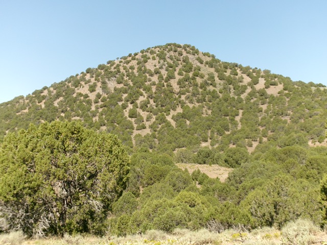
Peak 5590 as viewed from the east. Livingston Douglas Photo
Access
From Exit 13/Malad City on I-15, drive east on the underpass road to the east side of I-15. Reset your odometer when you reach the northbound frontage road. Drive north on the frontage road. At 1.8 miles, turn right/east onto an unsigned, paved side road. At 2.5 miles, reach an unsigned junction with FSR-233/Little Valley Road. You can see a cattle gate the FSR-233 sign at it, about 100 yards southeast of this junction.
Turn right/southeast onto Little Valley Road and quickly reach a cattle gate. Stay on the road as this section passes through private property. Drive 0.5 miles on Little Valley Road to a second cattle gate and park just after passing through it. You are now on public land. Better yet, continue another 0.3 miles to a meadow and a parking area. The second cattle gate is at 5,128 feet and 42°12’07.9”N, 112°13’01.2”W. LOJ is wrong in showing this area south of the second cattle gate as private land.
East Face, Class 2
The Climb
Have a copy of the LOJ land management map to stay on National Forest land when conducting this climb. Thankfully, the private land nearby is fenced and posted so the public/private land line is obvious. From the second cattle gate, bushwhack south up a fence row over forested Point 5336. Reach a fence corner and head right/west and descend west then south into a semi-forested drainage. You can avoid these ups and downs by starting the climb from a meadow 0.3 miles south of the second cattle gate and follow cattle trails southwest then west down a grassy, then forested, drainage that leads to the east side of the peak. I followed this latter route on my descent back to Little Valley Road.
This drainage leads to the east side of Peak 5590. Cross a small stream then scramble west up through steep gravel, scrub, and junipers to reach the summit ridge. Head briefly right/north to the summit. The high point seems to be an open boulder not the larger boulder that sits under a thick juniper tree nearby. Stand on both (as able) “just to be sure.” This peak has a large “M” (for Malad City) painted on its west face. The summit offers magnificent views of nearby I-15 and Malad City.
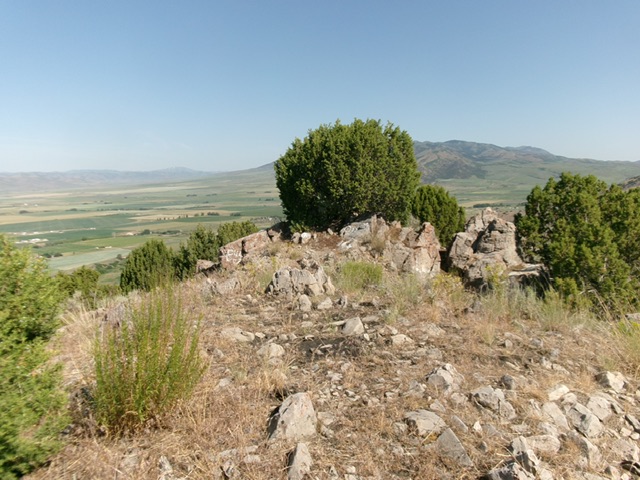
The summit of Peak 5590. Livingston Douglas Photo
Additional Resources
Regions: Bannock Range->Malad Range->SOUTHERN IDAHO
Mountain Range: Bannock Range
Longitude: -112.2277 Latitude: 42.1998