Elevation: 5,874 ft
Prominence: 334
This peak is not in the book. I recommend securing permission from the landowner before climbing this peak. Published October 2025
Peak 5874 sits above the convergence of the Little Malad River and West Elkhorn Canyon in the Pleasantview Hills. This area is a mix of private and public land, so be careful. The summit is on unposted private land. USGS Daniels
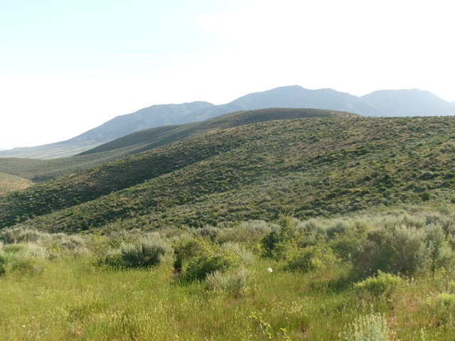
Peak 5874 (in mid-ground) as viewed from the critical saddle to its southwest. Livingston Douglas Photo
Access
Same as for Peak 5849. Park at a cattle guard at the 2.6 mile-point on John Evans Canyon Road. This improvised pullout is at 5,085 feet and 42°14’26.9”N, 112°23’58.1”W. To avoid the nearby, unposted private ranch land, drive another ½ mile up John Evans Canyon Road to a large corral on BLM land.
Map Updates
There is no road or pack trail in the dry drainage underneath Peak 5874 anymore. Remnants of the old road remain there.
Southwest Shoulder, Class 2
The Climb
From the cattle guard, walk briefly east on the road to a green cattle gate. Cross the gate then bushwhack north across an area of tall, thick field grass to reach another cattle fence. Cross this easier fence and scramble northwest up onto a grass/scrub shoulder that is on the left/west side of a prominent gully. Higher up, cross another easy cattle fence where the gully bends right-ish/north. Move into the drainage and find a cattle trail. Follow this trail to a ridge saddle at 5,540 feet.
From this saddle, descend north then northeast on a good cattle trail in a dry gully of thick-ish sagebrush to reach a dry drainage crossing at the base of the southwest shoulder of Peak 5874. Scramble northeast up this steep-ish, but easy, shoulder of gapped grass/scrub to reach the high summit ridge. Head left/north to the summit hump. I rebuilt the torn-down summit cairn.
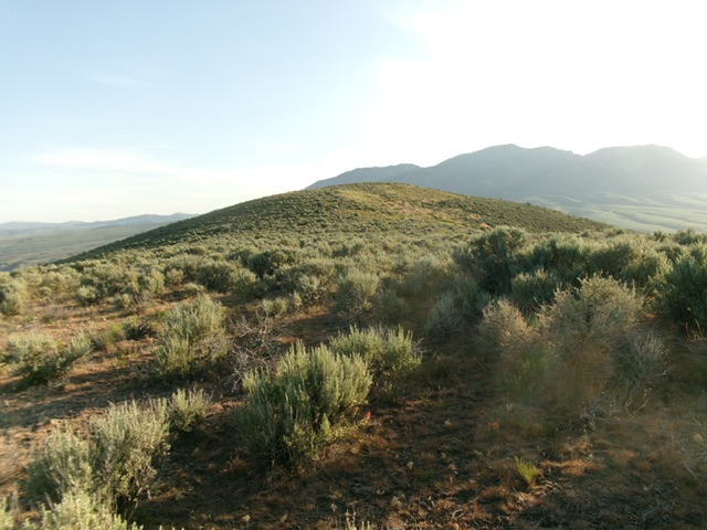
The summit hump of Peak 5874. Livingston Douglas Photo
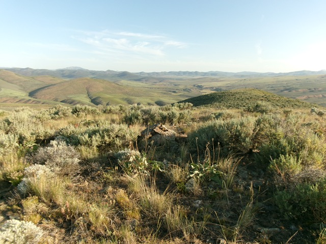
The sagebrush summit of Peak 5874 with its newly-built summit cairn. Livingston Douglas Photo
Additional Resources
Regions: Pleasantview Hills->SOUTHERN IDAHO
Mountain Range: Pleasantview Hills
Longitude: -112.3956 Latitude: 42.2637