Elevation: 6,005 ft
Prominence: 310
This peak is not in the book. The elevation and prominence figures are based on recent LiDAR measurements. Published October 2025
Peak 6005 is a newly-ranked peak thanks to LiDAR. It sits between Wilson Creek and Evans Creek on the northwest side of the Anderson Ranch Reservoir. This area is a mix of private and public land, so be careful. USGS House Mountain
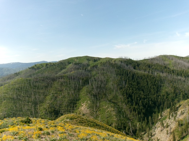
Peak 6005 (summit is just left of center) and its brushy north ridge (dead center). This was my descent route. Livingston Douglas Photo
Access
Anderson Dam Road is located along US-20 about 20.3 miles from the I-84/US-20 junction. The road is well signed and is 5.2 miles up from (northeast of) Prairie Road which is also well signed. Drive 5.0 miles north up Anderson Dam Road to drop down to the dam and cross to its north side. Once across the dam, reach a signed “T” junction with Fall Creek Road. Reset your odometer here.
Go right/east onto Fall Creek Road. At 0.3 miles, reach the boat dock parking area. At 4.7 miles, reach a sharp bend at the Evans Creek Campground. Park in a pullout at this bend [4,239 feet; 43°24’05.2”N, 115°24’50.3”W]. This is the first leg of a 2-peak adventure that includes Peak 6005 and Peak 6418. It covers 6.5 miles with 3,400 feet of elevation gain round trip.
Map Updates
The National Forest map fails to show three roads in this area, all of which emanate from the Evans Creek Campground road bend. One 2-track road goes northeast from the road bend to God-Knows-Where. Two other better 2-track roads (both signed with NF road numbers) leave from across the road from the campground. Both of these roads show up on the USGS topo map but not on the NF map. One of these roads heads up Rock Creek.
The USGS map fails to show the full extent of the Rock Creek Road. The other jeep road (if publicly accessible) heads up the left/west side of Evans Creek then leaves the creek drainage to climb up and west toward Peak 6005. Both of these roads are in decent shape and are drivable with a 4WD vehicle. There is a spur road (not shown on maps) that continues up the Evans Creek drainage to two private cabins.
East Ridge, Class 2
The Climb
From the road bend, follow Fall Creek Road west then south briefly back to the campground. Leave Fall Creek Road and hike west up the NF road that heads up the right/north side of Rock Creek. When the road bends left/south to cross Rock Creek, leave the road and scramble steeply north up gravel/dirt and short grass/scrub to reach the crest of the east ridge of Peak 6005. Follow the steep-ish, open ridge crest in a mix of easy, short scrub/grass and patches of thick veg/brush.
The bushwhacking is thick in a saddle just west of Point 5358 and in much of the area from that elongated saddle to a junction with the high summit ridge. There are some on-and-off game trails on the summit ridge. However, there are some thick patches of veg and willows in heading west then northwest to reach the open summit. There was no summit cairn so I built a decent one on the high point. Please note that there is a short section of unposted, unfenced private land on the east ridge of Peak 6005 to cross on the way to the summit.
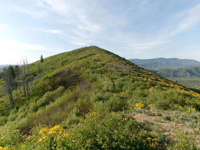
The summit hump of Peak 6005 as viewed from high on the north ridge. Livingston Douglas Photo
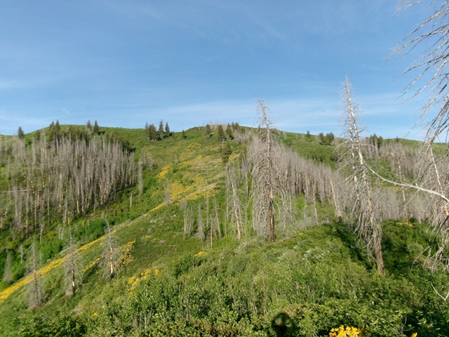
Looking up the east ridge of Peak 6005. This upper section gets quite thick with vegetation and brush. Livingston Douglas Photo
North Ridge, Class 2+
The Descent
From the summit, descend north-northwest then northeast on a surprisingly difficult open ridge with too many thick patches of veg, willows, and other brush. Bend left-ish/north to descend and cross Evans Creek in mercilessly-thick brush/veg/willows in a burn area with downed, charred timber. This descent was steep and brutally thick, especially near the bottom. The crossing of Evans Creek is the low point between Peak 6005 and Peak 6418. It concludes the first leg of today’s 2-peak journey. Peak 6418 is up next.
Additional Resources
Regions: Boise Mountains->WESTERN IDAHO
Mountain Range: Boise Mountains
Longitude: -115.43831 Latitude: 43.40157