Elevation: 6,117 ft
Prominence: 337
This peak is not in the book. Published October 2025
Peak 6117 is located northeast of Prairie, Idaho. It sits between Aden Creek and Dry Buck Creek in the foothills of the Boise Mountains. The peak is mostly on State of Idaho Land. This area is a mix of private and public land, so be careful. This climb is entirely on public land. USGS Prairie
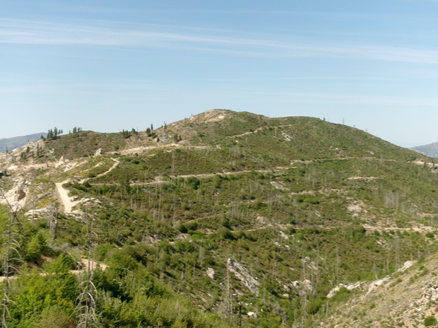
Peak 6117 as viewed from the northeast. Livingston Douglas Photo
Access
From downtown Prairie at a signed junction of Prairie Road and Smith Creek Road, drive east on Prairie Road. At 0.8 miles, reach a signed 4-way junction with FSR-159. Go left/east onto FSR-159. At 3.1 miles, go left at an unsigned junction. At 5.4 miles, reach a signed junction with [gated closed] FSR-175A on the left/west side of the road. Park here [5,807 feet; 43°31’34.8”N, 115°30’37.7”W]. FSR-159 is a narrow, badly-rutted 2-track road. While unpleasant, FSR-159 is NOT a jeep trail as the USGS topo map indicates.
Map Updates
The USGS topo map fails to show the ATV/Jeep Trail that heads up the northeast ridge of Peak 6117.
Northeast Ridge, Class 2
The Climb
From the gated road closure, hike southwest up the ATV trail (FSR-175A) as it heads up the right/north side of the ridge crest and skirts Point 6080+ entirely. Once past Point 6080+ and at a ridge saddle just north of the high point (and just south of a repeater station), leave the road/trail and scramble left/south up through easy, gapped scrub to reach the first hump (the north/true summit). I continued to the more impressive, but slightly lower, south summit hump. The south summit offers a beautiful view of Prairie, Idaho.
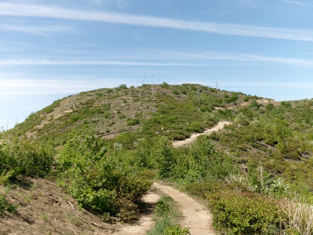
The summit hump of Peak 6117 as viewed from high on the northeast ridge. This was my ascent route. Livingston Douglas Photo
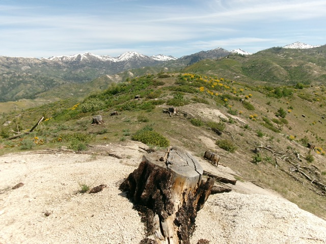
Looking back at the true/north summit from the [lower] south summit. Livingston Douglas Photo
Additional Resources
Regions: Boise Mountains->WESTERN IDAHO
Mountain Range: Boise Mountains
Longitude: -115.5254 Latitude: 43.5208