Elevation: 6,418 ft
Prominence: 358
This peak is not in the book. Published October 2025
Peak 6418 separates Evans Creek from Castle Creek in the Boise Mountains. It towers above Anderson Ranch Reservoir to its southeast. The peak is most easily climbed from nearby Fall Creek Road. This area is a mix of private and public land, so be careful. USGS House Mountain
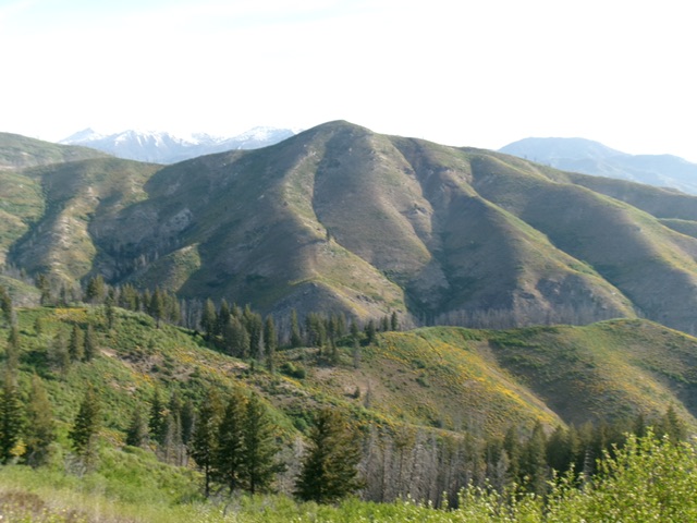
Peak 6418 as viewed from Peak 6005 to its south. Livingston Douglas Photo
Access
Same as for Peak 6005. This is the second leg of a 2-peak adventure that includes Peak 6005 and Peak 6418. It covers 6.5 miles with 3,400 feet of elevation gain round trip.
Map Updates
The National Forest map fails to show three roads in this area, all of which emanate from the Evans Creek Campground road bend. One 2-track road goes northeast from the road bend to God-Knows-Where. Two other better 2-track roads (both signed with NF road numbers) leave from across the road from the campground. Both of these roads show up on the USGS topo map but not on the NF map. One of these roads heads up Rock Creek.
The USGS map fails to show the full extent of the Rock Creek Road. The other jeep road (if publicly accessible) heads up the left/west side of Evans Creek then leaves the creek drainage to climb up and west toward Peak 6005. Both of these roads are in decent shape and are drivable with a 4WD vehicle. There is a spur road (not shown on maps) that continues up the Evans Creek drainage to two private cabins.
South Ridge, Class 2+
The Climb
From the crossing of Evans Creek, scramble northeast up steep, but easy, open terrain (short grass/scrub and gravel) to reach the crest of the south ridge of Peak 6418. The south ridge has some veg to deal with but an on-and-off game trail helps to advance higher. High up, the ridge bends right-ish/northeast in easy, short scrub to reach the open summit. There was no summit cairn so I built one.
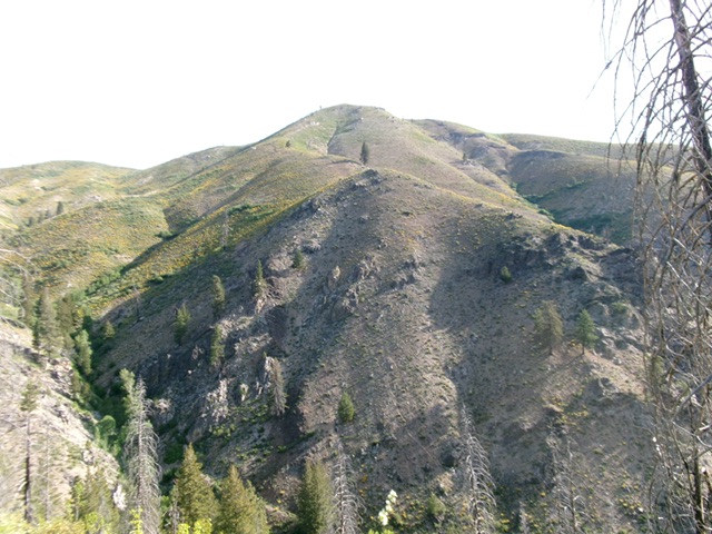
The steep, mostly-open south ridge of Peak 6418 (in dead center). This was my ascent route. Livingston Douglas Photo
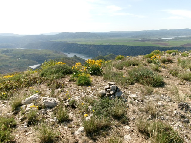
The summit of Peak 6418 with Anderson Ranch Reservoir in the distance (left of center). Livingston Douglas Photo
Southeast Ridge/South Spur, Class 2
The Descent
From the summit, descend southeast on a meandering, sometimes ill-defined ridge with a surprising amount of veg and willow patches. Leave the ridge at about 5,350 feet to descend the south spur. This spur is a mix of rock/gravel and scattered scrub. Lower down, move left/east into a gully and follow game/cattle trails much of the way down to the east side of Evans Creek. Head down Evans Creek in open terrain, using cattle trails and (finally) an old road to return to the road bend and your parked vehicle. Much of this descent route is on unposted, unfenced private land and is indistinguishable from the nearby National Forest land.
Additional Resources
Regions: Boise Mountains->WESTERN IDAHO
Mountain Range: Boise Mountains
Longitude: -115.4301 Latitude: 43.4220