Elevation: 6,453 ft
Prominence: 368
This peak is not in the book. The elevation and prominence figures are based on recent LiDAR updates as found on Peakbagger.com. The USGS quad shows an elevation of 6,430 feet. Published October 2025
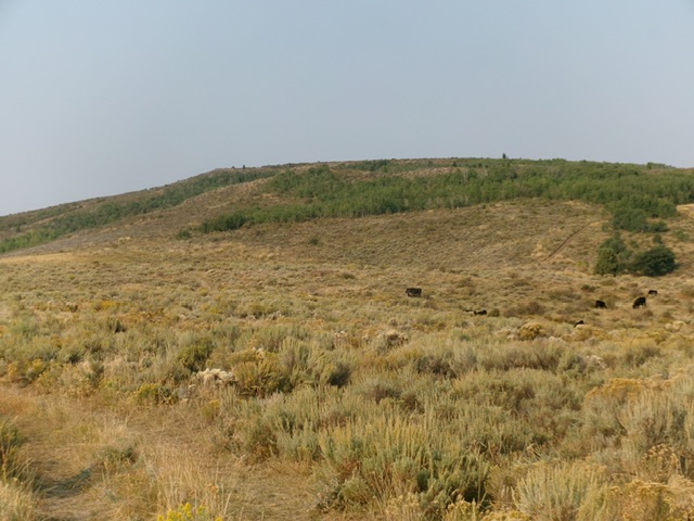
Peak 6453 is a minor forest/scrub hump that sits southwest of the Blackfoot River in the northern section of the Chesterfield Range. It is most easily climbed from Lincoln Creek Road to its northeast. This area is a mix of private and public land, so be careful. The upper section of this peak is on private land that is open to the public based on signage that I saw (see photo). USGS Dunn Basin
Peak 6453 as viewed from Lincoln Creek Road to its east (start of climb). Livingston Douglas Photo
Access
From the south end of Firth on US-91, drive 1.7 miles south on US-91 to [signed] East 600N. This is Wolverine Road, a well-maintained county road. Turn left/east onto paved Wolverine Road and reset your odometer. At 10.3 miles, reach a signed junction with Blackfoot River Road. Go right onto Blackfoot River Road and follow this winding gravel road (county-maintained) generally southeast for 13.6 miles to a signed junction with Trail Creek Road. Turn right/south onto Trail Creek Road and follow this meandering, up-and-down, gravel road (county-maintained) for 6.8 miles to its end at a “T” junction with Paradise Road.
[You can also reach this junction by driving west from Blackfoot Reservoir Road on Paradise Road all the way to here. The county roads are of better quality on this alternate approach drive.] Turn right/southwest onto Paradise Road and drive 0.3 miles to a signed junction with Lincoln Creek Road (also signed for Graves Creek Road). Go left/south onto Lincoln Creek Road and drive 2.0 miles to a ridge crossing and an unsigned junction with an unmapped 2-track BLM road heading right/west. Park here near a wire cattle gate [5,959 feet and 43⁰02’12.8”N, 111⁰54’43.3”W].
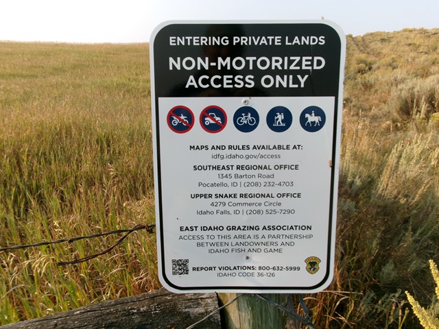
The private land on the upper half of Peak 6453 is open to hikers. Livingston Douglas Photo
Map Errors
Maps fail to show several of the helpful 2-track roads in this area.
East Face, Class 2
The Climb
From the parking area, cross the wire cattle gate and hike southwest up the 2-track road to a road junction at a fence corner. Go right/northwest here on a 2-track and follow it up through an aspen forest to reach an open area. From there, leave the road and bushwhack southwest to the summit area in relatively easy scrub with cattle trails. The open summit has a large cairn atop it.
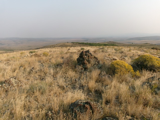
The open summit and large cairn atop Peak 6453. Livingston Douglas Photo
Additional Resources
Regions: Blackfoot Mountains->Chesterfield Range->SOUTHERN IDAHO
Mountain Range: Blackfoot Mountains
Longitude: -111.9259 Latitude: 43.6332