Elevation: 6,542 ft
Prominence: 362
This peak is not in the book. Published October 2025
Peak 6542 is the high point on a ridge that separates West Elkhorn Canyon from North Fork Canyon. A rugged jeep road (BLM-612) leads up to a pass at the base of the southwest ridge. This is the easiest access to the top of Peak 6542. USGS Daniels
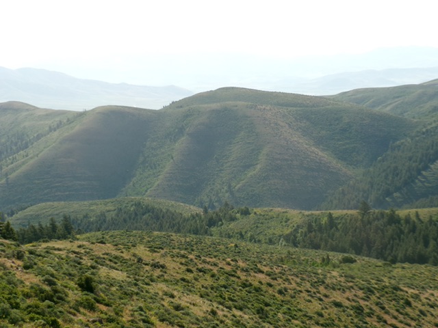
Peak 6542 (dead center) as viewed from Peak 6850 to its west. Livingston Douglas Photo
Access
Same as for Peak 5849. At the junction of Daniels Road and John Evans Canyon Road/4000N, reset your odometer and turn onto 4000N. At 3.1 miles, reach a BLM-617 road sign. At 4.4 miles, reach an unsigned road junction. Go straight onto BLM-612/North Fork Canyon Road. At 5.7 miles, park along the road here [5,784 feet; 42°14’37.4”N, 112°27’23.5”W] or continue another 0.7 miles up the road to a sharp bend and a signed road junction with BLM-697. This is the first leg of a 2-peak adventure that includes Peak 6542 and Peak 6850. It covers 7.0 miles with 2,650 feet of elevation gain round trip.
Map Updates
Metcalf Road (on the USGS topo map) is now an overgrown 2-track road that heads up the southwest ridge of Peak 6542 from a saddle/pass. It is closed to motor vehicles.
Southwest Ridge, Class 2
The Climb
From North Fork Canyon Road, scramble north up a steep, but easy, grass/scrub slope to reach the crest of the southwest ridge. Find an old 2-track road on the ridge crest and follow it northeast then east as it skirts the top of a brushy gully to the right/east. The 2-track then skirts the left/west side of Point 6439 as the road descends to a saddle southwest of Peak 6542. Ignore an unmapped 2-track that heads to the left/northwest. Stay on the original 2-track road as it heads right/east and drops a little before turning left/north and climbing to a 6,420-foot saddle just west of Peak 6542. The 2-track weakens to a cattle trail in the old grassy road bed.
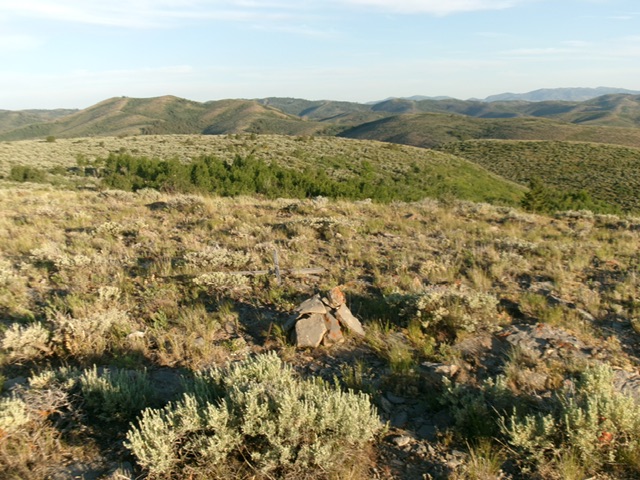
From the high saddle, bushwhack east up and over a minor ridge hump. Once past this hump, the summit comes into view. Continue east on the ridge crest and avoid the thicker sagebrush and other brush on the sides of the ridge and in the nearby gullies. The summit is open and easy. It has triangulation wood, wiring, and two pieces of rebar protruding from the ground. There was no summit cairn, so I built one next to the highest piece of rebar. I also stood on two boulders that are just east of the rebar and may be slightly higher.
The summit of Peak 6542. Livingston Douglas Photo
West Ridge, Class 2
The Descent
From the summit, return west to the high saddle. From there, bushwhack west up through thick-ish sagebrush with gaps over a minor hump (55 feet of uphill). From this hump, descend west down an easy ridge of sagebrush then field grass steeply down to West Elkhorn Canyon. The final drop to the canyon road is steep and has thick-ish sagebrush to work through. This concludes the first leg of today’s 2-peak journey. Peak 6850 is up next.
Additional Resources
Regions: Pleasantview Hills->SOUTHERN IDAHO
Mountain Range: Pleasantview Hills
Longitude: -112.4427 Latitude: 42.2568