Elevation: 6,632 ft
Prominence: 274
This peak is not in the book. Published October 2025
Peak 6632 is the neighbor to Black Cap Peak (6,579 feet). It sits above Graveyard Canyon to the east and is most easily reached from Graveyard Canyon Road. USGS Grouse
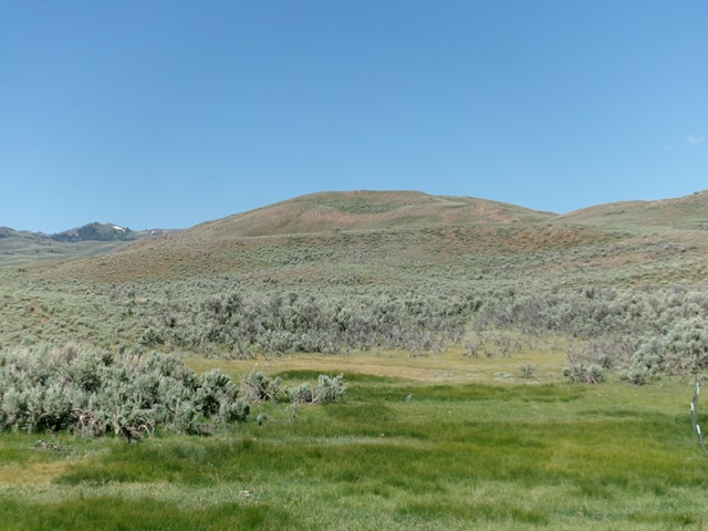
Peak 6632 as viewed from the fence corner (road departure point) to its east. Livingston Douglas Photo
Access
Same as for Black Cap Peak. Park at the base of Graveyard Canyon Road (unsigned), a narrow 2-track road that I chose to NOT drive up. This road junction is located along Antelope Creek Road exactly 2.7 miles after crossing to the south side of Antelope Creek on a good bridge and is 13.5 miles from US-93.The road junction is at 6,144 feet and 43°40’30.0”N, 113°35’37.6”W.
East Side/North Ridge, Class 2
The Climb
From the road junction, hike about 1.2 miles south up Graveyard Canyon Road to a grassy clearing in open terrain at a fence corner. This is the end of the cattle fencing along the road. Leave the road here and scramble west across field grass. Bash through a patch of tall, thick sagebrush to reach easier scrub. Head west up over two or three ridges/humps and across two or three dry gullies. Reach a final ridge saddle crossing. This is where you reach the crest of the north ridge.
Once on the north ridge, drop about 10 feet as you had left/south to the summit in easy, short scrub. The summit had no cairn so I built one. The high point is at the south end of the ridge crest. I also investigated a possible high point/hump to the southwest (nearby). It looks slightly lower but my altimeter could not find a measurable difference between the two potential high points. Most of the bushwhack up Peak 6632 is in easy, short, gapped grass/scrub but the minor gully crossings have some sagebrush to contend with.
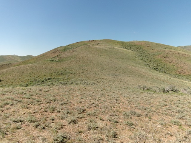
The final push to the summit up the north ridge. This was the final leg of my ascent route. Livingston Douglas Photo
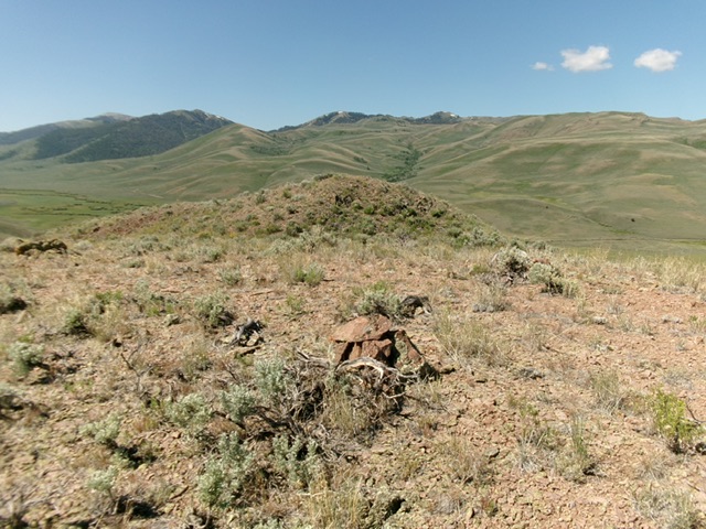
The summit of Peak 6632. Livingston Douglas Photo
Additional Resources
Regions: EASTERN IDAHO->Pioneer Mountains
Mountain Range: Pioneer Mountains
Longitude: -113.60657 Latitude: 43.65765