Elevation: 6,336 ft
Prominence: 313
This peak is not in the book. Published October 2025
Peak 6336 sits on the north side of Rock Creek and is north-northwest of House Mountain (7,700 feet). It is most easily reached via a rugged 2-track road from House Mountain Road. USGS House Mountain
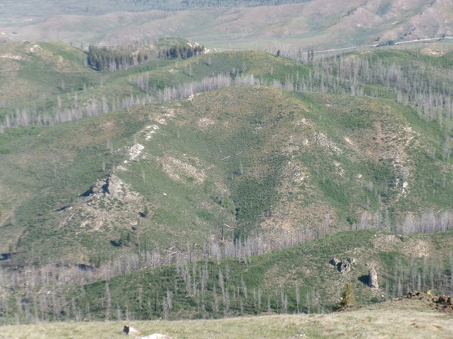
Peak 6336 (in mid-ground) and its south face. Livingston Douglas Photo
Access
From downtown Prairie at a signed junction of Prairie Road and Smith Creek Road, drive east on Prairie Road. At 0.8 miles, reach a signed 4-way junction. Turn south onto an unsigned, smooth county road (soon to be signed as Meadow Creek Road) and drive 1.3 miles to a signed road junction. Reset your odometer here. Head east on Meadow Creek Road/FSR-128. At 5.5 miles, reach a signed junction with rugged FSR-137/House Mountain Road (right). Please note that House Mountain Road is signed as “South House Mountain Road.”
Turn right onto House Mountain Road and reset your odometer. At 0.3 miles, reach a signed junction with FSR-101 (left). At 1.9 miles, reach a signed junction with FSR-136 (left). At 2.4 miles, reach an unsigned junction with a jeep trail (right). Park at this junction or drive 1.0 mile on this narrow, rutted, overgrown jeep trail and park in a pullout [6,103 feet; 43°27’04.7”N, 115°28’56.7”W].
Map Errors
The USGS topo map mis-labels Meadow Creek Road as House Mountain Road. The final rugged 2-track spur road is shown on the USGS topo map but is mis-positioned. This road is not shown on the National Forest map. The road has many more curves in it than the USGS topo map suggests. There is a southbound 2-track road (not shown on maps) that heads left/south at a road junction just before the primary jeep trail ends. There is a jeep trail shown on the USGS topo map (heading right/north) that no longer exists.
Northeast Ridge, Class 2
The Climb
From the roadside pullout, hike west-northwest on the narrow 2-track as it weaves around three gullies to reach its end in just over a mile. There are lot more curves in the road than the USGS topo map shows. Ignore an unmapped southbound 2-track road in the final gully. From the end of the road, continue south up a good game/use trail until it soon ends. Bushwhack left/east up through thick brush to reach the brush-clogged northeast ridge crest.
Follow the ridge south then southwest using gaps in the brush, and some easier sections of brush, to advance toward the summit. The summit hump is semi-open but has a thick patch of willows guarding the summit cap. Bash through the willows to reach the high point. I built a small cairn on top. On the descent, I left the northeast ridge a bit early to avoid the thick willows and reach the gully and a decent game trail that leads back to the 2-track jeep trail.
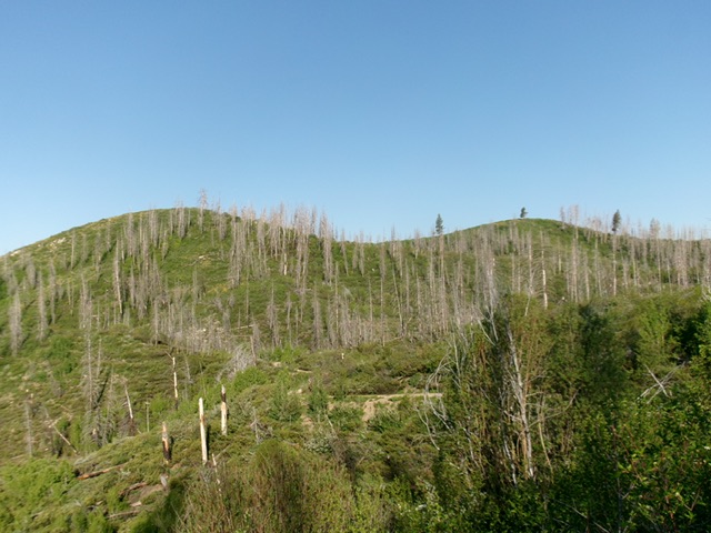
Peak 6336 (left hump) and the [lower] north summit (right hump) as viewed from the east. Livingston Douglas Photo
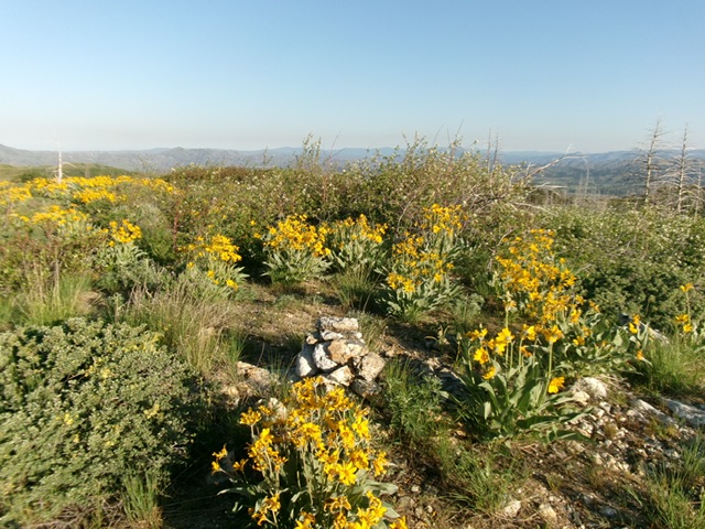
The summit of Peak 6336 with its newly-built summit cairn. Livingston Douglas Photo
Additional Resources
Regions: Boise Mountains->WESTERN IDAHO
Mountain Range: Boise Mountains
Longitude: -115.49728 Latitude: 43.45238