Elevation: 6,482 ft
Prominence: 502
This peak is not in the book. Published October 2025
Peak 6482 is a scrub hump that separates the Right Fork East Fork drainage from the Left Fork East Fork drainage in the foothills of the Deep Creek Mountains east of Rockland. It is most easily climbed from a gully on its south side and the Right Fork East Fork jeep road. USGS Bannock Peak
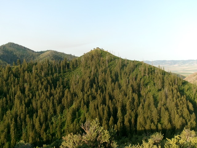
Peak 6482 (dead center) as viewed from the northeast. Livingston Douglas Photo
Access
Same as for Peak 6423. This is the second leg of a 2-peak adventure that includes Peak 6423 and Peak 6482. It covers 4.5 miles with 1,775 feet of elevation gain round trip.
Map Errors
Maps fail to show some older 2-tracks that are on Peak 6482. These 2-tracks are helpful in climbing and descending this mountain.
Northeast Ridge, Class 2
The Climb
From the road crossing, scramble south up an easy, dry gully (forested with minimal understory). This gully leads up to the crest of the northeast ridge. Follow the ridge southwest on an excellent cattle trail. This trail soon fades to a narrow game trail then no trail at all. Continue climbing southwest then right-ish/west higher up. The ridge loses its definition high up. Find a fence row with an unmapped 2-track on its right/east side up to the [lower] east summit. The road ends here but the dilapidated fence row turns left/west. From the east summit, descend 35 vertical feet to a minor saddle where the fence row ends. Scramble west up through thick-ish scrub (initially) to reach the open summit of cairned Peak 6482.
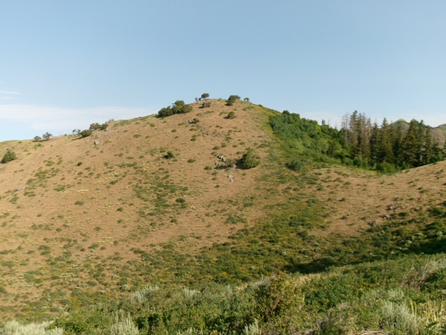
The summit hump of Peak 6482 as viewed from high on the northeast ridge. This was the final leg of my ascent route. Livingston Douglas Photo
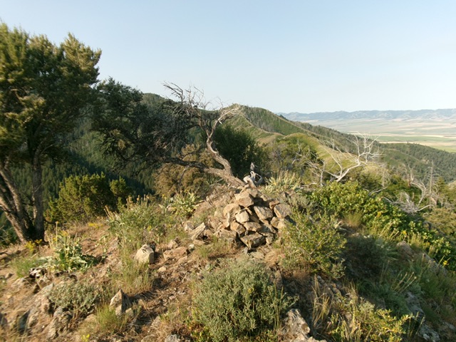
The summit of Peak 6482. Livingston Douglas Photo
South Ridge/South Gully, Class 2
The Descent
From the summit, return to the east summit then follow the 2-track and fence row south on the ridge to a fence corner, where the 2-track heads left/east. Leave the road and cross the cattle fence. Descend easy, open scrub south-southwest to about 6,050 feet. Leave the ridge here and descent left/southeast to reach a dry gully and an unmapped jeep trail. Follow this jeep trail west-southwest down to the Right Fork East Fork jeep road and follow it west to quickly return to the canyon fork/meadow and your parked vehicle.
Additional Resources
Regions: Deep Creek Mountains->SOUTHERN IDAHO
Mountain Range: Deep Creek Mountains
Longitude: -112.7398 Latitude: 42.5703