Elevation: 6,850 ft
Prominence: 510
This peak is not in the book. Published October 2025
Peak 6850 is the high point on a ridge that separates Point Canyon from West Elkhorn Canyon in the Pleasantview Hills. It is most easily climbed from the West Elkhorn Canyon BLM Road. USGS Daniels
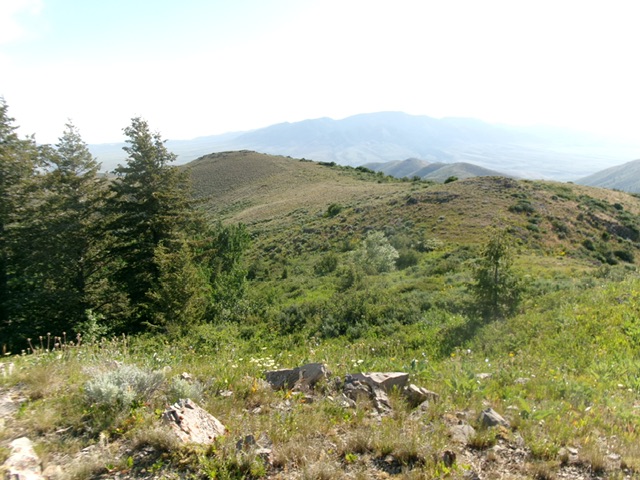
Peak 6850 as viewed from the southeast. The south ridge is left of center. This was my descent route. Livingston Douglas Photo
Access
Same as for Peak 6542. This is the second leg of a 2-peak adventure that includes Peak 6542 and Peak 6850. It covers 7.0 miles with 2,650 feet of elevation gain round trip.
East Ridge, Class 2
The Climb
From the West Elkhorn Canyon BLM Road, drop slightly then scramble north (or northwest) up a steep slope of field grass and gapped sagebrush to reach the crest of the east ridge. Head left/west on the flattish ridge in somewhat-tedious grass and sagebrush to reach much steeper, thicker scrub and a left-ish/southwest bend in the ridge. Scramble up over an annoying hump of thick sagebrush and other scrub, staying close to (or just on the left/south side of) the ridge crest. Look for gaps and old cattle trails to alleviate the bushwhacking difficulty here.
Head west across a thick section of flattish sagebrush then follow the ridge as it bends right-ish/northwest and is easier, steeper scrub. The final push to the summit is in easy, short grass/scrub with gaps. A final jog left/west over a false summit hump (with a 15-foot drop after it) puts you on the bare, open summit. I built a small summit cairn near the high point.
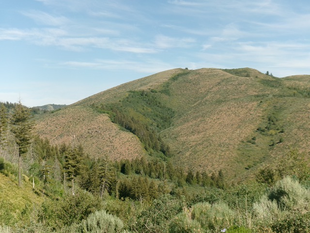
Peak 6850 as viewed from the east. The east ridge is in the foreground. It heads left/west then curls right-ish/northwest to reach the summit. This was my ascent route. Livingston Douglas Photo
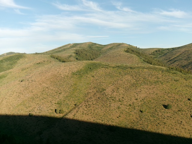
Looking at the [lower] northeast summit from the true/southwest summit of Peak 6850. Livingston Douglas Photo
South Ridge, Class 2
The Descent
From the summit, descend a ridge south-southeast in easy then thick-ish sagebrush. Stay close to the rounded ridge crest. The ridge bends left-ish/southeast as it approaches the West Elkhorn Canyon BLM Road. Do a final descent down a grass-and-rock shoulder then a steep, loose face of talus and scree (including a talus/scree field) to carefully reach the blessed road. Follow the road east down to a signed junction. Go right/south onto BLM-612 and follow it upward almost 400 vertical feet over a pass then down two long switchbacks into North Fork Canyon. Go left/east at a signed junction and continue east then southeast down BLM-612 to the parking spot/campsite and your awaiting vehicle.
Additional Resources
Regions: Pleasantview Hills->SOUTHERN IDAHO
Mountain Range: Pleasantview Hills
Longitude: -112.4834 Latitude: 42.2602