Elevation: 6,913 ft
Prominence: 284
This peak is not in the book. The elevation and prominence figures are based on recent LiDAR updates. The USGS quad shows an elevation of 6,910 feet. Published October 2025
Peak 6913 sits at the headwaters of Elevator Canyon and Mine Canyon in the Samaria Hills. It sits due south of [ranked] Sam Benchmark (6,266 feet) and west-northwest of impressive Peak 7695. This peak is rarely climbed. USGS Grover Canyon
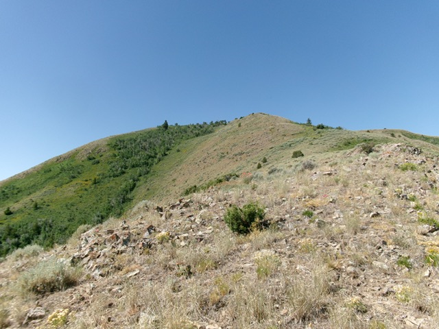
Peak 6913 as viewed from high on the northeast ridge. This was my ascent route. Livingston Douglas Photo
Access
From ID-38 west of Malad City, turn south onto [signed] Samaria Road. Drive 3.0 miles south to a signed junction with Samaria Creek Road (signed as 5000S). Reset your odometer and turn right/west onto 5000S. This maintained county road bends left/south and becomes [signed] 5600W. At 1.4 miles, reach a critical junction. Go right/west here to avoid a private ranch road heading south.
Drive 1.3 miles west then southwest on this unsigned 2-track road (still of decent quality) to reach a 3-way road junction. Go left here (not straight onto BLM-136 or right onto a gravel pit spur road) onto an unsigned, rougher 2-track road and reset your odometer. You are still on [unsigned] Samaria Creek Road. Samaria Creek is to the left of the 2-track road. You will need a 4WD with good tires from here and lots of patience. Reset your odometer at this junction.
The first mile on this 2-track road is the roughest, with several hills and gullies to cross and some rocky sections. At 2.5 miles, park at an unsigned junction with an ATV trail heading left/south up Mine Canyon [5,580 feet; 42°04’59.3”N, 112°24’37.7”W]. Samaria Creek Road follows the right/north (or northwest) side of a posted fence row of a private cattle ranch and eventually goes past the private land onto BLM land.
Map Errors
The USGS topo map fails to show the continuation of Samaria Creek Road up over a pass/saddle and down into the wide valley (and good county road) to the west. It fails to show the two side roads at the 3-way junction. The USGS topo map shows a nonexistent road heading left/south onto private ranch land. It also fails to show the short ATV trail that heads up Mine Canyon. The map elevation of 6,910 has been updated by LiDAR to 6,913 feet.
Northeast Ridge, Class 2
The Climb
From the unsigned junction, climb south-southwest then southwest then briefly south to reach the northwest summit, which is the high point of Peak 6913. Continue southeast a short distance down to the slightly-lower, official/southeast summit. The ridge terrain is mostly easy, short grass/scrub but has some thicker patches of brush and willows to navigate. Skirt the thicker brush/willow sections as necessary or find a game trail near the ridge crest directly through them.
There is an alternative ridge to the right/west that you could also climb. It leads to the summit with a final left/southeast bend to reach it. My ascent ridge and this alternative ridge merge at the northwest summit. The rocky northwest summit had no summit cairn so I built one there. The bare southeast summit had no cairn either.
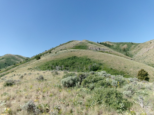
Looking up the rounded northeast ridge from early in the climb. Livingston Douglas Photo
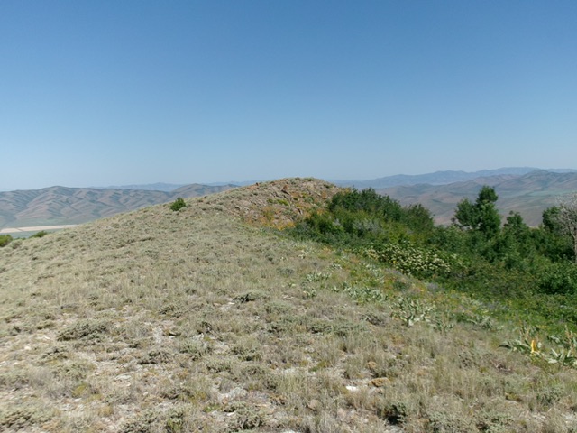
The northwest summit hump of Peak 6913 as viewed from the [slightly-lower] official/southeast summit. Livingston Douglas Photo
Additional Resources
Regions: Samaria Mountains->SOUTHERN IDAHO
Mountain Range: Bannock Range
Longitude: -112.41878 Latitude: 42.07209