Elevation: 6,397 ft
Prominence: 497
This peak is not in the book. Published October 2025
Peak 6397 is a western foothill in the Pleasantview Hills of southern Idaho. It sits east of Arbon Valley Road. This area is a mix of private and public land, so be careful. This climb is entirely on public land. USGS Buist
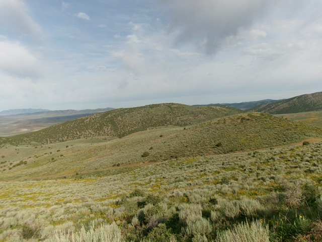
Peak 6397 (in center in distance) as viewed from the east. Livingston Douglas Photo
Access
From the signed junction of ID-38 and Arbon Valley Road, drive north on Arbon Valley Road for 2.1 miles to a signed junction with county road 17200W. Go straight/north onto 17200W and drive 1.6 miles to a corral (shown on maps) and a “T” junction. Go right onto [unsigned] BLM-609/Sheep Creek Spring Road and drive northeast for 1.2 miles to a large dispersed campsite just after crossing a cattle guard/fence row. Park at this campsite/pullout area [5,377 feet; 42°14’06.0”N, 112°33’48.5”W]. BLM-609 is an excellent 2-track road to this campsite. It then becomes a steep, rutted, sometimes-rocky jeep/ATV road.
South Ridge, Class 2
The Climb
From the campsite, walk 50 yards southwest down BLM-609 to the cattle guard and cross to its west side. Follow a cattle trail northwest up the left/west side of the fence row until it reaches a fence corner. Jump to the north side of the fence row and follow a good cattle trail west down across a dry gully (45-foot drop) then up onto the south ridge.
Head northwest then north up the juniper-clad ridge in mostly easy, gapped junipers. The ridge is quite rounded early on. Higher up, the ridge gains definition and its base becomes much rockier. The ridge leads to just left/west of the summit of Peak 6397. I built up the summit cairn. This is clearly the high point. Overall, this is a pleasant ridge scramble but with minimal views thanks to the thick junipers. It is a bit tedious with ground boulders/talus midway up and higher.
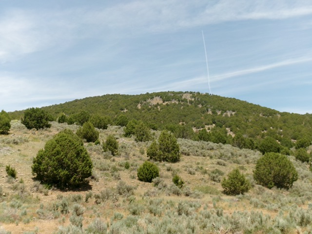
Peak 6397 as viewed from the south (start of climb). Livingston Douglas Photo
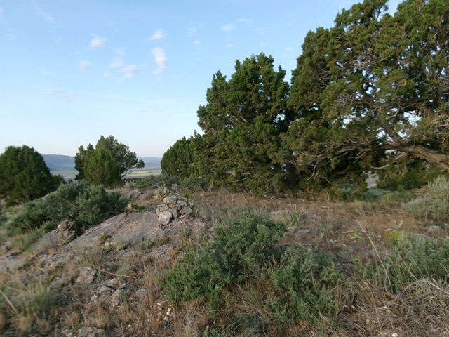
The summit of Peak 6397. Livingston Douglas Photo
Additional Resources
Regions: Pleasantview Hills->SOUTHERN IDAHO
Mountain Range: Pleasantview Hills
Longitude: -112.5706 Latitude: 42.2526