Elevation: 6,987 ft
Prominence: 847
This peak is not in the book. Rick Baugher proposed the name South Taurus. Published October 2025
Peak 6987 is the high point on a lengthy ridgeline that sits just east of the South Fork of Bull Canyon in the Deep Creek Mountains. It is most easily climbed from nearby South Bull Canyon Road. This area is a mix of private and public land, so be careful. This climb is entirely on BLM land. USGS Cedarhill
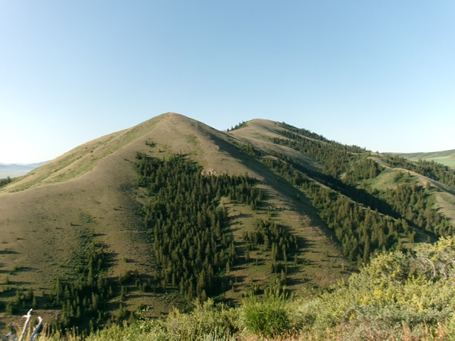
Peak 6987 as viewed from Peak 6203 to its north. The elusive summit hump is not visible from here. Point 6542 (left of center) and Point 6842 (in center) are humps on its magnificent north ridge. Livingston Douglas Photo
Access
From Arbon Valley Road, turn west onto [signed] Bull Canyon Road. Drive 4.4 miles west up Bull Canyon Road to a signed BLM road junction in Bull Canyon. Alternatively, drive up [signed] county road 18500 from farther south on Arbon Valley Road to a junction with Bull Canyon Road and proceed west on Bull Canyon Road from there. This route has better road quality than coming directly in on Bull Canyon Road from the east.
From the signed junction in Bull Canyon, drive south on South Bull Canyon Road/BLM-653 for 1.7 miles to a roadside pullout (of sorts) at the base of a shoulder. This is as far south as you can drive on BLM-653 and remain on BLM land. This roadside pullout is at 5,745 feet and 42°20’30.6”N, 112°40’55.5”W.
West Shoulder, Class 2
The Climb
From the roadside pullout, bushwhack east then east up through steep-ish, thick veg/brush/grass onto a ridge crest that has a few pines here and there. Follow the steep-ish ridge crest east-southeast from here to the high summit ridge. The first 400 feet of uphill from the road is tedious due to the thick veg/scrub. Look for any gaps or game trails in the thick terrain and weave around as necessary. Reach a large boulder/rocky outcrop and climb up over it. Now the terrain is short scrub/grass and goes quickly.
The summit hump is just to the right/south of this shoulder. Aim diagonally right/southeast as you approach the summit ridge. Follow a game trail across the face then scramble left/east to reach the summit ridge at a minor saddle. From this saddle, scramble right/south in short scrub to the well-cairned summit.
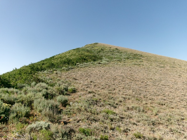
The elusive summit hump of Peak 6987. Livingston Douglas Photo
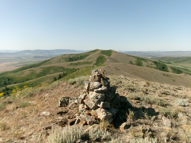
The large summit cairn atop Peak 6987, looking south. Livingston Douglas Photo
Additional Resources
Regions: Deep Creek Mountains->SOUTHERN IDAHO
Mountain Range: Deep Creek Mountains
Longitude: -112.6716 Latitude: 42.3366