Elevation: 6,990 ft
Prominence: 762
This peak is not in the book. The elevation and prominence figures are based on recent LiDAR updates. The USGS quad shows an elevation of 6,985 feet. Published October 2025
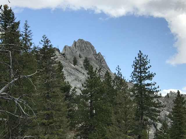
Peak 6990 is one of many granite spires found on ridges above the Middle Fork Payette River. It is located north-northeast of the Silver Creek Fire Lookout. It sits at the top of the Silver Creek and Lake Creek drainages. USGS Bull Creek Hot Springs
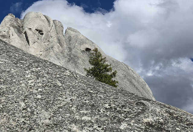
Peak 6990 as viewed from the southwest
Access
From Garden Valley, Idaho leave the Banks/Lowman Highway/Payette River Road and turn north on to the Middle Fork Payette River Road [(D)(1.1) on Page 140]. Follow the road north, through downtown Garden Valley and then continue north for a total of 23.0 miles to the signed turn for the Silver Creek Lookout (FS-678). The Middle Fork Road is paved at first, then good gravel, and then maintained dirt. FS-678 is a steep road with lots of potholes.
FS-678 reaches the ridge crest where there is a complicated intersection. Turn left and then immediately turn left again. This new road is designated FS-678B. Follow this road north to a junction in roughly 0.75 miles. FS-678B continues right and FS-678C continues straight. In good conditions, a 2WD with sufficient ground clearance and careful driving can reach this point.
Park here as the road to the lookout is gated just above the junction. You can either follow the ridge crest northeast from the lookout or follow FSR-678C (see map) until you reach the point that crosses Lake Creek. From this point, it is a bushwhack through the forest to the ridge top.
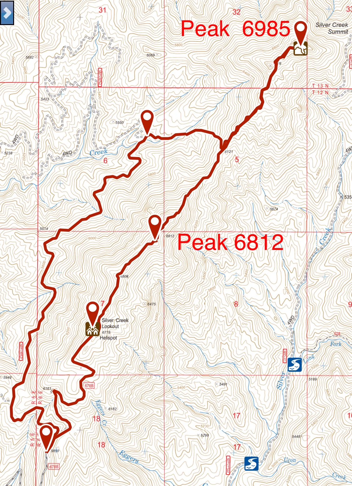
John Platt and I attempted this peak in 2018. My GPS track for Peak 6812 and Peak 6990 (6,985 feet on this map).
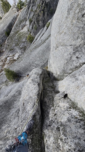
Northeast Face, Class 5.8 by Kaden Platt
Adan Estrada and I made the first ascent of this peak in 2025. Our route climbs up a dirty chimney, but is low angle making the climbing easier. However, the rock quality makes it feel much more miserable and insecure.
Not sure what we’d need, we decided to pack in a quad rack (overkill) All we ended up using was a .5-#4-#5. Then a .75-#1-#2 to belay up Adan. After we both got up, we wrapped some tat around a boulder by the summit then backed it up with a piton. Unfortunately, to get into the rappel you must downclimb 7 feet of a chossy #3 crack (5.2) Then there is a tree you can use to rap the “class 4” slab. We’d recommend bringing doubles from #4-#6 if you wanted sew it up.
The tree used for rappel A rappel anchor. Kaden Platt Photo
Where the chimney eases up, section just above belay is “crux.” Kaden Platt Photo
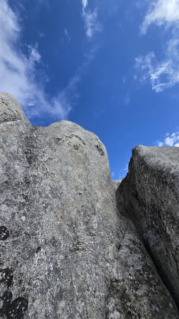
Easy scrambling through the corridor to summit. Kaden Platt Photo
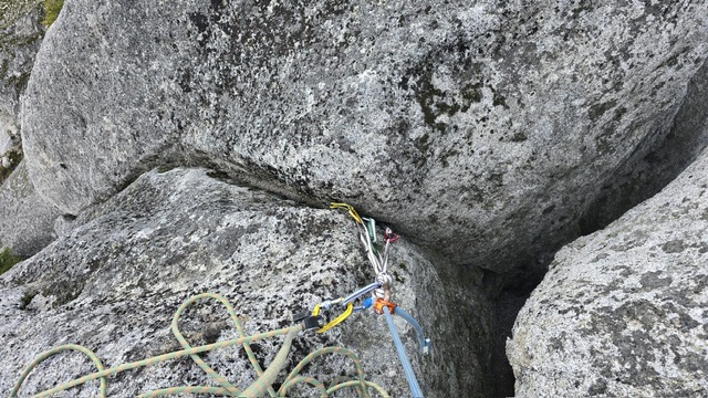
Anchor used to belay follower up, summit is separated boulder to the right. Kaden Platt Photo
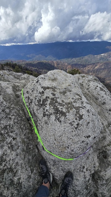
The summit. Kaden Platt Photo
Additional Resources
Mountain Range: Western Salmon River Mountains
First Ascent Information:
- First Ascent Year: 2025
- Season: Summer
- Route: Northeast Face
- Party: Kaden Platt and Adan Estrada
Longitude: -115.76024 Latitude: 44.41364