Elevation: 7,025 ft
Prominence: 445
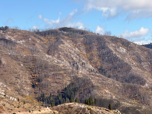
This peak is not in the book. The area north and northeast of Prairie, Idaho was devastated by a the Sheep wildfire in 2011. while few trees have grown back the bush including alder, elderberry has proliferated on many slopes. I followed Livingston’s route to the summit. The game trails come and go. In places the brush is nearly impenetrable. So, be forewarned this hike is the quintessential bushwhack. Published October 2025
Peak 7025 sits between Burnt Creek and Dry Buck Creek deep in the Boise Mountains. It is most easily reached from a road saddle to its northwest. USGS Trinity Mountain
Peak 7025 viewed from Peak 6117.
Access
From downtown Prairie at a signed junction of Prairie Road and Smith Creek Road, drive east on Prairie Road. At 0.8 miles, reach a signed 4-way junction with FSR-159. Go left/east onto FSR-159. At 3.1 miles, go left at an unsigned junction. At 5.4 miles, reach a signed junction with [gated closed] FSR-175A on the left/west side of the road. At 7.2 miles, reach a saddle and a large parking/pullout area. Park here [6,559 feet; 43°32’17.2”N, 115°29’14.2”W]. FSR-159 is a narrow, badly-rutted 2-track road. While unpleasant, FSR-159 is NOT a jeep trail as the USGS topo map indicates.
Northwest Ridge, Class 3+
The Climb
Only the summit tower is Class 3+. From the saddle/pass, find a game trail heading south up through the thick willows to reach the first ridge hump at 6,760+. From this flattish area, continue south-southeast up the ridge in thick-ish scrub that isn’t too bad thanks to lanes and gaps. The ridge soon bends right-ish/southeast and stays on a southeast line all the way to the summit towers. The northwest ridge has a few ups and downs (25 feet and 75 feet) and some willow patches, but you can almost always find a weak game trail to help.
Midway up, stay left-ish on snowfields (or bare ground if the snow is gone) to avoid the tiresome, endless willows. Pass a rocky tower higher up and be glad that it is not the high point. Drop about 75 vertical feet from this tower to reach a final saddle. From this saddle, head southeast to the summit hump and its surprising high point—two towers of almost equal height. The second tower (the south one) is slightly higher and is the high point of Peak 7025. Climbing atop this tower is tricky but I found a few wide ledges and a helpful willow bush (to stand on) to reach the ledges. The tower top is airy.
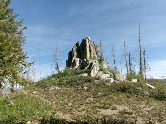
The summit blocks atop Peak 7025. The right/south one is the high point. Livingston Douglas Photo
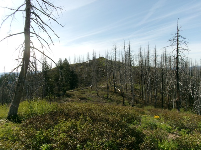
The summit hump of Peak 7025 finally comes into view. Livingston Douglas Photo
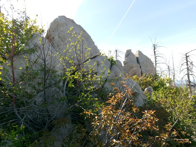
A beautiful rocky tower on the way to the summit of Peak 7025. Livingston Douglas Photo
Use the following link to view a short video by Steve Grantham of me climbing the summit block.
Climbing the Peak 7025 Summit Block
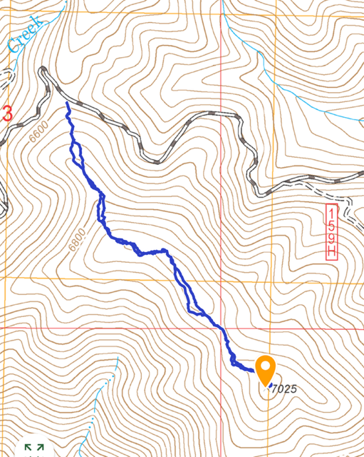
My GPS track covered just under 2 miles with 351 feet of elevation gain round trip. The dense vegetation makes for slow going in places.
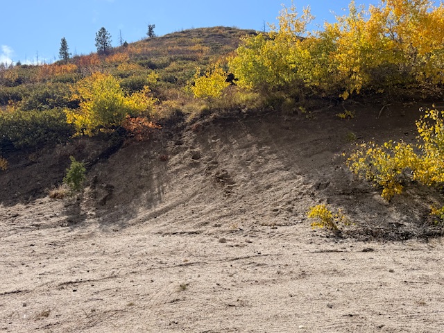
From our parking spot we found a good game trail at the top of this slope. This trail lead about a third of the way up the first slope before it ended in a tangle of 8 foot high brush. You are on your own from this point.
Additional Resources
Regions: Boise Mountains->WESTERN IDAHO
Mountain Range: Boise Mountains
Year Climbed: 2025
Longitude: -115.4780 Latitude: 43.5282