Elevation: 7,100 ft
Prominence: 720
This peak is not in the book. The name was proposed by Rick Baugher. Use the link below to read the history behind the name proposal. Published October 2025
Peak 7100 sits at the headwaters of Baker Creek in the foothills of the Lemhi Range. It is located on the north side of Withington Creek and on the east side of Mulkey Creek. Peak 7100 is most easily climbed from Withington Creek Road to its south. USGS Sal Mountain
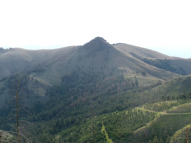
Peak 7100 as viewed from the south. The rocky summit hump is left of center. Livingston Douglas Photo
Access
From ID-28 in Baker, Idaho (at virtual MM126.3), turn southwest onto [signed] South Baker Road and follow it for 0.2 miles to a signed “T” junction with Red Rock Stage Road. Go left/southeast onto this road and follow it for 0.2 miles to a signed junction with Withington Creek Road (right). Reset your odometer here. Go right/southwest onto Withington Creek Road.
At 4.4 miles, reach BLM land. At 5.2 miles, reach the Salmon National Forest boundary at a road junction. The road is now FSR-031. Park at a campsite here [5,440 feet; 45°02’29.4”N, 113°47’48.6”W]. This is the first leg of a 2-peak adventure that includes Peak 7100 and Mill Benchmark (6,934 feet). It covers 5.5 miles with 2,450 feet of elevation gain round trip.
Southeast Spur/South Ridge, Class 2+
The Climb
From the campsite, walk a short distance up to the road junction. Drop about 10 feet onto the weak, 2-track continuation of BLM’s Withington Creek Road (only suitable for jeeps and ATVs/MCs). Walk through an open cattle gate almost immediately and continue about ½ mile west up Withington Creek to reach a dry side gully and the toe of the southeast spur of the south ridge of Peak 7100. Leave the 2-track road and bushwhack right/north down through thick sagebrush and veg to cross [small] Withington Creek in a willow-free spot.
Once across the creek, head left/northwest across the dry gully and onto the shoulder. Scramble up steep grass with a loose scree/gravel base initially. Higher up, the ridge gains definition and the slope eases. There is less loose scree/gravel now. Continue up this easy ridge of short field grass to a junction with the south ridge. There is a steep, final pitch to reach the open ridge junction that has 2-3 scattered pines on it. Head right/north and drop slightly to a saddle.
Continue north then angle left-ish/northwest to reach a ridge saddle just east of the rocky summit area of Peak 7100. Scramble up onto the first rocky blocks (Class 2+). Continue west along the choppy, brush-and-rock ridge crest to the cairned high point about 75-100 feet away. These ridge blocks are awfully close in height to the gentler/official west summit hump. Stand atop all of them “just to be sure.”
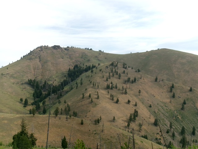
Peak 7100 (dead center) as viewed from the west. Livingston Douglas Photo
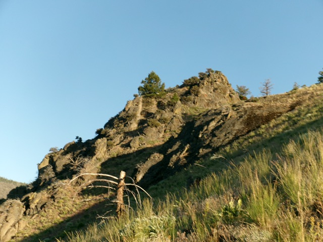
The rocky summit of Peak 7100. Livingston Douglas Photo
Northeast Ridge, Class 2+
The Descent
From the gentle west summit hump, scramble east over the ridge blocks (Class 2+) to return to gentle, open scrub. Head east then northeast over the [lower] east end of the summit massif. Follow the ridge in thick-ish sagebrush left/north as it heads toward a hump with an old unmapped 2-track road going up its south face from a saddle. Reach this saddle then skirt the hump on its right/east side. Do a descending traverse northeast to reach a flattish area near Point 6726.
The side-hilling is in gapped, thick-ish sagebrush but it goes reasonably well. I found a decent cattle trail midway along in this traverse and followed it quickly north back onto the ridge crest. Follow the easy ridge crest northeast in short grass/scrub to the 6,580-foot connecting saddle with Mill Benchmark (6,934 feet). This concludes the first leg of today’s 2-peak journey. Mill Benchmark is up next.
Additional Resources
Regions: EASTERN IDAHO->Lemhi Range
Mountain Range: Lemhi Range
Longitude: -113.8150 Latitude: 45.0534