Elevation: 7,135 ft
Prominence: 475
This peak is not in the book. Published October 2025
Peak 7135 is a thickly-forested hump that sits above Smith Canyon in the Portneuf Range. It is located due south of Peak 7180 and east of Arimo. This area is a mix of private and public land, so be careful. USGS Lava Hot Springs
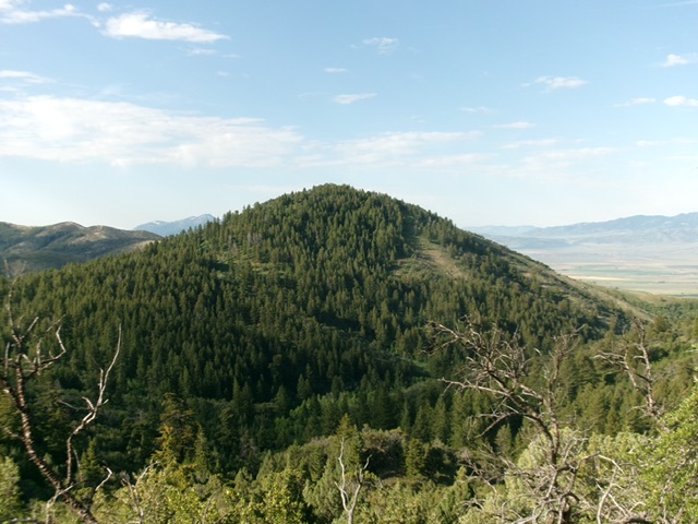
Peak 7135 as viewed from the northeast. Livingston Douglas Photo
Access
Same as for Peak 7180. This is the second leg of a 2-peak adventure that includes Peak 7180 and Peak 7135. It covers 3.7 miles with 1,500 feet of elevation gain round trip.
Map Errors
Maps fail to show the extensive private roads and homes in this area.
Northeast Ridge, Class 2
The Climb
From the 6,660-foot connecting saddle with Peak 7180, head right/southwest through thick-ish sagebrush and other brush to reach a ridge of sorts. Scramble southwest up this steep-ish, forested ridge in mountain mahogany with some open areas of scrub. The ridge bends left/west to reach the small summit area. A pair of boulders is probably the high point but there is also a large boulder about 30 feet to the east that may be the high point. Stand atop all of these boulders “just to be sure.” There is no summit cairn but this is clearly the high point of Peak 7135.
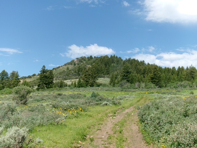
Peak 7135 as viewed from the east, near Smith Canyon Road. The east face (dead center) was my descent route. Livingston Douglas Photo
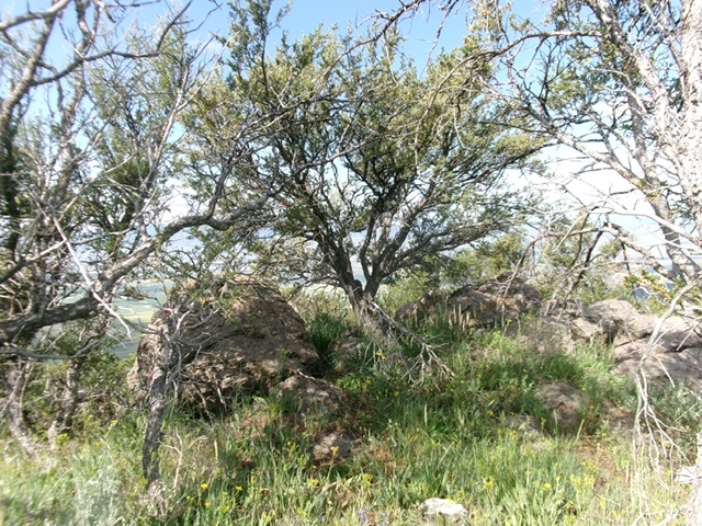
The boulder-and-mahogany summit of Peak 7135. Livingston Douglas Photo
East Face, Class 2
The Descent
From the summit, bushwhack east then northeast (a little) to reach Smith Canyon Road at its crest and the old, short spur road (shown on the USGS topo map). This spur road seems to be on public land (or public access is allowed on it) but there is posted, private land just to its north. Once on Smith Creek Road, walk 0.3 miles north then northeast down into Deer Creek Canyon to the junction with Wolverine Pass Road and your parked vehicle. Please note that IF the aforementioned spur road IS on public land (or is publicly accessible), it makes for a better spot from which to climb Peak 7180 and Peak 7135.
Additional Resources
Regions: Portneuf Range->SOUTHERN IDAHO
Mountain Range: Portneuf Range
Longitude: -112.0740 Latitude: 42.5441