Elevation: 7,286 ft
Prominence: 823
This peak is not in the book. Rick Baugher reported in his trip report linked below that USGS topographer T.M. Bannon called it ‘Continental Divide Range’ in his 1915 report on this area. Since the Board of Geographic Names frowns on long names, I shortened the proposed name to CDR Peak. Published October 2025
Peak 7286 is a Lemhi foothill that separates Hayden Creek from Lake Creek. It is most easily climbed from its south side and Rye Grass Road. While this area is a mix of private and public land, this climb is entirely on BLM land. USGS Hayden Creek
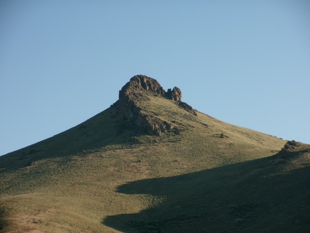
Peak 7286 and its magnificent summit block. Livingston Douglas Photo
Access
From the hamlet of Lemhi (18 miles northwest of Leadore on ID-28), drive west on [signed] Lemhi Road for about a mile to a signed junction with Hayden Creek Road. Go left/southwest on Hayden Creek Road and reset your odometer. At 5.4 miles, reach an unsigned junction with Rye Grass Road (right). Drive 0.4 miles west up Rye Grass Road and park at an unmapped, unsigned road junction [6,024 feet; 44°48’12.1”N, 113°42’30.8”W].
South Ridge, Class 2+
The Climb
From the junction, scramble right-ish/northeast up a steep hump of loose scree/gravel to reach the crest of the south ridge. This ridge is just right/east of Rye Grass Road and it heads right/northwest from the road junction. Follow this easy ridge of broken rock and short grass/scrub north then northeast as it bends right-ish to join the southwest ridge (Baugher route) high up.
Finish with a steep, somewhat loose scramble up scree/gravel and scrub. Aim directly at the gap between the two rocky summit blocks. Make one Class 2+ move up a slot to reach the notch. From the notch, go right/south up a grassy chute amongst the ridge rock to quickly reach the rocky summit area. I enlarged the modest summit cairn.
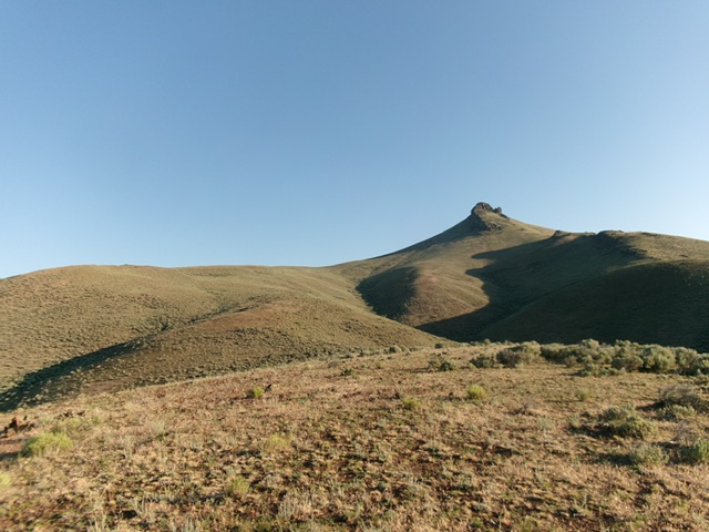
Peak 7286 (right of center) and its south ridge (left of center). This was my ascent route. Livingston Douglas Photo
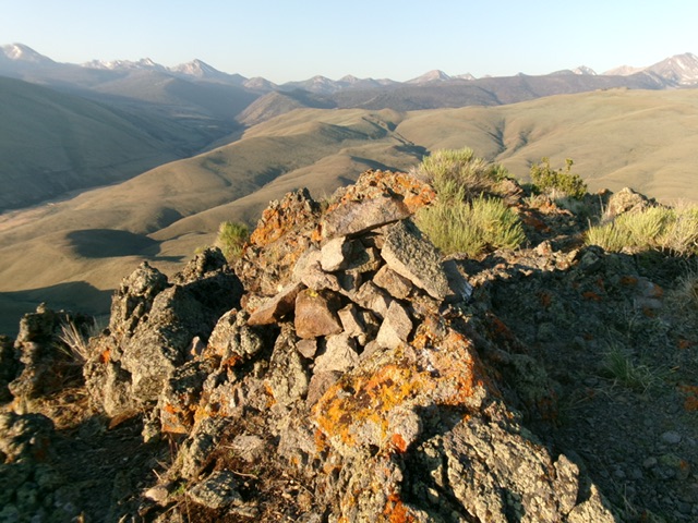
The summit of Peak 7286. Livingston Douglas Photo
South Ridge (Southeast Variation), Class 2
The Descent
From the summit, return down the south ridge to a juncture at about 6,650 feet. Head southeast here onto a different shoulder. Follow this easy, open scrub shoulder southeast then south to approach Rye Grass Road. Angle right-ish/southwest then drop into a dry gully to reach the road. Follow Rye Grass Road for about 100 yards west to return to the road junction.
Additional Resources
Regions: EASTERN IDAHO->Lemhi Range
Mountain Range: Lemhi Range
Longitude: -113.7088 Latitude: 44.8189