Elevation: 7,312 ft
Prominence: 443
This peak is not in the book. The elevation and prominence figures are based on recent LiDAR measurements as reported on peakbagger.com. The USGS quad shows an elevation of roughly 7,300 feet. Published October 2025
Peak 7312 separates Hillhouse Canyon from Stewart Canyon in the Deep Creek Mountains. It can be climbed from either Stewart Canyon or Box Canyon. The summit is on unposted, unfenced private land. This is a thick, unpleasant bushwhack to the ill-defined summit. USGS Cedarhill
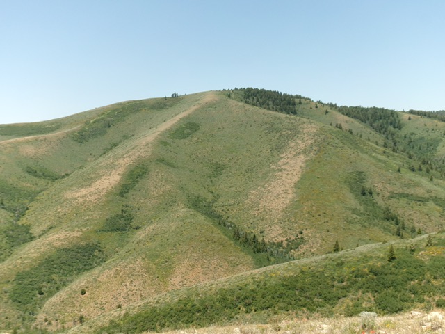
Peak 7312 as viewed from the south. Livingston Douglas Photo
Access
Same as for Bull Benchmark. An alternative route is to drive up BLM-921 into Box Canyon and climb the west face or southwest ridge from there.
Northwest Ridge, Class 2
The Climb
From the open area near the water tanks and cattle cistern, follow cattle trails and easy scrub/trees to gain the crest of the northwest ridge. Once on the ridge crest, bushwhack southeast up through somewhat-thick sagebrush and other brush, using cattle trails and gaps to help you advance higher. Reach a patch of shorter scrub with loose, scattered scree underneath. Continue up the ridge in thicker scrub with pines, aspens, and willows on the left/northeast side of the ridge crest. Stay to the right/southwest of the forest as long as you can.
Higher up, the thick forest, underbrush, and willows is unavoidable. Look for an old 2-track road at about 7,200 feet that heads east up the ridge (on its south side). This road eventually flames out. Bushwhack through a short, thick patch of pine forest with unpleasant brush/willows to find another old road heading right/south to a higher, open area of sagebrush. This open area is the high point of Peak 7312. Ground boulders and a nearby, small summit cairn compete for the highest spot.
The LOJ placement of the high point is wrong. The summit cap (7280+) is a vast area of both pine forest and open, thick sagebrush. The old 2-track roads that I found up on the summit cap come up the west ridge and the northeast gully.
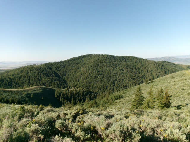
The thickly-forested north side of Peak 7312. Livingston Douglas Photo
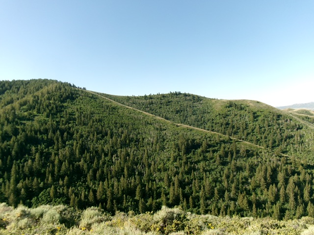
Peak 7312 and its northwest ridge (descending diagonally right in mid-ground). This was my ascent route. Livingston Douglas Photo
Additional Resources
Regions: Deep Creek Mountains->SOUTHERN IDAHO
Mountain Range: Deep Creek Mountains
Longitude: -112.7452 Latitude: 42.3505