Elevation: 7,325 ft
Prominence: 305
This peak is not in the book. Published October 2025
Peak 7325 is a foothill in the Pioneer Mountains. It is located just west of Fish Creek Road and is accessible thanks to the Access Yes program. Peak 7325 sits above the headwaters of both Telfer Canyon and the West Fork Fish Creek. USGS Trail Creek
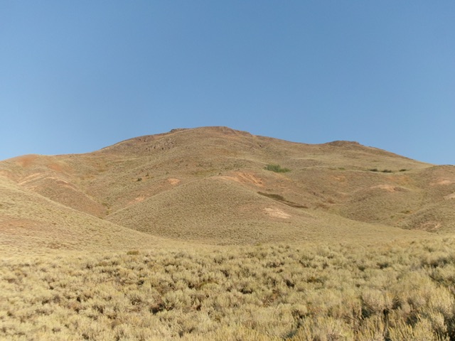
Peak 7325 as viewed from the southeast. Livingston Douglas Photo
Access
Fish Creek Road is located along US-20 at virtual MM212.1. This road junction is 6.6 miles east of the north end of Carey. Turn north onto [signed] Fish Creek Road and reset your odometer. At 5.4 miles, pass the left turnoff for West Fork Fish Creek Road (signed for “Boat Ramp”). At 6.6 miles, pass the right turnoff for East Fork Fish Creek Road (unsigned). At 9.8 miles, go right at an unsigned junction. At 11.9 miles, reach an unsigned junction at the mouth of Telfer Canyon. Park here [5,871 feet; 43⁰31’20.0”N, 113⁰46’30.1”W].
Southeast Shoulder, Class 2
The Climb
From the road junction, hike west up an old, overgrown 2-track road to an old cabin (and several outbuildings). Continue on the old 2-track as it passes the left/south side of the cabin and then turns right-ish/northwest to head up a shoulder. The road turns into a good cattle trail then back into a road bed again. Leave the road bed when it turns right-ish/north to climb a shoulder at about 5,200 feet. Bushwhack left-ish/northwest to angle into Telfer Canyon in thick-ish sagebrush and other scrub. Hike briefly north up an easy grassy patch in the middle of the dry gulch.
Leave the gulch and bushwhack northwest up the obvious shoulder. This bushwhack is thick and unpleasant (sagebrush and other scrub) initially but the shoulder opens up and is easier scrub. There are also some open sections of scree/gravel. Higher up, the shoulder steepens considerably and changes back to thick sagebrush and scrub but has some weak gaps and game trails in it.
High up, the shoulder becomes mostly a scree/gravel scramble with gapped, short scrub. It is not difficult or too loose. Work back-and-forth to keep the steep terrain manageable. Reach the top of the shoulder and pop out on the summit ridge about 70 yards northeast of the cairned high point. Head left/southwest to the top. The summit has triangulation wiring and a few small cairns. I built a new cairn on the highest point, a ground boulder about 15 feet from the triangulation cairns.
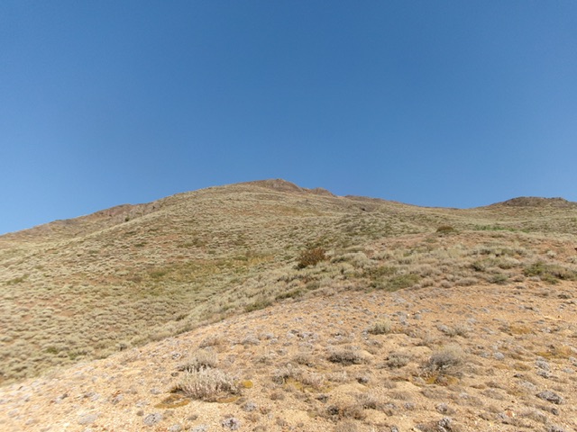
The final push up the southeast shoulder. This was my ascent route. Livingston Douglas Photo
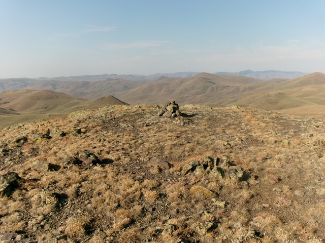
The summit of Peak 7325. Livingston Douglas Photo
Additional Resources
Regions: EASTERN IDAHO->Pioneer Mountains
Mountain Range: Pioneer Mountains
Longitude: -113.7966 Latitude: 43.5310