Elevation: 7,415 ft
Prominence: 475
This peak is not in the book. Published October 2025
Peak 7415 is a ranked summit in the extreme southern section of the Lemhi Range. It is located along a frontage road in the southern foothills of the Lemhi Range. This area is a mix of INL land, private land, and public land. Be very careful where you drive and where you hike here. USGS Tyler Peak
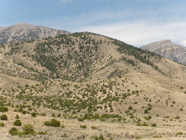
Peak 7415 (in mid-ground) as viewed from the southeast. Livingston Douglas Photo
Access
Same as for Mahogany Butte (7,006 feet). Continue south on the South Foothills Road/BLM-789. Reset your odometer at the junction of the unsigned 2-track BLM road heading up Tyler Canyon and the South Foothills Road. Drive south on the South Foothills Road. At 2.5 miles, reach a signed junction with Bartel Canyon Road/BLM-530 (Junction 6087 on maps). At 3.7 miles, reach a signed junction with Deer Canyon Road/BLM-534. Drive 0.4 miles west then southwest up BLM-534 and park [6,156 feet; 43°56’57.0”N, 112°53’45.8”W].
Map Errors
There are numerous road errors on the USGS topo map for this area. Don’t trust it.
Northeast Ridge, Class 2
The Climb
From the improvised roadside pullout, bushwhack southwest across a dry gully. Climb south up steep grass/scrub with a few scattered pines to reach the open crest of the northeast ridge. Scramble southwest then south then southwest up the ridge to the summit. The ridge terrain becomes a mix of mountain mahogany then gapped pines. Stay left/east to remain in semi-open, easy grass/scrub when climbing this ridge. The forested areas are not difficult to navigate.
High up, the northeast ridge quietly merges into the broader northeast shoulder. Be careful to avoid getting off-course and heading northeast then east on this open shoulder on the descent. The summit is semi-open and the high point is obvious. It had a small, torn-down summit cairn. I built a nice, new cairn on the high point, next to some mountain mahogany trees.

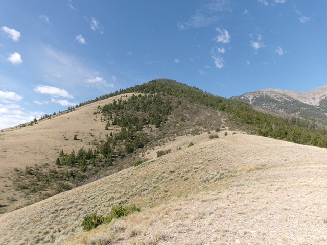
Peak 7415 as viewed from the northeast (start of climb). The forested summit hump is right of center. Livingston Douglas Photo
Looking at the forested summit hump from the entry point on the northeast ridge. This was the upper half of my ascent route. Livingston Douglas Photo
Additional Resources
Regions: EASTERN IDAHO->Lemhi Range
Mountain Range: Lemhi Range
Longitude: -112.9031 Latitude: 43.9409