Elevation: 7,563 ft
Prominence: 343
This peak is not in the book. Published October 2025
Peak 7563 is located southeast of the South Fork of Williams Creek in the Eastern Salmon River Mountains. It is most easily climbed from FSR-028 and a closed Forest Service road that leads to its west face. USGS Lake Mountain
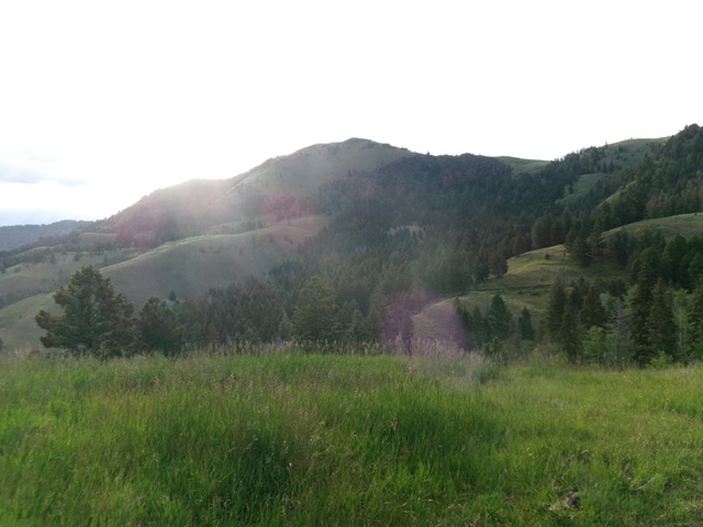
Peak 7563 (dead center) as viewed from the west (start of climb at road bend). Livingston Douglas Photo
Access
From US-93 about five miles south of Salmon, turn right/west onto Williams Creek Road (signed for Williams Lake and Shoup Bridge). Follow this well-maintained road (paved initially) as it weaves its way into the Williams Creek drainage and enters the Salmon National Forest as FSR-021. Continue west on FSR-021 for about two miles from the National Forest boundary to reach an unsigned road junction with the South Fork Williams Creek Road/FSR-028 (left).
Go left/south onto FSR-028 and reset your odometer. At 1.4 miles, cross a cattle guard. At 3.9 miles, reach a sharp right/northwest bend in the road with a dispersed campsite on a bluff. Park here [6,661 feet; 45°03’00.9”N, 114°01’52.2”W].FSR-028 is a narrow but good 2-track, gravel road to a road junction at 1.5 miles. It is rockier and steeper after this point but is still an “OK” road to drive up.
Map Updates
The USGS topo map fails to show a handy, gated/closed 2-track road that goes from the road bend all the way over to the west face of Peak 7563.
West Face, Class 2
The Climb
From the road bend, Peak 7563 is due east and is obvious. From the open bluff/campsite, look right and find a gated/closed Forest Service road. Follow this road as it heads southeast then east to reach the west side of Peak 7563. The road crosses several ridges and gullies (mostly forested) on the way there. The ups and downs are minimal. The road makes a final bend left/north to cross a gully and reach the steep west face.
After passing the rocky section of the west face, leave the road and scramble east up a grassy shoulder to reach the steeper east face higher up. The east face is steep grass and loose gravel, but there are diagonal game trails to assist in this climb. The underlying gravel is a bit loose high up, especially on the descent. Aim for just right/south of a block of ridge rock to get up onto the south ridge. A short scramble left/north leads to the high point. There was no summit cairn so I built a nice one.
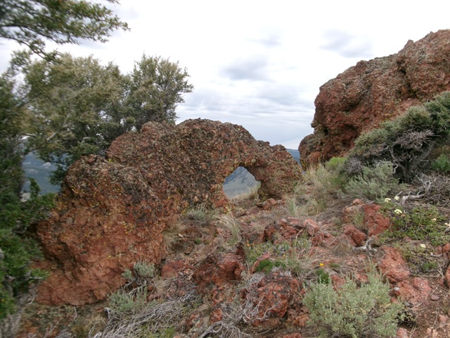
An interesting “hole-in-the-rock” formation just below the summit.
Livingston Douglas Photo
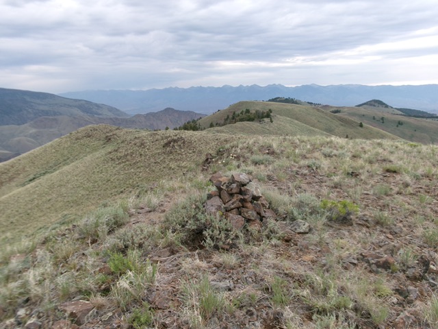
The summit of Peak 7563 with its newly-built summit cairn, looking northeast at Point 7524 on the high ridge. Livingston Douglas Photo
Additional Resources
Mountain Range: Eastern Salmon River Mountains
Longitude: -124.0142 Latitude: 45.0504