Elevation: 7,669 ft
Prominence: 274

This peak is not in the book. Elevation and prominence figures are based on recent LiDAR measurements. The USGS quad shows an elevation of 7,663 feet. Published October 2025
Peak 7669 is a Lemhi foothill that sits due east of Summit Reservoir. The northwest summit hump is the high point. Peak 7669 is most easily climbed from the Little Lost River Highway. USGS Moffett Springs
Peak 7669 as viewed from the northwest. The summit hump is left of center. Livingston Douglas Photo
Access
From ID-33 in Howe, drive north on the paved Little Lost River Highway (which becomes a good gravel road) all the way northwest to the Summit Reservoir. Park on a spur road at the southeast corner of the Summit Reservoir [6,601 feet;44°18’23.6”N, 113°30’24.1”W].
West Face, Class 2
The Climb
From the spur road, walk across the highway and scramble directly east at the northwest summit, which is left/north of the antenna-clad southeast summit. Initially, the terrain is flattish, gapped grass/sagebrush and goes quickly. The terrain steepens after crossing the first dry gully but is still easy short grass and sagebrush with gaps. Descend 10-15 feet to cross a second dry gully with some thicker sagebrush. Climb steeply out of this gully onto a rounded shoulder of very short grass/scrub. Follow this shoulder east then east-northeast to the rocky summit. The summit has a nice quartzite cairn. You may also be able to drive an access road (all on BLM land) to reach the summit area.
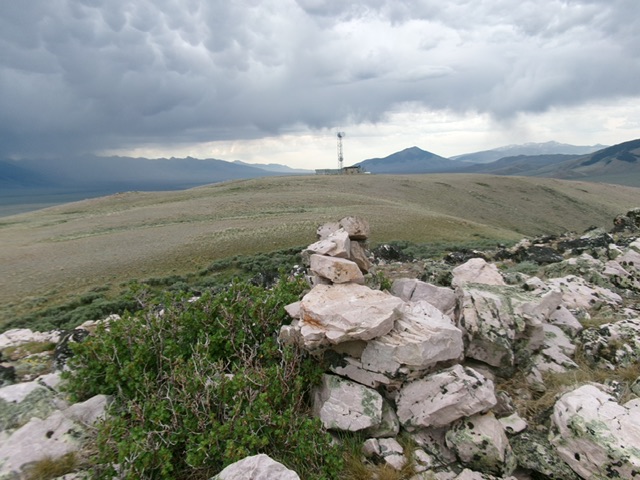
The summit cairn atop Peak 7669 with the tower-clad south summit in the background. Livingston Douglas Photo
Additional Resources
Regions: EASTERN IDAHO->Lemhi Range
Mountain Range: Lemhi Range
Longitude: -113.48661 Latitude: 44.30846