Elevation: 7,764 ft
Prominence: 344
This peak is not in the book. Published October 2025
Peak 7764 is a Lemhi foothill that sits above Bear Valley Creek. It is most easily climbed from a spur road off of Bear Valley Creek Road via its south shoulder. USGS Hayden Creek
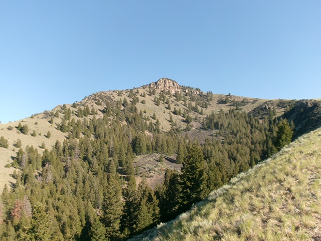
Peak 7764 (in center) as viewed from midway up the south shoulder. Livingston Douglas Photo
Access
From the hamlet of Lemhi (18 miles northwest of Leadore on ID-28), drive west on [signed] Lemhi Road for about a mile to a signed junction with Hayden Creek Road. Go left/southwest on Hayden Creek Road and reset your odometer. At 5.4 miles, reach an unsigned junction with Rye Grass Road (right). At 7.4 miles, reach the Salmon National Forest boundary.
At 7.7 miles, reach a signed road junction. Go right here onto FSR-009/Bear Valley Creek Road. At 8.5 miles, reach an unsigned road junction where FSR-009 goes hard left/southwest. Go straight onto a spur road and drive 0.1 miles to a grassy parking area. Park here [6,180 feet; 44°46’26.0”N, 113°43’36.8”W].
South Gully/South Shoulder, Class 2
The Climb
From the parking area, follow a cattle trail northwest through thick sagebrush. This trail leads up over an intervening shoulder to reach a large gully that cuts the south face of Peak 7764. Hike up cattle trails in this easy, wide section of the gully through a meadow then sagebrush to reach the toe of the [obvious] south shoulder. There is a rocky outcrop near the toe of the ridge crest.
Climb west up out of the gully on steep gravel and scrub. Skirt the right/east side of the rocky outcrop then immediately scramble left/southwest to gain the ridge crest just above the rocky ridge outcrop. Follow the open, steep (in a few sections) ridge crest in short grass/scrub and firm scree/gravel. Higher up, scattered mountain mahogany join the mix. High up, the ridge bends left-ish/northwest then west to reach the summit ridge just south of the high point.
Pass a rocky, forested ridge section to reach the ridge crest just above it. From below, this rocky section appears to be the high point of Peak 7764 but it is not. Scramble up the ridge crest in a mix of rock, mountain mahogany, and pines to reach the open, rocky summit area. There are triangulation posts and wiring on the ground. A nearby boulder appears to be the high point but there is a collection of boulders about 100 feet to the south that may be the actual high point. Stand atop both areas “just to be sure.”

Peak 7764 (left of center) and its magnificent south shoulder (right of center). This was my ascent route. Livingston Douglas Photo

The summit of Peak 7764. Livingston Douglas Photo
Additional Resources
Regions: EASTERN IDAHO->Lemhi Range
Mountain Range: Lemhi Range
Longitude: -113.7426 Latitude: 44.7872