Elevation: 7,810 ft
Prominence: 390
This peak is not in the book. Rick Baugher and Dave Pahlas suggested the name. Their trip reports are linked below. Published October 2025
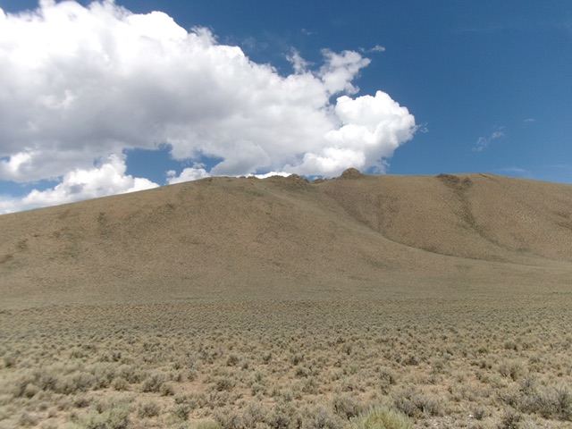
Peak 7810 separates Burnt Creek from Pinto Creek in the foothills of the northern Boulder Mountains. It sits above nearby Trail Creek Road and is best reached from that road on a spur road that heads up Pinto Creek. The east ridge is an aesthetically beautiful sight to see from Trail Creek Road. USGS Jerry Peak
Peak 7810 as viewed from Trail Creek Road. The skyline left of center is the south ridge. Livingston Douglas Photo
Access
Pinto Creek Road is unsigned and is located along Trail Creek Road 0.2 miles northeast of the signed junction with Bartlett Point Road. Park in a nice parking area/campsite near the base of the road [6,690 feet; 44°00’07.7”N, 114°01’43.8”W].
Map Updates
The Pinto Creek Road is not shown on the USGS topo map.
East Ridge, Class 2
The Climb
From the parking area at the base of Pinto Creek Road, bushwhack up steep-ish sagebrush and other scrub to reach the crest of the east ridge. Work up through a few rocky outcrops early on. The shale scree/gravel on this ridge is only moderately loose in a few spots. The sagebrush quickly shortens and becomes more gapped, making the ascent to the rocky summit area quite easy.
The summit of this scrub hump is surprisingly rocky. A rocky, north-to-south high ridge segment has the high point. The north summit seems to be the high point. The cairned south summit is a few rocky humps, and a good 100 feet, away. Visit both “just to be sure.” While the southeast face is a shorter climb to the top, it requires scaling mostly steep, loose gravel and there are no roadside pullouts along Trail Creek Road from Bartlett Creek Road to Burnt Creek Road anyway. Stick to the beautiful east ridge for this peak.
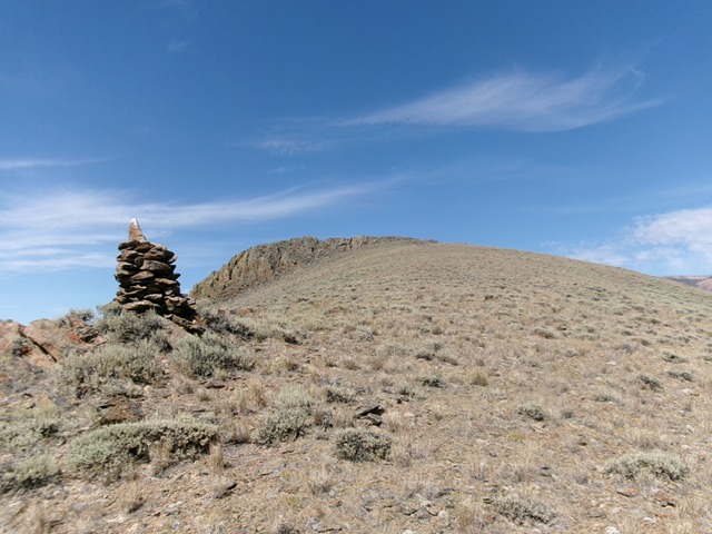
The rocky summit hump of Peak 7810 as viewed from high on the east ridge. This was my ascent route. The nearby, tall cairn is just a rancher’s creation, not the summit. Livingston Douglas Photo
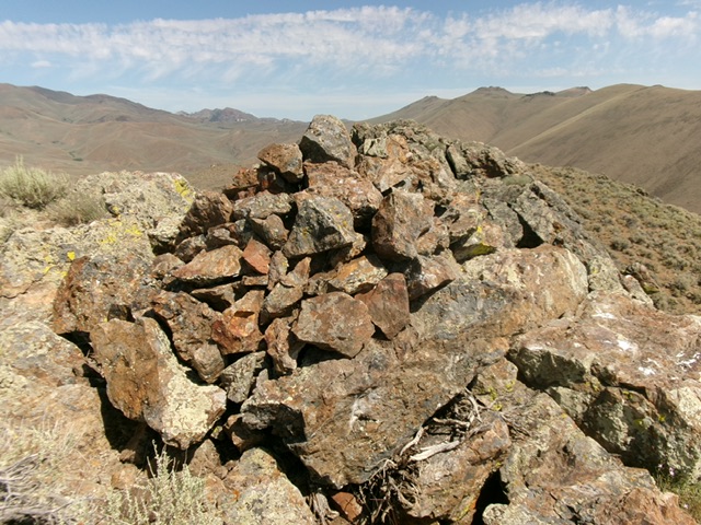
The large cairn atop the south summit of Peak 7810. But is this the true high point? Livingston Douglas Photo
Additional Resources
Regions: Boulder Mountains->EASTERN IDAHO
Mountain Range: Boulder Mountains
Longitude: -114.0453 Latitude: 44.0020