Elevation: 7,820 ft
Prominence: 440
This peak is not in the book. Published October 2025
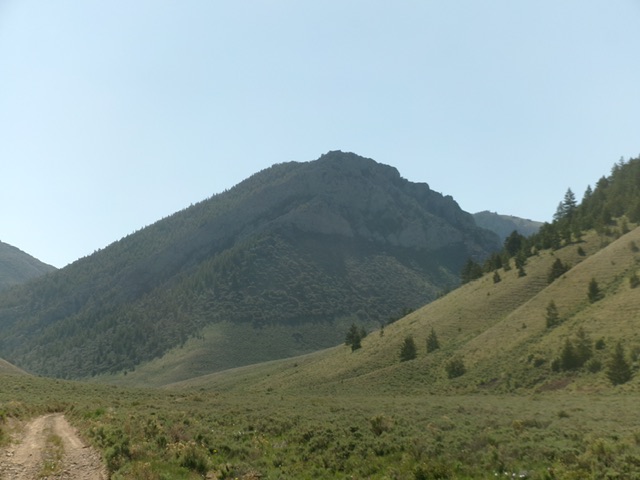
Peak 7820 is a rugged, rocky peak located deep in the Arco Hills area of the Lost River Range. It sits above Wood Canyon and is northwest of Howe Peak (8,705 feet). USGS Arco Hills
Rugged Peak 7820 as viewed from Wood Canyon Road to its west. Livingston Douglas Photo
Access
Same as for Peak 8170. Continue up Wood Canyon Road. At 9.8 miles, the road gets rockier and rougher. At 10.8 miles, reach a road junction with FSR-562. Continue straight/east on Wood Canyon Road/FSR-561. At 11.9 miles, reach a junction signed for “Jump-Off Peak.” Park here as the road now becomes a jeep/ATV trail [6,440 feet; 43°44’03.5”N, 113°08’25.8”W.
Map Errors
The USGS topo map shows Wood Canyon Road/FSR-561 as a jeep trail from Combe Reservoir. However, it is a decent 2-track from there for about two miles to a signed junction northwest of Peak 7820.
Northeast Face, Class 2
The Climb
From the road junction, hike east-northeast then southeast on a 2-track jeep/ATV trail to reach the north (and northeast) side of Peak 7820. Leave the trail at the mouth of a massive gully on the left/north side of the trail. On the south side of the trail is a forested gully on the northeast face. Bushwhack briefly up it then leave it to scramble steeply right-ish/southwest up onto a forested shoulder of sorts. This shoulder eventually becomes part of the northeast face. Keep heading southwest then south-southwest (higher up) until you reach the crest of the east ridge high up. The forest bushwhack is steep and mountain mahogany make it a bit challenging early on.
Once on the east ridge, scramble right/west up over a rocky point then drop 15-20 feet to a notch. Continue up the ridge to the rocky summit. The mountain mahogany on the east ridge is a headache but, higher up, the ridge is mostly an easy, grassy scramble in semi-open pine forest to the cairned, rocky summit. A final scramble up the summit boulders puts you on the airy summit. The views are spectacular. The other rocky points to the southwest of the high point, while shown of similar height on the USGS topo map, are not even close to the height of the northeast summit.
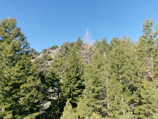
Looking up the thickly-forested east ridge of Peak 7820. This was the final leg of my ascent route. Livingston Douglas Photo
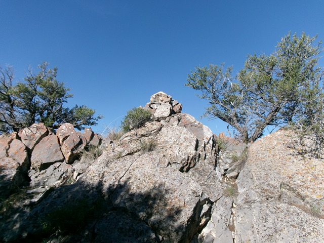
The summit boulders and summit cairn atop Peak 7820. Livingston Douglas Photo
North Face, Class 2
The Descent
From the summit, descend back down to just above the ridge entry point. From there, bushwhack north down through the pine forest and bend a little left-ish/northwest at the finish to reach the jeep/ATV trail at the mouth of a much steeper, rougher side gully on the north side of the trail. Walk 0.7 miles west-southwest down the jeep/ATV trail back to the road junction.
Additional Resources
Regions: EASTERN IDAHO->Lost River Range
Mountain Range: Lost River Range
Longitude: -113.1275 Latitude: 43.7307