Elevation: 7,938 ft
Prominence: 798
This peak is not in the book. Published October 2025
Bull Benchmark sits at the headwaters of both Goddard Canyon and Stewart Canyon in the Deep Creek Mountains.This area is a mix of private and public land, so be careful. This climb is entirely on public land. USGS Cedarhill
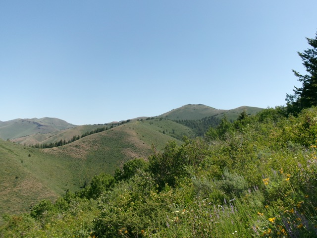
Bull Benchmark (in distance, just right of center). The ridge in mid-ground (heading up and right) was my ascent route. Livingston Douglas Photo
Access
From ID-37 at about 42°24’00”N, turn east onto Stewart Canyon Road West (unsigned at ID-37 and shown as Harwood Road on the USGS topo map) and reset your odometer. Drive 1.7 miles east on this well-maintained county road to a [signed] “T” junction. Turn right/south onto Stewart Canyon Road South and drive 2.0 miles to reach a BLM wire cattle gate. BLM-921 begins here at the entrance to Stewart Canyon.
BLM-921 is a narrow, rocky, rutted 2-track road. Reset your odometer here. At 1.2 miles, reach a signed junction. Go straight onto BLM-920 to continue up Stewart Canyon. At 2.1 miles, park in an open area with shade trees, two large rusty water tanks, and a cattle cistern. I camped here just up the road from the cattle cistern and had several bovine friends visit me [6,137feet; 42°21’33.0”N, 112°45’33.6”W]. Be aware that there is a significant patch of private property that is located another 0.4 miles up Stewart Canyon. Avoid it.
Southwest Ridge, Class 2+
The Climb
From the improvised campsite, walk about 50 feet up Stewart Canyon Road to find a lane/clearing through the trees to reach the steep south face of the southwest ridge quickly. Scramble up steep, loose scree/gravel and scrub with an old cattle fence nearby (initially) that heads up toward the ridge crest. Once on the ridge crest, the slope is much easier but the scrub is much thicker. Head northeast up the rounded, sagebrush ridge to reach open Point 6972.
The ridge now changes direction and has several ups and downs along the way (730 feet of additional elevation gain round trip). There are some short sections of easy scrub (often with loose scree mixed in) but also a few thickly-forested sections (with underbrush and other growth) in the saddles west and northeast of Point 7425. Higher up, the ridge terrain has much more underlying talus/scree and a few minor rocky ridge outcrops—a bit tedious both on the ascent and descent.
There is a rocky ridge section (a final false summit) just before reaching the high point of Bull Benchmark. The summit has a dilapidated triangulation tripod on the ground and the USGS “Bull” benchmark. I built a summit cairn next to the benchmark. This is a magnificent mountain when you get high enough to see its length and prominence.
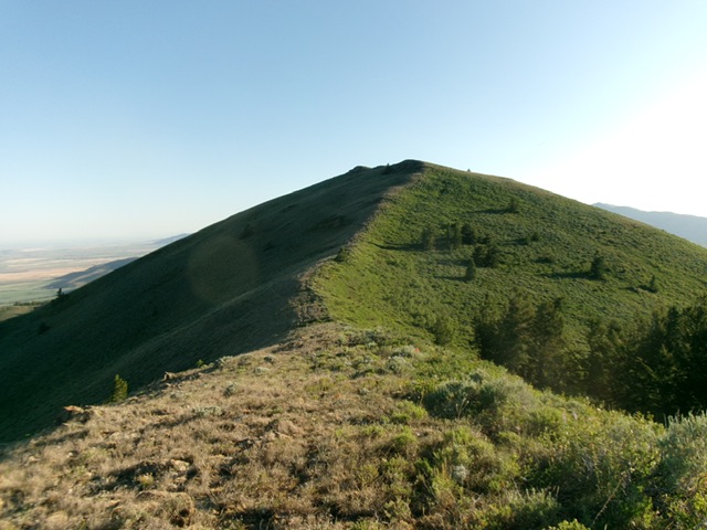
The final push up the south ridge to the summit. Livingston Douglas Photo
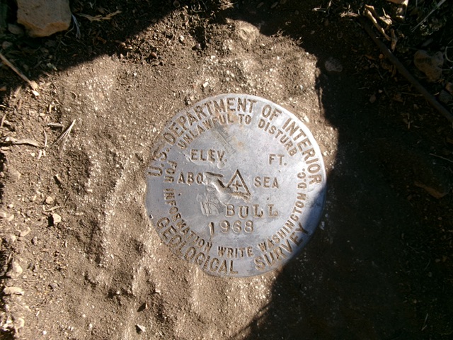
The USGS benchmark atop Bull Benchmark. Livingston Douglas Photo
Additional Resources
Regions: Deep Creek Mountains->SOUTHERN IDAHO
Mountain Range: Deep Creek Mountains
Longitude: -122.7255 Latitude: 42.3744