Elevation: 7,964 ft
Prominence: 316
This peak is not in the book. Published October 2025
Peak 7964 is a rather insignificant hump that separates Bull Creek from Muddy Creek in the foothills of the Lemhi Range. It is most easily approached from Mormon Canyon Road to its north. USGS Poison Peak
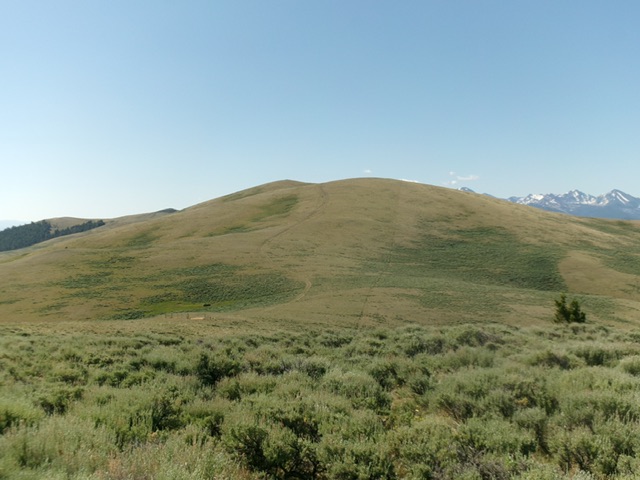
Peak 7964 and its north ridge (right of center). The summit hump is the bump left of center. This was my ascent route. Livingston Douglas Photo
Access
From ID-28 at virtual MM 113.9 (about two miles south of Tendoy), turn west onto [signed] McDevitt Creek Road/FSR-150 and reset your odometer. At 4.1 miles, reach the Salmon National Forest boundary. At 5.4 miles, reach an unsigned road junction with Mormon Canyon Road/FSR-151 (left). Drive 0.8 miles up Mormon Canyon Road to a sharp right/west bend and park [6,166 feet; 44°55’05.7”N, 113°45’06.5”W].
Better yet, drive another 0.2 miles up the road to a junction with an unmapped mining road that heads left/east up onto the north ridge. Even better than that, continue driving up Mormon Canyon Road all the way to a junction on the high ridge. From there, hike (or drive) a rugged 2-track road south then southeast to a 7,660-foot saddle on the north side of Peak 7964.
Map Errors
The USGS topo map grossly mis-positions Mormon Canyon Road. The road actually climbs the south side of Mormon Canyon rather than the north side as the map shows. In addition, Mormon Canyon Road is a decent road and is not a jeep trail as the map indicates. There are several old mining roads on the north ridge that are not shown on the USGS topo map.
North Ridge, Class 2
The Climb
From the road bend, bushwhack briefly west up a steep scrub slope to reach the crest of the magnificent north ridge. Scramble south-southwest then south up the ridge in a mix of scrub, pines, sections of old mining roads, and old mines. Higher up, the terrain is easy, short grass/scrub. Reach a two-track road on the high ridge crest and follow it briefly to a junction. Go left/south then southeast on a two-track ridge road that drops to a saddle at 7,660 feet. From the saddle, follow the 2-track up the north ridge. Leave the road and bushwhack left-ish/east in easy, short grass/scrub to reach the summit. I rebuilt the torn-down summit cairn and enlarged it.

The summit hump of Peak 7964. Livingston Douglas Photo
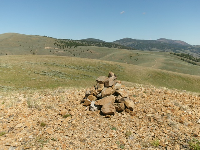
The large summit cairn atop Peak 7964. Livingston Douglas Photo
Additional Resources
Regions: EASTERN IDAHO->Lemhi Range
Mountain Range: Lemhi Range
Longitude: -113.75424 Latitude: 44.88814