Elevation: 7,966 ft
Prominence: 346
This peak is not in the book. Published October 2025
Peak 7966 separates Russell Creek from Dry Gulch in the thickly-forested foothills of the northern Caribou Mountains. Palisades Reservoir is to its southeast. Peak 7966 is most easily climbed from either the Russell Creek Trail or from nearby Bear Creek Road. A difficult bushwhack is inevitable. USGS Red Ridge
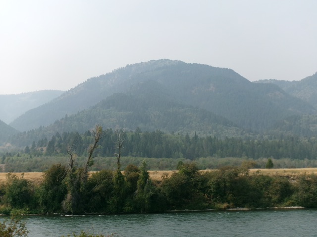
Peak 7966 as viewed from US-26 to its east. The Snake River is in the foreground. Livingston Douglas Photo
Access
From the junction of US-26 and ID-31 in Swan Valley, drive about 10 miles southeast on US-26 to a [signed] turnoff for “Little Lemhi/Riverside Park” just north of Palisades Reservoir Dam. Turn right/south off US-26 and reset your odometer. Follow the paved road south briefly then right/west as it skirts the Riverside Park Campground and crosses the Snake River on a good bridge. Please note that the USGS topo map does NOT show this road or bridge crossing but the Caribou-Targhee NF Map does show it.
Please be advised that the Palisades Dam Road is closed and has been closed for years. Both the USGS topo map and the National Forest map make the dam road look drivable but it’s not. At 2.1 miles, turn left onto [signed] Bear Creek Road. Bear Creek Road was closed to all traffic in September 2025 so I parked at this junction [5,446 feet; 43⁰21’01.0”N, 111⁰13’58.4”W]. This junction can also be reached from the Snake River Road. From its northern terminus at US-26 at the bridge crossing of the Snake River, drive 12.1 miles southeast on the maintained Snake River Road to the signed junction with Bear Creek Road.
Northeast Ridge, Class 2+
The Climb
From the road junction, hike (or drive) southeast then southwest on [paved] Bear Creek Road to a spot where the road bends left-ish/south and is close to the crest of the northeast ridge. Leave the road here and bushwhack west onto the rounded, ill-defined ridge. Head left-ish/southwest from here and bushwhack up the very thick forest/brush combination. This is truly brutal. There is no visibility, no open areas or gaps, and no game trails. Higher up, the ridge gains definition and there is a good game trail (a moose trail) on or near the ridge crest. The understory is less dense now.
Follow this splendid game trail up past Point 6802 on its right/northwest side and onto the narrower, rockier, more open northeast ridge crest. The game trail is weak at times but you can always find it soon after you lose it. Just stay on or near the ridge crest in rockier terrain with less scrub and more gaps in the ridge trees. The summit of Peak 7966 is surprisingly open and has a summit cairn. It sits at the south tip of the summit ridge.
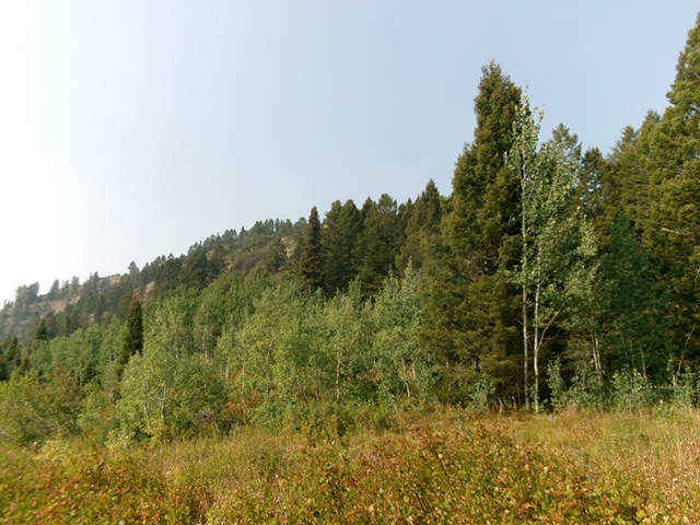
The forested summit hump of Peak 7966 as viewed from high on the northeast ridge. This was my ascent route. Livingston Douglas Photo
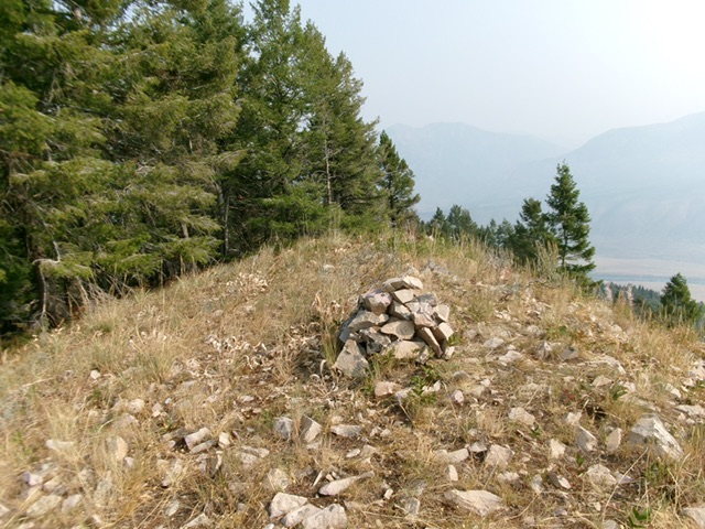
The summit of Peak 7966. Livingston Douglas Photo
Northeast Ridge/East Gully, Class 2
The Descent
From the summit, descend back down the northeast ridge to the head of the gully that sits just below, and south of, Point 6802. Bushwhack southeast down this forested gully through some thick-ish brush. The dead center of the gully seems to work best. As the gully approaches its end near Russell Creek, the terrain gets flatter and much thicker. Bash through it to reach the Russell Creek Trail. Follow the trail for ½ mile northeast back to Bear Creek Road. Hike north on Bear Creek Road for about a mile to the road junction.
Additional Resources
Regions: Caribou Range->SOUTHERN IDAHO
Mountain Range: Caribou Range
Longitude: -111.2551 Latitude: 43.3321