Elevation: 8,069 ft
Prominence: 302
This peak is not in the book. The elevation is based on recent LiDAR measurements. Published October 2025
Peak 8069 is the northernmost Lemhi peak that is located on the primary Lemhi Range Crest. It is most easily climbed from an old 2-track Forest Service road that leads up to a saddle on its south side. USGS Sal Mountain
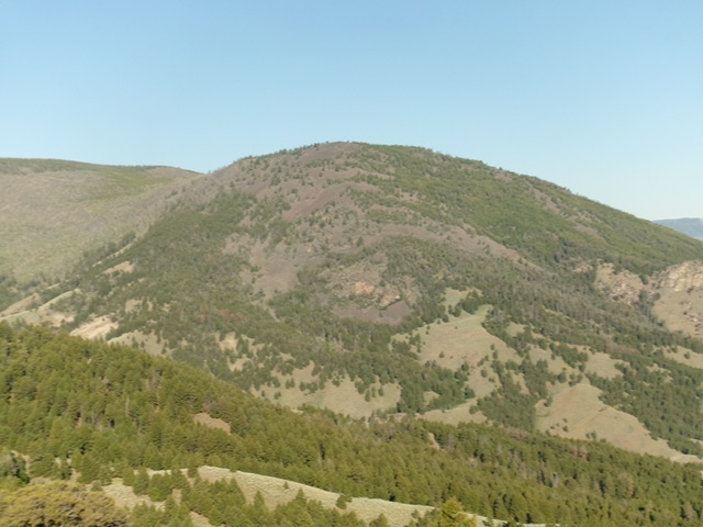
Peak 8069 as viewed from Mill Benchmark to its east. Livingston Douglas Photo
Access
From ID-28 in Baker, Idaho (at virtual MM126.3), turn southwest onto [signed] South Baker Road and follow it for 0.2 miles to a signed “T” junction with Red Rock Stage Road. Go left/southeast onto this road and follow it for 0.2 miles to a signed junction with Withington Creek Road (right). Reset your odometer here. Go right/southwest onto Withington Creek Road.At 4.4 miles, reach BLM land. At 5.2 miles, reach the Salmon National Forest boundary at a road junction. Go left/south here to stay on FSR-031. Reset your odometer here.
At 0.8 miles, reach a signed junction with FSR-041 (at Junction 5798 on maps). Go right to stay on FSR-031. FSR-031 is steeper and rockier from this point. At 3.6 miles, reach a signed junction with FSR-030 (right). Go straight to stay on FSR-031. The road has lots of dried mud now; avoid it in wet conditions. At 3.9 miles, reach an open cattle gate. At 4.3 miles, park in an improvised pullout just before a sharp drop to cross a narrow, wet gully and much rougher road conditions. This pullout is at 6,727 feet and 45°02’59.0”N, 113°50’21.1”W. This is the first leg of a 2-peak adventure that includes Peak 8060 and Peak 8260 North. It covers 5.0 miles with 1,850 feet of elevation gain round trip.
Map Errors
The USGS topo map fails to show all of the old roads and road segments in this area.
South Ridge, Class 2
The Climb
From the improvised pullout, hike up the old 2-track road (only suitable for ATVs/MCs from this point) as it switchbacks its way to the 7,740-foot connecting saddle between Peak 8069 and Peak 8285. Contrary to the USGS topo map, the 2-track road does not descend for a section as it makes its way to the saddle. There is a lot of loose rock on this old 2-track and it does two switchbacks to get there. The connecting saddle is broad and lengthy. It has lots of young pines and blowdown to contend with.
Leave the 2-track road and bushwhack northeast then north to the open summit of Peak 8069. The terrain on this ridge is always rocky underneath (talus/scree/boulders) and has rocky outcrops on its right/east side to skirt early on. There is an initial burn area with burnt logs on the ground and blowdown as well, which makes this section a bit tedious to bushwhack. The forest higher up is not too bad but has pesky underlying boulders and talus. The summit of Peak 8069 is open and has a large, tall cairn.
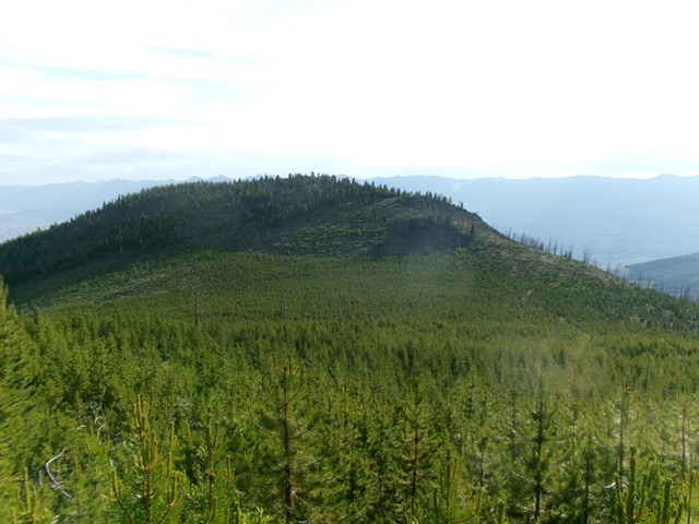
Peak 8069 as viewed from Peak 8285 to its southwest. My ascent route climbs the south ridge (skyline right of center). Livingston Douglas Photo
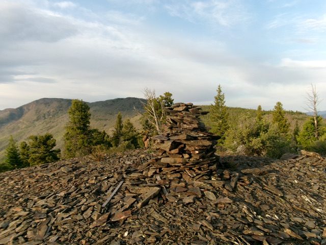
The tall summit cairn atop Peak 8069. Livingston Douglas Photo
From the summit, return to the 7,740-foot connecting saddle. This concludes the first leg of today’s 2-peak adventure. Peak 8285 is up next.
Additional Resources
Regions: EASTERN IDAHO->Lemhi Range
Mountain Range: Lemhi Range
Longitude: -113.8448 Latitude: 45.06338