Elevation: 8,241 ft
Prominence: 1,221
This peak is not in the book. Published October 2025
Peak 8241 is located north of McDevitt Creek and south of Baldy Creek in the foothills of the Lemhi Range. It is most easily climbed from McDevitt Creek Road to its south. Peak 8241 has an impressive prominence of 1,221 feet. USGS Tendoy
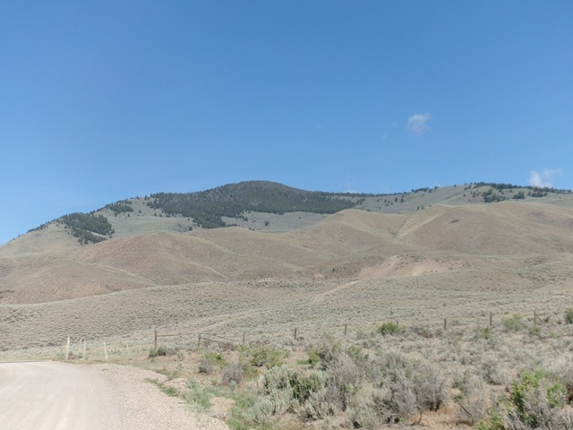
Peak 8241 as viewed from McDevitt Creek Road to its southeast. Livingston Douglas Photo
Access
From ID-28 at virtual MM 113.9 (about two miles south of Tendoy), turn west onto [signed] McDevitt Creek Road/FSR-150 and reset your odometer. At 4.1 miles, reach the Salmon National Forest boundary. At 5.2 miles, reach a minor roadside pullout. Park here [5,766 feet; 44°55’26.7”N, 113°44’15.0”W].
South Face, Class 2
The Climb
From the roadside pullout, cross to the north side of the road and move right/east to find a suitable crossing of a cattle fence. Scramble north up an easy grass/scrub shoulder with a pronounced dry gully to its right/east. Stay on this shoulder as it bends left-ish/north-northwest. Move right-ish twice to cross dry gullies with minimal drops. These moves put you on the top of the south shoulder and the base of the steep south face.
Scramble up the steep, loose scree/scrub/grass and scattered pines/blowdown on the south face, avoiding steep scree patches as much as possible. Stay in scrub or easy, steep forest to finally reach the summit ridge crest (southeast ridge) just below the open sagebrush summit hump. I rebuilt the torn-down summit cairn and enlarged it. The high point is in the open and all sides of it descend gradually away from it, as the USGS topo map indicates.
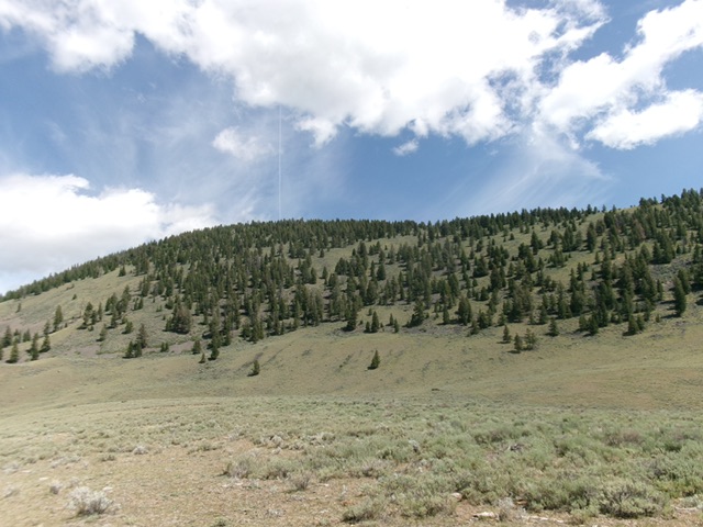
Peak 8241 and its rocky, forested south face. This was the upper leg of my ascent route. Livingston Douglas Photo
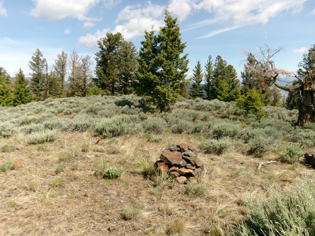
The summit of Peak 8241. Livingston Douglas Photo
South Face/South Shoulder, Class 2+
The Descent
From the summit, descend briefly southeast then directly south to reach the easy, open scrub of the south shoulder. This descent route is on a lot of steep, loose scree with grass/scrub mixed in. There are trees/blowdown and some boulders to skirt on the way down. Once on the easy, broad shoulder (at just above 6,800 feet), follow it south. Bend a little right-ish/south-southwest as you near the road. Do a final drop to a gully then descend easy scrub and sagebrush to the road. Walk about 0.3 miles west up the road to the roadside pullout and your parked vehicle.
Additional Resources
Regions: EASTERN IDAHO->Lemhi Range
Mountain Range: Lemhi Range
Longitude: -113.7311 Latitude: 44.9447