Elevation: 8,250 ft
Prominence: 670
This peak is not in the book. Published October 2025
Peak 8250 towers over Haynes Creek to its north. It sits at the head of Baldy Basin to the east. It is most easily climbed from a Forest Service road to its south. USGS Poison Peak
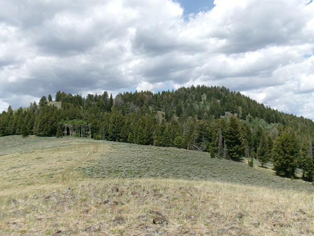
Peak 8250 as viewed from Point 7934 to its southeast. The forested summit hump is right of center. Livingston Douglas Photo
Access
From ID-28 at virtual MM 120.4 (about 15 miles south of the US-93/ID-28 junction in Salmon), turn west onto [signed] Haynes Creek Road/FSR-350. Drive 4.1 miles to a signed junction with Baldy Basin Road/FSR-152. Drive 1.1 miles up this rough, rutted, narrow 2-track road and park in a nice, grassy parking area at an unsigned junction where the road steepens and is badly rutted [5,952 feet; 44°59’18.5”N, 113°43’37.5”W].
Map Errors
The USGS topo map fails to show all of the old 2-track roads in this area. It also mis-labels FSR-152 as Haynes Creek Road.
East Spur/South Ridge, Class 2
The Climb
From the parking area, hike up FSR-152 to reach the east spur. Leave the road at 6,400 feet (at a sharp right bend) and bushwhack directly southwest up through thick-ish sagebrush (with some easier bare areas) to intersect the road about 400 feet higher. Rejoin the road and follow it up to the east spur at 7,240 feet, where the road bends sharply left/south and moves permanently away from the ridge crest. Scramble up the east spur in thick-ish sagebrush to find a cattle fence coming up from the right/northeast.
Cross an unmapped 2-track road and find a nice, grassy unmapped 2-track road heading up the ridge crest all the way up over Point 7934 then down 45 feet to a saddle then briefly northwest to reach a patch of pine forest where it ends. From the end of the helpful 2-track road, bushwhack northwest up through easy pine forest and quickly reach open scrub. Follow the left edge of the forest in easy sagebrush as the ridge bends right/north and becomes very rocky and forested.
Scramble up through a tedious final patch of talus slopes, boulders, rocky outcrops, and pines to reach the cairned, official/measured high point (the northwest summit). However, an earlier rocky ridge outcrop (an easy hump to reach and stand atop) is 10 feet higher, based on altimeter readings and visuals. Stand atop both high points “just to be sure.”
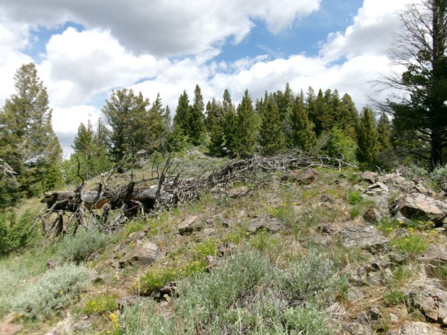
The forest-and-rock summit hump of Peak 8250. Livingston Douglas Photo
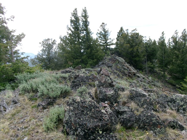
The forest-and-boulder summit of Peak 8250. Livingston Douglas Photo
Additional Resources
Regions: EASTERN IDAHO->Lemhi Range
Mountain Range: Lemhi Range
Longitude: -113.7638 Latitude: 44.4799