Elevation: 8,260 ft
Prominence: 400
This peak is not in the book. The name was suggested by Rick Baugher. He explains this suggestion in the trip report linked below. Published October 2025
Peak 8260 is located about midway between Sal Mountain to the west and K Mountain to the east. It is most easily climbed from nearby FSR-041. USGS Sal Mountain

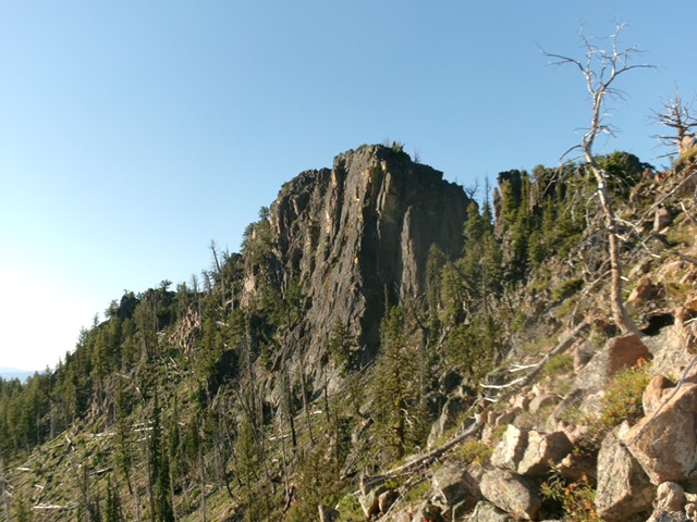
Peak 8260 (in center) as viewed from the west. Livingston Douglas Photo
Access
From ID-28 in Baker, Idaho (at virtual MM126.3), turn southwest onto [signed] South Baker Road and follow it for 0.2 miles to a signed “T” junction with Red Rock Stage Road. Go left/southeast onto this road and follow it for 0.2 miles to a signed junction with Withington Creek Road (right). Reset your odometer here. Go right/southwest onto Withington Creek Road. At 4.4 miles, reach BLM land. At 5.2 miles, reach the Salmon National Forest boundary at a road junction. Go left/south here to stay on FSR-031. Drive another 0.8 miles up FSR-031 to a signed junction with FSR-041. This is Junction 5798 on maps. Park here.
West Shoulder/North Ridge, Class 3
The Climb
From the road junction, hike up FSR-041 (a rocky, narrow 2-track only suitable for ATVs/MCs) for about a mile to a sharp right/west bend in the road. Leave the road here. The west shoulder sits directly above the bend. Bushwhack diagonally left/northeast to reach the crest of the north edge of the shoulder after climbing up and across stable talus/scree (there are remnants of an old foot trail here). Once on the ridge crest, scramble east and, higher up, southeast to intersect the north ridge. Keep a brushy gully to your left/north as you climb.
The west shoulder is steep and is a tedious mix of field grass, veg, downed logs, and some standing snags. This is a burn area. It requires a lot of weaving due to downed, charred tree logs. The scattered scree under the field grass is a loose, slipper mess when descending it. The north ridge is steep and is much rockier high up. Skirt several ridge towers/blocks on the right/west side to reach the summit blocks. Work around the first two blocks on their right/south side to reach the final massive block.
Scramble up an easy Class 3 chute then left across a rocky ramp. From there, head up another Class 3 chute to reach the false summit. Continue a short distance southeast on the high ridge to reach the cairned high point of Peak 8260. The summit is a magnificent piece of rock and the challenging ridge rock scramble more than made up for the rather unpleasant bushwhacking to reach this rocky, open terrain high up.i
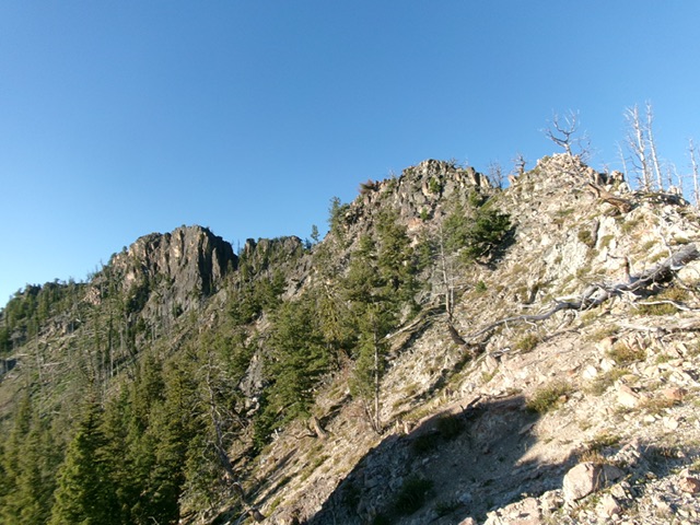
The final push to the summit of Peak 8260. The summit block is left of center. Livingston Douglas Photo
The summit block of Peak 8260. It is an intimidating sight. Its back side is its weakness. Livingston Douglas Photo
Additional Resources
Regions: EASTERN IDAHO->Lemhi Range
Mountain Range: Lemhi Range
Longitude: -114.8002 Latitude: 45.0124