Elevation: 8,311 ft
Prominence: 431
This peak is not in the book. The elevation and prominence figures are based on recent LiDAR updates on Peakbagger.com. Published November 2025
This peak sits at the top of the long gentle ridge that separates the South and North Forks of Soldier Creek, just northwest of the Soldier Mountain Ski Resort and northeast of Smoky Dome. The only previous trip report I found was of an early Spring snow ascent by “Big Dan” Robbins and the late, great John Platt (“Splattski”). Dan called this peak “Cottonwood Peak” because Cottonwood Creek drains its east face. I’m adding the word “Soldier” to distinguish it from other Cottonwood Peaks in Idaho. USGS Boardman Creek

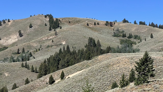
Peak 8311 and North Smoky Dome..Steve Grantham Photo
Access
Access the South Fork of Soldier Creek as described on Page 216 of the book (A)(1.1). Note that the road up the South Fork is open only to vehicles 50 inches or less in width (e.g., ATVs), enforced by a narrow drive-over ATV gate. There is a large parking area just east of the gate.
Ascent via the Ridge North of Cottonwood Creek, Class 2
I ascended the peak via essentially the same route than Dan and John took though, due to snow, they had to walk an extra 3/4 mile of so along the road that runs north from the ski area parking lot to reach the junction of the South Fork Road. Walk through the ATV gate to get past the fence line, then look for a good point to leave the road and gain the ridge. The first few hundred vertical feet are the steepest and brushiest, then the grade eases and becomes more open.
In fact, there is a network of surprisingly good elk/cattle trails (mostly cattle, alas), and you can usually find one that takes you in the direction you want to go, namely towards point 7174, which you reach after about a mile and 1,200 feet of elevation gain. From there, you get good views of your objective, as well as the Smoky Dome ridge to the southwest and Basque and Gora Euzkotarak peaks to the north.
The next mile or so is mostly flat to slightly undulating. You go through several thick stands of forest, mostly Douglas fir, with occasional short stretches of deadfall and thick brush. After emerging from the last of those patches, you get a clear view of Peak 8311 and the gentle east ridge that leads to the top. The last 50 vertical feet are slightly steep, and Dan and John found it corniced in April. There is a kind of “natural cairn” at the very top but no summit register. My GPS showed 3.14 miles and 2,190 feet of elevation gain. It took me a little under three hours at my leisurely old-guy pace.
Peak 8311 summit hump. Steve Grantham Photo
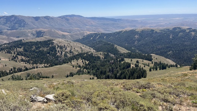
View east to the Soldier Mountain Ski Area. Steve Grantham Photo
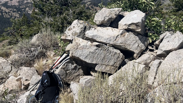
The summit cairn. Steve Grantham Photo

My GPS track for Peak 8311
Descent via the CCC Route, Class 2 (not recommended)
Since this is mostly open country, I thought it would be fun to try to make a loop and descend the ridge that runs more or less parallel to the one I ascended, but on the south side of Cottonwood Creek. I think that is more or less the route Dan and John descended, but I’m not sure. I just know they found some nice glissading.
I started down that way, dropping 700 or 800 feet to the south-southeast fairly quickly on somewhat steeper, rockier terrain than the ascent ridge. But then, looking further down the route, I started feeling uneasy about whether I would find myself in a more extensive stretch of thick, brushy forest that could be slow and unpleasant.
It probably would have been fine. I could probably have followed that ridge over Points 7067 and 6820 all the way to the confluence of Cottonwood Creek and the South Fork of Soldier Creek. But instead, I wimped out and decided to work my way back across the various upper branches of Cottonwood Creek back to my ascent route. I call this the CCC route, meaning “Cowardly Cattle Contouring”, not “Civilian Conservation Corps.”
The creek crossings involved some extra descending and ascending (but hardly any water in mid-August), and there were a few patches of alder that would have made John Platt smile, plus quite a few cows. But eventually I rejoined my ascent route a little above Point 7174, and cruised back down it to the trailhead. My meanderings added about 1/2 mile and 200 extra feet of elevation gain.
Additional Resources
Regions: Soldier Mountains->WESTERN IDAHO
Mountain Range: Soldier Mountains
Longitude: -114.8817 Latitude: 43.5107